
Smooth Island (Tasmania): Difference between revisions
Vitreology (talk | contribs) |
Vitreology (talk | contribs) |
||
| Line 39: | Line 39: | ||
===Ecological rehabilitation=== |
===Ecological rehabilitation=== |
||
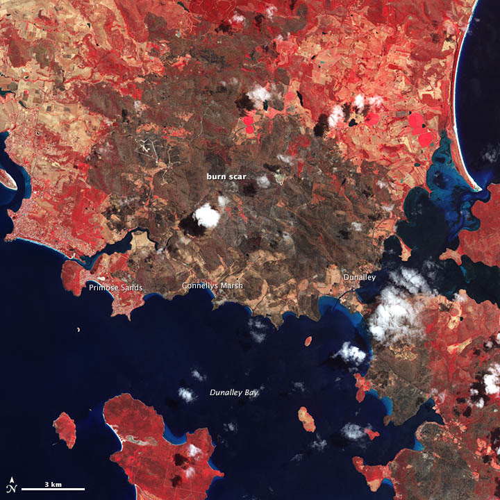
The terrestrial ecosystem of Smooth Island has previously been damaged through [[overgrazing]], [[Slash-and-burn|slashing-and-burning]]<ref>http:// |
The terrestrial ecosystem of Smooth Island has previously been damaged through [[overgrazing]], [[Slash-and-burn|slashing-and-burning]]<ref name="core.kmi.open.ac.uk">{{cite web|url=http://core.kmi.open.ac.uk/download/pdf/12187235.pdf|format=PDF|title=THE EFFECTS OF FIRE ON BURROW-NESTING SEABIRDS PARTICULARLY SHORT-TAILED SHEARWATERS (PUFF/NUS TENU/ROSTR/S) AND THEIR HABITAT IN TASMANIA|publisher=Core.kmi.open.ac.uk|accessdate=11 January 2015}}</ref> and through the commercial hunting of wildlife.<ref>{{cite web|url=http://www.currawonglakes.com.au/pdf/Newsletter2010.pdf|format=PDF|title= Currawong Lakes : What's New for 2010|publisher=Currawonglakes.com.au|accessdate=11 January 2015}}</ref> The island's natural vegetation has been largely displaced with exotic grass, [[thistle]], [[bracken]], scattered [[eucalypt]]s and [[Lycium ferocissimum|African boxthorn]] bushes. Between 0.86<ref>{{cite web|url=http://marineornithology.org/PDF/24/24_1.pdf|format=PDF|title=DISTRIBUTION, ABUNDANCE AND CONSERVATION STATUS OF SHORT-TAILED SHEARWATERS PUFFINUS TENUIROSTRIS IN TASMANIA, AUSTRALIA|publisher=Marineornithology.org\accessdate=11 January 2015}}</ref> and 18 hectares of [[short-tailed shearwater|shearwater]] [[Rookery|rookeries]] are present on Smooth Island and the impact of repeated fires on these habitats has been studied.<ref name="core.kmi.open.ac.uk"/> |
||
The current owners intend to systematically restore the island's native ecosystem. Remnant [[eucalypt]]s are expected to seed from the island's south-east coast now that grazing has ceased. In March 2014, a diverse range of [[Flora and fauna of Tasmania|native Tasmanian flora]] were planted in striation along the island's east coast.<ref>{{cite web|url=http://www.themercury.com.au/lifestyle/an-island-of-your-own/story-fnj64ocs-1226761782996|title=An island of your own|work=Mercury|accessdate=2015-04-06}}</ref> |
The current owners intend to systematically restore the island's native ecosystem. Remnant [[eucalypt]]s are expected to seed from the island's south-east coast now that grazing has ceased. In March 2014, a diverse range of [[Flora and fauna of Tasmania|native Tasmanian flora]] were planted in striation along the island's east coast.<ref>{{cite web|url=http://www.themercury.com.au/lifestyle/an-island-of-your-own/story-fnj64ocs-1226761782996|title=An island of your own|work=Mercury|accessdate=2015-04-06}}</ref> |
||
Revision as of 03:55, 11 April 2015
 | |
| Geography | |
|---|---|
| Location | Tasmania |
| Coordinates | 42°56′S 147°47′E / 42.933°S 147.783°E |
| Archipelago | Sloping Island Group |
| Adjacent to | Norfolk Bay |
| Administration | |
| Additional information | |
| Time zone | |
Smooth Island is a privately owned island with an area of 61 hectares (150 acres)* in south-eastern Australia. It is part of the Sloping Island Group, lying close to the south-eastern coast of Tasmania in Norfolk Bay, surrounded by the Tasman and Forestier Peninsulas.[1] It is nearest the towns Dunalley and Murdunna and it resides within the Pembroke land district.
Ecology
Terrestrial
Fauna
This island has no introduced vermin such as rats, mice, rabbits, snakes or foxes. Recorded breeding seabird species are little penguin, Pacific gull, and short-tailed shearwater (Ardenna tenuirostris). The latter predominantly habitates inland from the western to southern coasts.[2] A survey by the Department of the Environment (Australia) in 2010 revealed the presence of the Eurasian skylark (Alauda arvensis), house sparrow (Passer domesticus), common pheasant (Phasianus colchicus), common starling (Sturnus vulgaris) and common blackbird (Turdus merula) on the island.[3] The presence of Sea eagle, Wedge-tailed eagle, Kelp gull, Tern, Silver gull, Oystercatcher, Cormorant and Gannet species have been described.[4]
Flora
The island has been classified as a drooping she-oak (Allocasuarina verticillata) forest, despite having relatively sparse foliage. Large Macrocarpa have been identified around the remnants of an old cottage on the north-east coast. Eucalyptus globulus and Allocasuarina striata (Small bull-oak) are also present on the island.[5] The Marrubium vulgare weed has been identified towards the island's north. The island's fire attributes are "medium flammability, low sensitivity".[2]
Marine

Smooth Island is surrounded by a reef with less than a 1 metre profile. A region of gravel or hard sand extends from the reef on the eastern coast towards King George Island and King George Sound. The reef on the western coast is surrounded by sand and a body of silt approaches the south-west coast of the island. Between Smooth Island and King George Island lies a dense bed of seagrass (Halophila australis) and eelgrass (Zostera tasmanica) approximately 12.5 hectares in size.[6] Studies have found dense populations of South Australian cobbler (Gymnapistes marmoratus) within this region, as this fish has a preference for patchy beds of eelgrass.[7] A species of Red algae (Rhabdonia verticillata)[8][9] has been found very close to the island.[10] The following fish can be found in the waters immediately surrounding the island: Flathead, Trumpeter, Perch, Cod and Australian Salmon. Dolphins are frequently sighted and Whales are infrequently sighted near the island.[4][11]
Ecological rehabilitation
The terrestrial ecosystem of Smooth Island has previously been damaged through overgrazing, slashing-and-burning[12] and through the commercial hunting of wildlife.[13] The island's natural vegetation has been largely displaced with exotic grass, thistle, bracken, scattered eucalypts and African boxthorn bushes. Between 0.86[14] and 18 hectares of shearwater rookeries are present on Smooth Island and the impact of repeated fires on these habitats has been studied.[12]
The current owners intend to systematically restore the island's native ecosystem. Remnant eucalypts are expected to seed from the island's south-east coast now that grazing has ceased. In March 2014, a diverse range of native Tasmanian flora were planted in striation along the island's east coast.[15]
Geology

Smooth Island consists of diabase (or dolerite) rock, a subvolcanic intrusion which probably occurred from 56 to 33.9 million years ago during the Eocene epoch of the Cenozoic era.[16] A geological survey identified consolidated brownish fine-grained quartz sandstone occurring on the north east coastline of Smooth Island at approximately 2 metres above sea level, covered by sand. It was said to be similar to the sandstone samples retrieved from South Arm which contained numerous fossils, but no fossils were found in the samples taken from Smooth Island.[17][18]

Given the island predominantly has a sloping hard rock shore, there is minimal vulnerability to flooding or erosion due to a rise in sea level.[2] A "coastal acid sulfate soil analysis" was conducted producing a result of "extremely low" along the north/north east side of the island.[2] On 13 October 1941, a geological survey of Smooth Island was conducted to determine the possibility of mining phosphate on the island, concluding that phosphate mining on Smooth Island was unlikely to be viable. Further details of this study ("Phosphate Rock – Garden Island – Norfolk Bay") can be found within this reference.[19]
Geography
Measurements based upon satellite imagery suggest the perimeter of Smooth Island is 3.38 km (2.10 mi) and its area is 61.43 hectares (151.8 acres)—larger than previously thought. Two small hilly peaks exist on Smooth Island: The North and South peaks are located at 42°56′40″S 147°46′56″E / 42.9444°S 147.78219°E and 42°56′56″S 147°47′10″E / 42.94877°S 147.7862°E respectively. An intermediary saddle is located at 42°56′46″S 147°47′05″E / 42.9461°S 147.78472°E.[2]
Climate
| Climate data for Hobart International Airport (26km from Smooth Island) | |||||||||||||
|---|---|---|---|---|---|---|---|---|---|---|---|---|---|
| Month | Jan | Feb | Mar | Apr | May | Jun | Jul | Aug | Sep | Oct | Nov | Dec | Year |
| Mean daily maximum °C (°F) | 22.6 (72.7) |
22.3 (72.1) |
20.8 (69.4) |
18.1 (64.6) |
15.3 (59.5) |
12.9 (55.2) |
12.5 (54.5) |
13.5 (56.3) |
15.4 (59.7) |
17.3 (63.1) |
19 (66) |
20.7 (69.3) |
17.5 (63.5) |
| Mean daily minimum °C (°F) | 12 (54) |
12.1 (53.8) |
10.8 (51.4) |
8.8 (47.8) |
6.6 (43.9) |
4.6 (40.3) |
4.1 (39.4) |
4.7 (40.5) |
6.1 (43.0) |
7.5 (45.5) |
9.2 (48.6) |
10.8 (51.4) |
8.1 (46.6) |
| Average precipitation mm (inches) | 40.8 (1.61) |
35.9 (1.41) |
36.1 (1.42) |
42.2 (1.66) |
35.6 (1.40) |
32.5 (1.28) |
43.8 (1.72) |
47.1 (1.85) |
41.6 (1.64) |
46.3 (1.82) |
44.9 (1.77) |
52.6 (2.07) |
499.4 (19.65) |
| Source: Australian Bureau of Meterology (1958-2015) [20] | |||||||||||||
Nomenclature
Between the early 1800 and the mid 1900s, Smooth Island was frequently referred to as Garden Island. The origins of this are not entirely clear; according to a 1911 newspaper article, the island "is not named in the map of D'Entrecasteaux, even though it was marked".[21] Matthew Flinders first named the island "Smooth Island", as appears on his maps.[22] In 1824 Thomas Scott referred to Smooth Island as 'Garden Island' in his maps. During the early 21st century, Smooth Island was occasionally listed as "Lot 1 Norfolk Bay, Dunalley TAS 7177" on certain real-estate classifieds.[23]
Much confusion exists about the names of many of the islands in South East Tasmania. Garden Island is an island along the Huon River, but Garden Island has become the pseudonym for both Green Island[24] as well as Smooth Island. A newspaper article from 1836 refers to a Garden Island in both the Pembroke as well as Buckingham land districts of Tasmania.[25] Green Island in turn has become a pseudonym for Fulham Island. Doughboy Island has replaced Isle of Caves[26]
History
.png)
Prior to European settlement, the Forestier Peninsula to the east of Smooth Island is believed to have been occupied by the Pydairrerme band of the Oyster Bay (Paredarerme) tribe of Aboriginal Tasmanians.[27][28][29] They spoke the Paredarerme language. There is no recorded evidence of any remaining Paredarerme people in the region after the 1830s.[29]
European settlement
On 15 December 1798, Matthew Flinders was the first Anglo-Saxon to discover Smooth Island.[30] He charted the island and his passage through the region on the map Chart of Terra Australis - By M Flinders - 1798-1799 - South Coast, Sheet VI.[22] He described his initial impression of sailing eastwards from Doughboy Island in Frederick Henry Bay towards Norfolk Bay. He wrote:
The country on the eastern side of the bay, is stony; and, wherever we landed, is wretchedly barren. The islands have a better appearance. Smooth Island, contains about one hundred acres of ground, that might answer for a garden: its soil is shallow and sandy.[31][32]
He appeared surprised by the nautical ability of the Aboriginal Tasmanians:
The natives of Frederick Henry Bay, have some mode of conveyance by water; for they had visited Betsey's Island, the Isle of Caves, Smooth Island, and Gull Island; and, perhaps, the others. It has been a received opinion, that the inhabitants of this part of Van Diemen's Land have no canoes; and, had our observations been confined to the Derwent River, we should have joined in that opinion.[31]
In A Voyage to Terra Australis he wrote, "Smooth Island ... is three quarters of a mile long, and covered with grass and a few small trees. It has been visited by the natives, as had the Isle of Caves; but from the eggs of gulls found upon both, I judge they do not go often."[26] In the same text he also said, "Of the four islands in the bay, Smooth and Gull islands were found superior in fertility to the mainland: the first contains about 40 acres of tolerable pasturage".[26]
1800s

In the early 1800s, eight insubordinate Irish prisoners, who had been caught plotting to plunder the settlement's supplies and escape, were placed on Smooth Island with one month's provisions while a Captain Bowen explored the Huon River.[33][34]
In 1824, Thomas Scott conducted a survey of Tasmania, producing a detailed map of Tasmania.[35] An extract of the map is shown to the right. The labels Smooth Island as Garden Island.
On 15 February 1836, Smooth Island was defined as lying within the county of Pembroke.[36] On the 17th of September, 1839, Smooth Island was offered for sale as part of the 'Estate of Fulham'.[37] In 1860 a "small wooden ketch" named Seabird weighing approximately 17 tons was built at Smooth Island. On 8/9 March 1895 it became a total wreck off Cape Patten in Apollo Bay. The crew were saved. It was owned by Mr G. McKay and registered in Adelaide at the time.[38]
On 14 April 1863, Smooth Island, which was classed as agricultural Crown land at the time, was designated for sale at public auction on the 23rd of April the following year, in accordance with the Waste lands Act:[39] It appears Thomas Gabriel Reid purchased the island on Thursday 21 April 1864 for only £155.[40] A "Thomas G. Read" was recorded as living in the nearby town of Sorell in 1866[41]
On 8 November 1869, Lieutenant Colonel Mundy said, "the pretty wooded Garden Island [was] lying in the jaws of [Norfolk Bay]",[42] suggesting that clearfelling had not yet occurred on the island. On 4 April 1870, a sailor traveling past Smooth Island wrote in a local newspaper, "Garden Island is the peaceful abode of two or three families, and its cultivated appearance renders its name quite apropos".[43]
In 1877, there were many reports of shipping vessels leaving Smooth Island laden with timber.[44] On 26 July 1878, Smooth Island was sold at auction for £400[45] after real estate agents submitted the following advertisement to local newspapers:[46][47]
Garden Island, in Norfolk Bay, opposite Fulham. ROBERTS & CO. Are instructed by the proprietor to sell, at the mart, on FRIDAY, 26th July, at 11 o'clock. GARDEN ISLAND, containing 145 acres of the most superior land, nearly all of which has been cultivated, and is now most luxuriantly grassed. It is situated within three miles of Fulham, and is passed daily by the Sorell craft. There are numerous shipping places with deep water. For richness of soil and the production of heavy root and grain crops, this property has no equal in Tasmania. To an industrious man it would be a fortune. Title-Grant. Terms: One-fourth cash ; one-fourth at six months ; balance may remain for three years at 7 per cent.
From 1883, numerous reports of ships leaving Smooth Island laden with timber were published, suggesting clearfelling was continuing. Timber was sent to Launceston and Melbourne.[48] On 2 June 1883, the island was again advertised for private sale:[49]

FOR PRIVATE SALE, GARDEN ISLAND, in Norfolk Bay, occupied by Mr. Quested. It contains 145 acres of superior land, well sub-divided, a considerable portion under cultivation; with homestead. The "Pinafore" passes three times a week. ROBERTS & Co, Murray-street
On 14 June 1884, a local newspaper reported, "Garden Island, of about 100 acres, situated about a mile off the northern limit of King George's Sound, Forestier's Peninsula, is occupied, and appears to have good soil by the newly-turned sod of the paddocks, and has upon it the buildings and paraphernalia of the average farm."[50] On 19 November 1889, an advertisement in a local newspaper offered "100 prime fat wethers from Garden Island".[51] From 3 December 1893 until December 1894, the island was advertised for private sale:[52] In January 1895, a real estate agent was used. It appears that all trees had been cleared from the island by this stage. The island was advertised as, "146 Acres Grass Land, suitable for cultivation. Easy Terms. R. DARLING, Agent,54, Murray-street."[53]
The British conducted a survey of Norfolk Bay and Frederick Henry Bay(aka North Bay) in 1894, producing the map seen to the right. It was published on the 1st of October, 1925[54][55]
1900s
On the 4th of January 1900 a reader of the Mercury demanded a lighthouse be placed on Garden Island.[56] Smooth Island was owned by Samuel Nicholas Wellard in the early 1900s. He was a well known sheep breeder who lived in Forcett, Tasmania.[57] He died in August 1934.[58]
S. N. Wellard's nephew Chris Wellard died mysteriously after sailing away from Smooth Island. This was reported in the Mercury on the 25th of August 1914[59]
DROWNING ACCIDENT IN NORFOLK BAY. A very sad drowning accident, in which one of the best-known residents, of Forester’s Peninsula lost his life, took place on Friday, in Norfolk Bay, near Garden Island. On Friday morning Mr. Charles Wellard, a resident of Murdunna, took some sheep out from Garden Island to the s. s. Breone. He intruded to return to the mainland after shipping the sheep, and so, after he had put them on board the Breone, towed his bout out for some distance from the island. He then cast off, and has not since been seen or heard of. A good deal of anxiety had been felt owing to his non-appearance, and the worst fears were confirmed when his boat was found upside down yesterday morning near Eaglehawk Neck, several miles from the place where he was last seen. Mr Wellard had three dogs in the boat with him when he cast off from the Breone, and when the boat was found yesterday one of these dog was sitting on the keel of the upturned boat. There seems, unfortunately, little reason to doubt that the boat was upset by a sudden squall, or that some other mishap happened to it, and that Mr. Wellard was drowned. He was the only son of Mr. W. W. Wellard, of Murdunna, and a man of between 20 and 40 years of age. He leaves a wife and two young children.
The mystery deepened when on the 2nd of September, 1914, the Mercury provided further details of the event in their article "The Norfolk Bay Tragedy - A mysterious occurrence - The details of the event"[60]
THE NORFOLK BAY TRAGEDY. A MYSTERIOUS OCCURRENCE. THE DETAILS OF THE EVENT.
Fuller details which have come to hand of the drowning tragedy in Norfolk Bay, by which Mr. C. Wellard lost his life, show that the whole affair is a mystery.
On the night before Mr. Wellard’s disappearance he stayed on the island with Mr. David Kingston, of Koonys. In the morning Mr. Wellard took several sheep out in his dinghy, and put them on board the s.s. Breone. He then went back to the island, and Mr Kingston helped him load the dinghy with six bags of fish manure, weighing some 7cwt ((approximately 317.5kg)), which, with a lamb in the bag and three dogs, formed the dinghy’s freight. Mr. Wellard then put out from the island in his dinghy, intending to cross to King George’s Sound on the west side of Forestier’s Peninsula and several miles from Garden Island, near which his home lay. The captain of the s.s. Breone offered to give him a tow for part of his journey, as the steamer would be going past the mouth of the Sound, and the dinghy was made fast to the steamer. As soon as the Breone got under way the captain noticed that the dinghy was slopping water over the bows. He then told Mr. Wellard he did not think the dinghy would stand towing, on which the latter asked him to cast off, which was at once done. The dinghy was then about 200 yards from the Garden Island jetty, but nor more than 60 or 70 yards from the nearest point on the island.
When the dinghy was cast loose from the steamer, Mr. Wellard at once turned round and started to pull back to the jetty. Presumably he intended to get a bailer, as it was noticed that he had not one on board. The steamer rounded a point, and those on board lost sight of him before he reached the jetty.
Mr. Wellard was never seen again, and what happened remains a mystery. He had no sail up at the time he was last seen. The dinghy is a stiff little boat, and it is hard to imagine how she got bottom upwards. The fact remains that she did turn over, and was found floating bottom upwards three days later. One of the dogs got on the bottom of the boat, and had been there three days and three nights before the boat was found.
The deepest sympathy is felt for Mr. Wellard’s family and relatives. He was a young man in the prime of life, with a wife and two young children. He had established a farm and orchard in the bush, near Murdunna, and was working hard with good prospects of success.
On the 4th of September, 1914, S. N. Wellard discussed his nephew's death in the Mercury in his letter entitled 'Norfolk Bay Tragedy'.:[61]
To the Editor of "The Mercury". Sir, —Being the late Charles Wellard's uncle and owner of Garden Island, I would like to explain to the public how I think the sad accident occurred. After driving the sheep on the s. s. Breonce (I would like here to say there is a good jetty on Garden Island, and all stock is loaded from it) Mr. David Kingston helped me to load the dinghy with fish manure. The dinghy is 14ft. long and about 5ft. beam, and thoroughly sea-worthy. No doubt, after being towed a short distance by the vessel, he re-turned to the Island, bailed out and made another start with a full load. A north-east wind sprang up when he was crossing, a little slop was going over and wetting the manure making it very much heavier. Mr. Kingston said he put the load in the bow of the boat, a very unusual thing for him to do and he was sitting down on the well (which was corked up) pulling. No doubt when he saw danger he threw the bag off the well, it being easy to get at. This would most likely cause the boat to go down head foremost, and roll over. Mr Dalton, from the opposite shore saw a dinghy about noon three-parts of the way across to the mainland. When he returned to his work he could not see it, and he presumed it was someone fishing who had gone home. It was also seen by Mr Dodridge, of Dunalley, about the same time. A bailer was picked up with name on it and several other things on Chronicle Point . Yours, etc., S. N. WELLARD.
Repeated livestock clearing sales occurred throughout 1919. These references suggest the clearing sale was due to the recent sale of the island.[62][63] The family which owned the island (immediately prior to the current owners) acquired it in 1927.[64] Newspaper articles from the 1940s suggest that the Bellerive Yacht Club held an annual boat race around Smooth Island.[65][66]
.jpg)
On the 9th of April 1946 a notice of "NO HUNTING OR SHOOTING ALLOWED ON FULHAM, GARDEN OR LOW ISLAND. TRESPASSERS PROSECUTED. S B. GRAY, DUNALLEY."[67]
Prior to change of ownership, Smooth Island was primarily used as pasturage for livestock. They report that on some occasions up to 600 sheep would graze on the island simultaneously.[64]
2000s
Between 2003 and 2007 Smooth Island was subleased to a local oyster farmer to transport oyster stock to and from a processing facility in Boomer Bay.[68] The current owners purchased the property after it had been on the market for 19 days.[69]
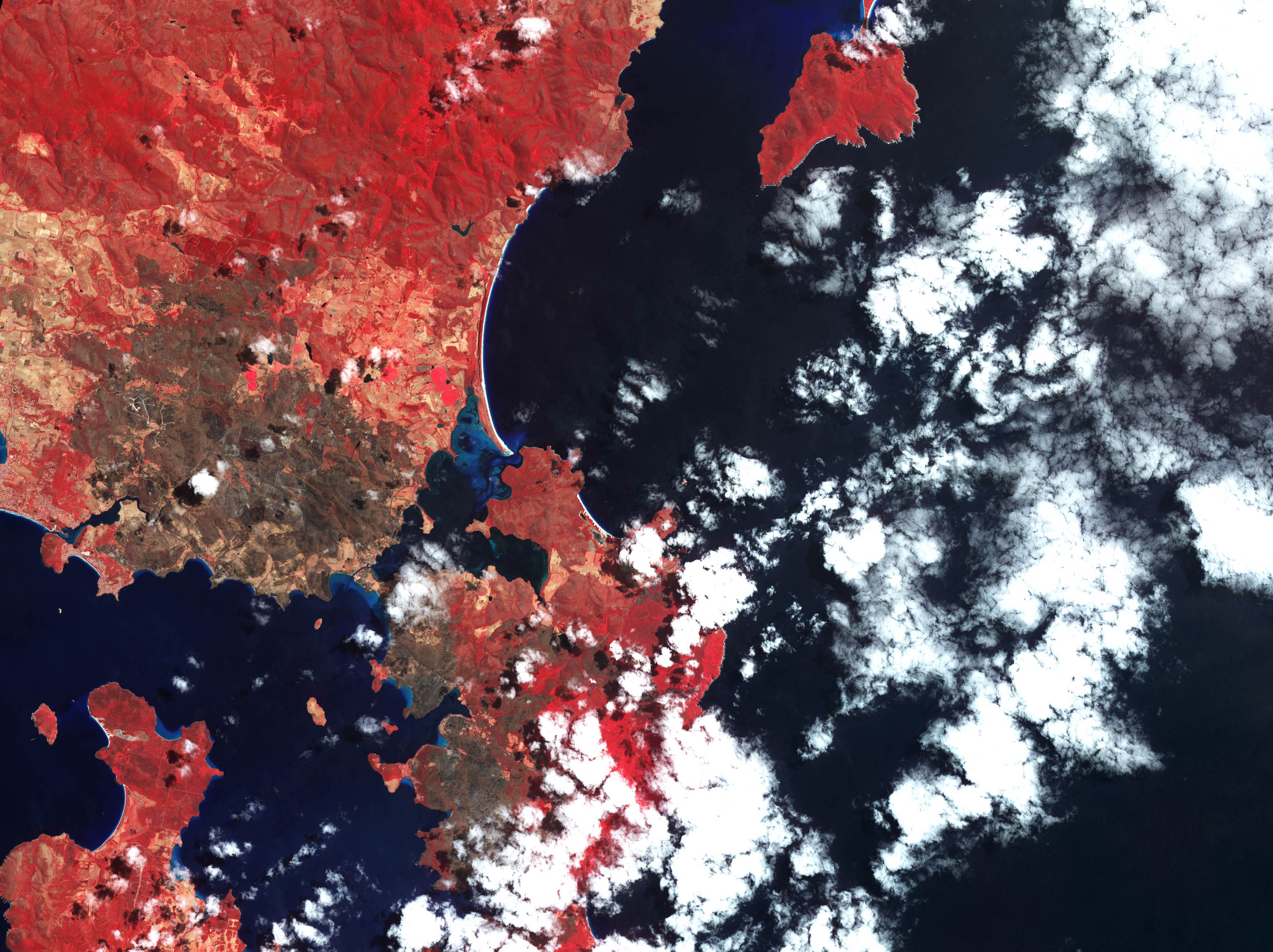
Despite satellite imagery indicating that the 2013 Tasmanian bushfires did not burn Smooth Island,[70][71] a blog from a nearby sailor during these bushfires suggests that they were "watching in dismay flames on Smooth Island near Dunalley".[72]
Tenure
Smooth island is private property. It has a freehold title with no covenants.[73]
Features
A lighthouse with the international marker identifier K 3621.2 was present on Smooth Island. However, since the island is private property to the water line the relevant authority was obligated to relocate it into the ocean around the northern tip of the island, to position: 42°56′24″S 147°46′53″E / 42.9399167°S 147.7812667°E.[74] The light characteristic remains unchanged. Its characteristics are: FL(3)W, period 6.1 seconds (i.e.: a cluster of 3 flashes of a white light is produced, which repeats every 6.1 seconds). Its height is 2 metres (6 feet). The light's range was 6 nautical miles in clear weather. It is a stainless steel pole in the water.[75]
Modern culture
The Australian artist Dale Frank produced a painting named "Dunalley, Smooth Island".[76]
Smooth Island and its lighthouse have also featured in poetry:[77]
I could lose or find myself
in this private Bermuda triangle-
Connelly's Bay, Lime Bay, Smooth Island;
In the dusk Smooth Island's navigation light
begins to blink its code name
to sailors bound for Dunalley
Gallery


References
- ^ Brothers, Nigel; Pemberton, David; Pryor, Helen; & Halley, Vanessa. (2001). Tasmania’s Offshore Islands: seabirds and other natural features. Tasmanian Museum and Art Gallery: Hobart. ISBN 0-7246-4816-X
- ^ a b c d e "Listmap: Land Information System Tasmania". Maps.thelist.tas.gov.au. Retrieved 28 December 2014.
- ^ "Ferals offshore islands". Environment.gov.au. Retrieved 28 December 2014.
- ^ a b "Murdunna - RBasket (Real Estate Basket), Best Search Engine for Real Estate". rbasket.com.au. Retrieved 2015-03-22.
- ^ "Murdunna, TAS 7178 Vacant land is recently sold". domain.com.au. Retrieved 2015-03-22.
- ^ "Mapping of Inshore Marine Habitats" (PDF). Imas.utas.edu.au. 2001. Retrieved 28 December 2014.
- ^ "FRDC 1994" (PDF). 1998. Retrieved 28 December 2014.
- ^ http://www.flora.sa.gov.au/efsa/algae_revealed/pdf/Rhabdonia_verticillata.pdf
- ^ "Rhabdonia verticillata, State Herbarium of South Australia". flora.sa.gov.au. Retrieved 2015-04-06.
- ^ "Halogenated phloroglucinols from Rhabdonia verticillata". sciencedirect.com. Retrieved 2015-04-06.
- ^ "Murdunna TAS 7178". Domain. Retrieved 2015-03-22.
- ^ a b "THE EFFECTS OF FIRE ON BURROW-NESTING SEABIRDS PARTICULARLY SHORT-TAILED SHEARWATERS (PUFF/NUS TENU/ROSTR/S) AND THEIR HABITAT IN TASMANIA" (PDF). Core.kmi.open.ac.uk. Retrieved 11 January 2015.
- ^ "Currawong Lakes : What's New for 2010" (PDF). Currawonglakes.com.au. Retrieved 11 January 2015.
- ^ "DISTRIBUTION, ABUNDANCE AND CONSERVATION STATUS OF SHORT-TAILED SHEARWATERS PUFFINUS TENUIROSTRIS IN TASMANIA, AUSTRALIA" (PDF). Marineornithology.org\accessdate=11 January 2015.
- ^ "An island of your own". Mercury. Retrieved 2015-04-06.
- ^ Mineral Resources of Australia. Books.google.com/np. Retrieved 11 January 2015.
- ^ http://www.mrt.tas.gov.au/mrtdoc/map_catalogue/map_public/898235_1/sorell50.pdf
- ^ A. B. Gulline, B.Sc. "Geological Survey Explanatory Report: Sorrell" (PDF). Tasmania Department of Mines. Retrieved 28 December 2014.
- ^ "Phosphate Rock – Garden Island – Norfolk Bay" Department of State Growth, Government of Tasmania. Retrieved 20 February 2015
- ^ "Climate statistics for Australian locations". bom.gov.au.
- ^ "Tasmanian Nomeclature: The Place-Names of the State, a Record of Origins and Dates". Trove.nla.gov.au. 16 September 1911. Retrieved 28 December 2014.
- ^ a b http://gutenberg.net.au/ebooks/e00049-images/flinders1-atlas3.jpg
- ^ "Lot 1 Norfolk Bay, Dunalley, TAS 7177 - Bedroom House For Sale". domain.com.au. Retrieved 2015-04-06.
- ^ "History". Gtdhs.com. Retrieved 11 January 2015.
- ^ "15 Jan 1836 - Classified Advertising". nla.gov.au.
- ^ a b c Flinders M (1814). A Voyage to Terra Australia, Undertaken for the Purpose of Completing the Discovery of that Vast Country, and Prosecuted in the Years 1801, 1802, and 1803, in His Majesty's Ship the Investigator and Subsequently in the Armed Vessel Porpoise and Cumberland Schooner. Books.google.com.au. Retrieved 11 January 2015.
- ^ Laurent Dousset. "Detailed record of the Oyster Bay Tribe". ausanthrop.net. Retrieved 2015-03-22.
- ^ Super User. "Local History". tasman.tas.gov.au. Retrieved 2015-03-22.
{{cite web}}:|author=has generic name (help) - ^ a b "Port Arthur, TAS - Aussie Towns". Aussie Towns. Retrieved 2015-03-22.
- ^ Egli, J. J. (Johann Jacob), 1825-1896. "Nomina geographica Versuch einer allgemeinen ... . - Full View - HathiTrust Digital Library - HathiTrust Digital Library". hathitrust.org. Retrieved 2015-03-22.
{{cite web}}: CS1 maint: multiple names: authors list (link) CS1 maint: numeric names: authors list (link) - ^ a b Flinders M (1965). "Observations on the Coasts of Van Diemen's Land, on Bass's Strait and Its Islands, and on Part of the Coasts of New South Wales: Intended to Accompany the Charts of the Late Discoveries in Those Countries". Gutenberg.net.au. Retrieved 11 January 2015.
- ^ Observations on the Coasts of Van Diemen's Land, on Bass's Strait and Its ... – Matthew Flinders – Google Books. Books.google.com.au. Retrieved 11 January 2015.
- ^ Walker JB (1914). "Tasmania RSo: Early Tasmania: papers read before the Royal Society of Tasmania during the years 1888 to 1899". J. Vail.
- ^ "The Mercury". Mercurynie.com.au. Retrieved 11 January 2015.
- ^ "LINC Tasmania catalogue • "0 @@ Chart of Van Diemen's Land from the best authorities and from actual surveys and measurements" by z @@ Scott, Thomas, 1800-1855". LINC Tasmania catalogue.
- ^ "The Hobart Town Courier (Tas. : 1827 – 1839)". Trove.nla.gov.au. Retrieved 11 January 2015.
- ^ "01 Oct 1839 - Advertising". nla.gov.au.
- ^ "The Mercury (Hobart, Tas. : 1860 – 1954)". Trove.nla.gov.au. Retrieved 11 January 2015.
- ^ "Garden Island, Norfolk Bay". Trove.nla.gov.au. Retrieved 11 January 2015.
Lot 2879, 145 acres 1 rood 30 perches, comprising an island known as Garden Island, situate in Norfolk Bay and King George's Sound. Upset price £227
- ^ "23 April 1864: Government Land Sale". Trove.nla.gov.au. Retrieved 28 December 2014.
- ^ "Sorell tasmania 1866 residents". ancestry.com. Retrieved 2015-03-22.
- ^ "Illustrated Australian News for Home Readers (Melbourne, Vic. : 1867 – 1875)". Trove.nla.gov.au. Retrieved 11 January 2015.
- ^ "he Cornwall Chronicle (Launceston, Tasmania : 1835 – 1880)". Trove.nla.gov.au. Retrieved 11 January 2015.
- ^ "The Mercury (Hobart, Tas. : 1860 – 1954)". Trove.nla.gov.au. Retrieved 11 January 2015.
- ^ "30 Jul 1878 - COMMERCIAL INTELLIGENCE. The Mercury Office, Mon..." nla.gov.au. Retrieved 2015-03-22.
- ^ "The Mercury (Hobart, Tas. : 1860 – 1954)". Trove.nla.gov.au. Retrieved 11 January 2015.
- ^ "The Mercury (Hobart, Tas. : 1860 – 1954)". Trove.nla.gov.au. Retrieved 11 January 2015.
- ^ "he Mercury (Hobart, Tas. : 1860 – 1954)". Trove.nla.gov.au. Retrieved 11 January 2015.
- ^ "The Mercury (Hobart, Tas. : 1860 – 1954)". Trove.nla.gov.au. Retrieved 11 January 2015.
- ^ "The Mercury (Hobart, Tas. : 1860 – 1954)". Trove.nla.gov.au. Retrieved 11 January 2015.
- ^ "The Mercury (Hobart, Tas. : 1860 – 1954)". Trove.nla.gov.au. Retrieved 11 January 2015.
- ^ "GARDEN ISLAND, Norfolk Bay, for private sale. Apply to CAPTAIN DE HOGHTON, "Winton," Brighton". Trove.nla.gov.au. Retrieved 11 January 2015.
- ^ "The Mercury (Hobart, Tas. : 1860 – 1954)". Trove.nla.gov.au. Retrieved 11 January 2015.
- ^ "The Sydney Morning Herald (NSW : 1842 – 1954)". Trove.nla.gov.au. Retrieved 11 January 2015.
- ^ "The Sydney Morning Herald (NSW : 1842 – 1954)". Trove.nla.gov.au. Retrieved 11 January 2015.
- ^ "04 Jul 1900 - EAST BAY NECK. To the Editor of "The Mercury."". nla.gov.au.
- ^ "Nelson Evening Mail — 24 July 1909 — LOCAL & GENERAL NEWS". Paperspast.natlib.govt.nz. Retrieved 11 January 2015.
- ^ "The Mercury (Hobart, Tas. : 1860 – 1954)". Trove.nla.gov.au. Retrieved 11 January 2015.
- ^ "The Mercury (Hobart, Tas. : 1860 – 1954)". Trove.nla.gov.au. Retrieved 11 January 2015.
- ^ "02 Sep 1914 - THE NORFOLK BAY TRAGEDY. A MYSTERIOUS OCCURRENCE..." nla.gov.au. Retrieved 2015-04-06.
- ^ "The Mercury (Hobart, Tas. : 1860 – 1954)". Trove.nla.gov.au. Retrieved 11 January 2015.
- ^ "The Mercury (Hobart, Tas. : 1860 – 1954)". Trove.nla.gov.au. Retrieved 11 January 2015.
- ^ "15 Oct 1919 - Advertising". nla.gov.au. Retrieved 2015-03-22.
- ^ a b "Lot 1 Norfolk Bay, Dunalley TAS 7177". Homebound.com.au. Retrieved 10 January 2015.
- ^ "The Mercury (Hobart, Tas. : 1860 – 1954)". Trove.nla.gov.au. Retrieved 11 January 2015.
- ^ "08 Nov 1946 - ENGINES NOT TO BE SEALED IN OCEAN RACE Hobart Re..." nla.gov.au. Retrieved 2015-03-22.
- ^ "09 Apr 1946 - Advertising". nla.gov.au.
- ^ "533 SCHEME AMENDMENT- BOOMER JETTY ROAD, BOOMER BAY.docx". Google Docs. Retrieved 2015-03-22.
- ^ http://reit.com.au/wp-content/uploads/SPDR-NOV13.pdf
- ^ http://eoimages.gsfc.nasa.gov/images/imagerecords/80000/80252/tasmania_ast_2013014.jpg
- ^ http://eoimages.gsfc.nasa.gov/images/imagerecords/80000/80252/tasmania_ast_2013014_lrg2.jpg
- ^ "Nahani Cruising Yacht – Voyages 19". livenet.com.au. Retrieved 14 February 2015.
- ^ http://www.parks.tas.gov.au/file.aspx?id=6674
- ^ Ionata Digital. "M46-14 Smooth Island Light". MAST. Retrieved 14 February 2015.
- ^ Prostar Nga List of Lights, Radio AIDS and Fog Signals 2006 West Coasts of ... Books.google.com.au. Retrieved 11 January 2015.
- ^ "ART GALLERIES". schubertcontemporary.com.au. Retrieved 2015-04-06.
- ^ Two Kinds of Silence. Books.google.com.np. Retrieved 11 January 2015.