Malakal County: Difference between revisions
Appearance
Content deleted Content added
Myrabert01 (talk | contribs) No edit summary |
No edit summary Tags: Reverted Mobile edit Mobile web edit |
||
| Line 1: | Line 1: | ||
{{Infobox settlement |
{{Infobox settlement |
||
<!-- See Template:Infobox settlement for additional fields and descriptions --> |
<!-- See Template:Infobox settlement for additional fields and descriptions --> |
||
| name = |
| name = Makal |
||
| native_name = |
| native_name = |
||
| native_name_lang = <!-- ISO 639-2 code e.g. "fr" for French. If more than one, use {{lang}} instead --> |
| native_name_lang = <!-- ISO 639-2 code e.g. "fr" for French. If more than one, use {{lang}} instead --> |
||
Revision as of 02:00, 13 September 2023
Makal | |
|---|---|
 | |
| Country | South Sudan |
| State | Upper Nile State |
| Payam | 6 payams |
| Time zone | UTC+2 (CAT) |
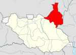
Malakal is a county in the Upper Nile State. Previously, it was a part of Upper Nile, South Sudan.[1][2][3]
Administrative divisions
Malakal county is divided into 6 Payams
- Central Malakal
- Eastern Malakal
- Northern Malakal
- Southern Malakal
- Lelo
- Ogot
References
- ^ "Referendum results: Upper Nile". Southern Sudan Referendum 2011. Retrieved 2012-01-30.
- ^ "Full list of Kiir's proposed new 28 states in S Sudan". Radio Tamazuj. 3 October 2015. Archived from the original on 5 March 2016. Retrieved 14 August 2016.
- ^ "East Nile governor create three counties, removes Pigi County Commissioner". Radio Tamazuj. 25 April 2016. Archived from the original on 19 August 2016. Retrieved 14 August 2016.
9°38′01″N 31°37′03″E / 9.6337°N 31.6174°E

