
Maarjamäe: Difference between revisions
Estopedist1 (talk | contribs) →Maarjamäe castle: harmonization |
expanded |
||
| Line 3: | Line 3: | ||
{{Infobox settlement |
{{Infobox settlement |
||
| name |
| name = Maarjamäe |
||
| settlement_type |
| settlement_type = Subdistrict of [[Tallinn]] |
||
| image_map |
| image_map = Tallinn maarjamae asum.png |
||
| map_caption |
| map_caption = Maarjamäe within [[Pirita]] District. |
||
| subdivision_type |
| subdivision_type = [[List of sovereign states|Country]] |
||
| subdivision_name |
| subdivision_name = {{flag|Estonia}} |
||
| subdivision_type1 |
| subdivision_type1 = [[Counties of Estonia|County]] |
||
| subdivision_name1 |
| subdivision_name1 = [[File:Flag of et-Harju maakond.svg|24px]] [[Harju County]] |
||
| subdivision_type2 |
| subdivision_type2 = [[List of cities and towns in Estonia|City]] |
||
| subdivision_name2 |
| subdivision_name2 = [[File:Flag of Tallinn.svg|24px]] [[Tallinn]] |
||
| subdivision_type3 |
| subdivision_type3 = District |
||
| subdivision_name3 |
| subdivision_name3 = [[File:Flag of Pirita district, Tallinn, Estonia.svg|24px]] [[Pirita]] |
||
| |
| area_total_ha = 155 |
||
| population_total |
| population_total = 2412 |
||
| population_as_of |
| population_as_of = 01.01.2022<ref name=population/> |
||
| population_density_km2 |
| population_density_km2 = auto |
||
| postal_code |
| postal_code = |
||
| website |
| website = |
||
}} |
}} |
||
'''Maarjamäe''' ([[Estonian language|Estonian]] for ''"Maria's Hill"'') is a subdistrict ({{lang-et|asum}}) in the district of [[Pirita]], [[Tallinn]], the capital of [[Estonia]]. It has a population of 2, |
'''Maarjamäe''' ([[Estonian language|Estonian]] for ''"Maria's Hill"'') is a subdistrict ({{lang-et|asum}}) in the district of [[Pirita]], [[Tallinn]], the capital of [[Estonia]]. It is bordered by Pirita and Kose to the north, Lasnamäe to the south, Kadriorg to the southwest and the Bay of Tallinn to the west. As of 2022, it has a population of 2,412.<ref name=population>{{cite web|title=Tallinna statistika aastaraamat "Tallinn arvudes 2022" |url=https://www.tallinn.ee/et/statistika/tallinna-statistika-aastaraamat-tallinn-arvudes|publisher=Tallinn City Government|access-date=24 September 2023}}</ref> |
||
Maarjamäe's known history dates back to 1689, with the area back then known as '''Ristimäe/Streitberg'''. The end of the 17th century saw the construction of a summer manor, with the area becoming a popular resort for the burghers. The construction of a sugar factory in 1811 saw the area become known as '''Suhkrumäe''', with it's current name only coming into existence in 1873.<ref name=":0">{{Cite web |title=Maarjamäe lossi lugu |url=https://www.ajaloomuuseum.ee/muuseumist/ajalugu/maarjamae-lossi-lugu |access-date=24 September 2023 |website=Eesti Ajaloomuuseum}}</ref> Suburbia construction ensued in the 1940s and 1950s, transforming the area into its modern form.<ref name=":1">Epp Lankots, [https://register.muinas.ee/ftp/XX_saj._arhitektuur/maakondlikud%20ylevaated/harjumaa/tallinn/tallinn2.pdf EESTI 20. SAJANDI ARHITEKTUURI KAITSE PROGRAMM. TALLINNA NÕUKOGUDEAEGNE EHITUSPÄRAND], Tallinn 2009, lk 20</ref> |
|||
== Etymology == |
|||
The earliest known name for the area is the German Streitberg/Strietberg ('strife hill'), referencing an alleged Livonian War battle between the Brotherhood of Blackheads and besieging Russians. An Estonian version of this name is Ristimäe or Riiumägi ('cross hill', 'strife hill').<ref name=":2">{{Cite web |title=KNR 'Maarjamäe' |url=https://www.eki.ee/dict/knr/index.cgi?Q=Maarjam%C3%A4e |access-date=24 September 2023 |website=EKI Kohanimeraamat}}</ref> |
|||
A colloquial name for the area, Suhkrumäe ('sugar hill') emerged in the 19th century with the construction of a sugar factory by Johan Gottlieb Clementz.<ref name=":0" /> |
|||
The current name emerged as the German Marienberg, most likely named by Count Anatoly Orlov-Davydov in honour of his wife or daughter, Maria. An alternative theory suggests the source as the historical, disused name for Pirita, ''Marienthal, Vallis Mariae''. Estonianization in the 1930s brought about the modern name Maarjamäe.<ref name=":2" /> |
|||
== History == |
|||
The first known location in the area was an inn (Ristimeh Krog), marked on a 1689 map.<ref name=":2" /> Ratsherr and Brotherhood of Blackheads member Christian von Geldern founded a summer manor overlooking the sea at the end of the 17th century.<ref name=":0" /> With the city falling into Russian hands, a naval battery was constructed on sea "in front" of the manor in 1715.<ref>{{Cite web |date=2003 |title=Maarjamäe |url=http://entsyklopeedia.ee/artikkel/maarjam%C3%A4e |url-status=live |access-date=24 September 2023 |website=Eesti Entsüklopeedia, 12}}</ref> |
|||
The burgher Johan Gottlieb Clementz obtained a plot of land and led the construction of a sugar factory on site in 1811. By the 1820s the site included several stone buildings, a wooden residential building, sheds, a forge, lime burning stove, ice cellar and a water distribution system for the factory. The plot was surrounded by a four-metre stone wall. Several stone buildings, the ice cellar and parts of the wall survive to this day.<ref name=":0" /> |
|||
Christian Abraham Rotermann purchased the factory in 1861, converting the site to produce starch and spirits. Rotermann also constructed Tallinn's first steam mill at Suhkrumäe. However, industrial production was ended for good in 1869 with the factory destroyed in a fire.<ref name=":0" /> |
|||
The 1870s brought about change with the area becoming a popular resort. Count Anatoly Orlov-Davydov purchased the manor in 1873 and renamed the area in honour of his wife, Maria.<ref name=":0" /> Designed by Robert Gödicke, 'Orlov's castle' was finished by 1874 and used mainly by the count's family. Summer houses were constructed near the castle, in today's administrative Maarjamäe. Larger plans to construct a garden city stretching from Lillepi were not realised.<ref name=":3">{{Cite news |last=Feldmann |first=Mati |date=3 April 2017 |title=Maarjamäel elustub ajalugu |pages=49-51 |work=Eesti Ehitab |url=https://dea.digar.ee/article/AKeestiehitab/2017/04/03/45 |access-date=24 September 2019}}</ref> |
|||
The turn of the century brought about social changes. The newly-exiled count rented out the castle for social events. In 1933, the most prestigious restaurant-hotel of the city was opened in the castle. However, in 1937 the castle was purchased by the state with the army's Air Force Academy moving in. Following Soviet occupation, the castle was shortly used by the Soviet army, later converted into tiny flats and left to dilapidate.<ref name=":0" /> |
|||
Some imperial-era resort homes remain in Maarjamäe today, but the vast majority of the district was constructed after the war. Estonia distinguished in the USSR with construction of private houses allowed in urban areas, though still strictly regulated with building series'. Architectural control was however less strict and unlike other buildings from the Stalinist era, German influence is strongly visible;<ref name=":3" /> the area is a stand-out example of the era's architecture.<ref name=":1" /> Expansion of the suburbia continued through the following decades.<ref name=":3" /> |
|||
Between the castle and suburbia lies a cemetery and memorial complex. Both Soviet and German troops were buried at Maarjamäe, including Bolshevik rebel sailors executed in 1919 on Naissaar and Estonian volunteers in German uniform. An obelisk was erected in 1960 commemorating the Ice Cruise of the Baltic Fleet, a larger memorial complex commemorating "those fallen fighting for Soviet rule" was opened in 1975.<ref>{{Cite web |last=Juske |first=Anto |date=9 February 2007 |title=Kalevipoeg, tahan sind aidata! |url=https://sirp.ee/s1-artiklid/c6-kunst/kalevipoeg-tahan-sind-aidata/ |url-status=live |access-date=24 September 2023 |website=Sirp}}</ref> A new, Estonian memorial commemorating the victims of communism between 1940-1991 was built next to the German cemetery and Soviet memorial. |
|||
In 1980 construction of a base of the Tallinn Higher Military-Political Construction School began.<ref>{{Cite news |date=9 September 2006 |title=Tunne oma kodukanti! |pages=4 |work=Pirita |url=https://www.tallinn.ee/et/media/281256 |url-status=live |access-date=24 September 2023}}</ref> The site was taken over by the newly-founded Estonian Academy of Security Sciences.<ref>{{Cite web |title=Ajalugu |url=https://www.sisekaitse.ee/et/node/108 |access-date=24 September 2023 |website=Sisekaitseakadeemia}}</ref> |
|||
Suburbia expansion continued in the 21st century, with new private homes, terraced housing and apartment complexes.<ref>{{Cite web |date=12 December 2001 |title=Maarjamäele kerkivad ridaelamud |url=https://arileht.delfi.ee/artikkel/50812859/maarjamaele-kerkivad-ridaelamud |website=Ärileht}}</ref> The castle was renovated in the 1980s by Polish company PKZ Wroclav. In 2018, the castle was re-opened as a history museum, also hosting the Estonian Film Museum.<ref name=":0" /> |
|||
==Landmarks and institutions== |
==Landmarks and institutions== |
||
Revision as of 20:02, 24 September 2023
Maarjamäe | |
|---|---|
Subdistrict of Tallinn | |
 Maarjamäe within Pirita District. | |
| Country | |
| County | |
| City | |
| District | |
| Area | |
| • Total | 155 ha (383 acres) |
| Population (01.01.2022[1]) | |
| • Total | 2,412 |
| • Density | 1,600/km2 (4,000/sq mi) |
Maarjamäe (Estonian for "Maria's Hill") is a subdistrict (Estonian: asum) in the district of Pirita, Tallinn, the capital of Estonia. It is bordered by Pirita and Kose to the north, Lasnamäe to the south, Kadriorg to the southwest and the Bay of Tallinn to the west. As of 2022, it has a population of 2,412.[1]
Maarjamäe's known history dates back to 1689, with the area back then known as Ristimäe/Streitberg. The end of the 17th century saw the construction of a summer manor, with the area becoming a popular resort for the burghers. The construction of a sugar factory in 1811 saw the area become known as Suhkrumäe, with it's current name only coming into existence in 1873.[2] Suburbia construction ensued in the 1940s and 1950s, transforming the area into its modern form.[3]
Etymology
The earliest known name for the area is the German Streitberg/Strietberg ('strife hill'), referencing an alleged Livonian War battle between the Brotherhood of Blackheads and besieging Russians. An Estonian version of this name is Ristimäe or Riiumägi ('cross hill', 'strife hill').[4]
A colloquial name for the area, Suhkrumäe ('sugar hill') emerged in the 19th century with the construction of a sugar factory by Johan Gottlieb Clementz.[2]
The current name emerged as the German Marienberg, most likely named by Count Anatoly Orlov-Davydov in honour of his wife or daughter, Maria. An alternative theory suggests the source as the historical, disused name for Pirita, Marienthal, Vallis Mariae. Estonianization in the 1930s brought about the modern name Maarjamäe.[4]
History
The first known location in the area was an inn (Ristimeh Krog), marked on a 1689 map.[4] Ratsherr and Brotherhood of Blackheads member Christian von Geldern founded a summer manor overlooking the sea at the end of the 17th century.[2] With the city falling into Russian hands, a naval battery was constructed on sea "in front" of the manor in 1715.[5]
The burgher Johan Gottlieb Clementz obtained a plot of land and led the construction of a sugar factory on site in 1811. By the 1820s the site included several stone buildings, a wooden residential building, sheds, a forge, lime burning stove, ice cellar and a water distribution system for the factory. The plot was surrounded by a four-metre stone wall. Several stone buildings, the ice cellar and parts of the wall survive to this day.[2]
Christian Abraham Rotermann purchased the factory in 1861, converting the site to produce starch and spirits. Rotermann also constructed Tallinn's first steam mill at Suhkrumäe. However, industrial production was ended for good in 1869 with the factory destroyed in a fire.[2]
The 1870s brought about change with the area becoming a popular resort. Count Anatoly Orlov-Davydov purchased the manor in 1873 and renamed the area in honour of his wife, Maria.[2] Designed by Robert Gödicke, 'Orlov's castle' was finished by 1874 and used mainly by the count's family. Summer houses were constructed near the castle, in today's administrative Maarjamäe. Larger plans to construct a garden city stretching from Lillepi were not realised.[6]
The turn of the century brought about social changes. The newly-exiled count rented out the castle for social events. In 1933, the most prestigious restaurant-hotel of the city was opened in the castle. However, in 1937 the castle was purchased by the state with the army's Air Force Academy moving in. Following Soviet occupation, the castle was shortly used by the Soviet army, later converted into tiny flats and left to dilapidate.[2]
Some imperial-era resort homes remain in Maarjamäe today, but the vast majority of the district was constructed after the war. Estonia distinguished in the USSR with construction of private houses allowed in urban areas, though still strictly regulated with building series'. Architectural control was however less strict and unlike other buildings from the Stalinist era, German influence is strongly visible;[6] the area is a stand-out example of the era's architecture.[3] Expansion of the suburbia continued through the following decades.[6]
Between the castle and suburbia lies a cemetery and memorial complex. Both Soviet and German troops were buried at Maarjamäe, including Bolshevik rebel sailors executed in 1919 on Naissaar and Estonian volunteers in German uniform. An obelisk was erected in 1960 commemorating the Ice Cruise of the Baltic Fleet, a larger memorial complex commemorating "those fallen fighting for Soviet rule" was opened in 1975.[7] A new, Estonian memorial commemorating the victims of communism between 1940-1991 was built next to the German cemetery and Soviet memorial.
In 1980 construction of a base of the Tallinn Higher Military-Political Construction School began.[8] The site was taken over by the newly-founded Estonian Academy of Security Sciences.[9]
Suburbia expansion continued in the 21st century, with new private homes, terraced housing and apartment complexes.[10] The castle was renovated in the 1980s by Polish company PKZ Wroclav. In 2018, the castle was re-opened as a history museum, also hosting the Estonian Film Museum.[2]
Landmarks and institutions
- Estonian Academy of Security Sciences (Kase 61)
Maarjamäe Palace

Maarjamäe Palace is locating on the area of earlier Maarjamäe summer manor (Estonian: Maarjamäe suvemõis) being its main building. The castle was built in 1872.[11]
Nowadays, the building is used by Estonian History Museum (administratively belongs to Kadriorg subdistrict).
Gallery
-

-
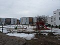
-
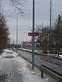
-
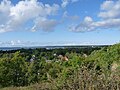 View from Lasnamäe.
 -
 World War II Memorial (administratively Kadriorg)


See also
References
- ^ a b "Tallinna statistika aastaraamat "Tallinn arvudes 2022"". Tallinn City Government. Retrieved 24 September 2023.
- ^ a b c d e f g h "Maarjamäe lossi lugu". Eesti Ajaloomuuseum. Retrieved 24 September 2023.
- ^ a b Epp Lankots, EESTI 20. SAJANDI ARHITEKTUURI KAITSE PROGRAMM. TALLINNA NÕUKOGUDEAEGNE EHITUSPÄRAND, Tallinn 2009, lk 20
- ^ a b c "KNR 'Maarjamäe'". EKI Kohanimeraamat. Retrieved 24 September 2023.
- ^ "Maarjamäe". Eesti Entsüklopeedia, 12. 2003. Retrieved 24 September 2023.
{{cite web}}: CS1 maint: url-status (link) - ^ a b c Feldmann, Mati (3 April 2017). "Maarjamäel elustub ajalugu". Eesti Ehitab. pp. 49–51. Retrieved 24 September 2019.
- ^ Juske, Anto (9 February 2007). "Kalevipoeg, tahan sind aidata!". Sirp. Retrieved 24 September 2023.
{{cite web}}: CS1 maint: url-status (link) - ^ "Tunne oma kodukanti!". Pirita. 9 September 2006. p. 4. Retrieved 24 September 2023.
{{cite news}}: CS1 maint: url-status (link) - ^ "Ajalugu". Sisekaitseakadeemia. Retrieved 24 September 2023.
- ^ "Maarjamäele kerkivad ridaelamud". Ärileht. 12 December 2001.
- ^ Estonian Encyclopaedia, nr 12. 2003. Page 322.
External links
59°27′22″N 24°49′48″E / 59.456°N 24.830°E
Places adjacent to Maarjamäe | |
|---|---|
Administrative districts (linnaosad) and subdistricts (asumid) of Tallinn | ||
|---|---|---|
| Haabersti |  | |
| Kesklinn | ||
| Kristiine | ||
| Lasnamäe | ||
| Mustamäe | ||
| Nõmme | ||
| Pirita | ||
| Põhja-Tallinn | ||
This Tallinn location article is a stub. You can help Wikipedia by expanding it. |