A98 road: Difference between revisions
Appearance
Content deleted Content added
m Reverted edits by 139.47.10.78 (talk) (HG) (3.4.12) |
Ollyhinge11 (talk | contribs) ADDED next and prev route |
||
| Line 3: | Line 3: | ||
{{Use British English|date=February 2013}} |
{{Use British English|date=February 2013}} |
||
{{Infobox road |
{{Infobox road |
||
|country=GBR |
| country = GBR |
||
|type=A |
| type = A |
||
|route=98 |
| route = 98 |
||
|map=[[File:A98 road map.png|200px]]|map_custom=yes |
| map = [[File:A98 road map.png|200px]] |
||
| map_custom = yes |
|||
| |
| length_mi = 50.7 |
||
|length_ref = <ref>{{cite web|title=Driving directions to A98|url=https://maps.google.co.uk/maps?saddr=High+St%2FA98&daddr=A98&hl=en&ll=57.676989,-2.536469&spn=0.412671,1.240082&sll=57.613371,-3.081751&sspn=0.025837,0.077505&geocode=FddWcAMdDl7h_w%3BFZgTbwMdffLQ_w&t=h&mra=mift&mrsp=1&sz=14&z=10|publisher=[[Google Maps]]|accessdate=21 September 2013}}</ref> |
| length_ref = <ref>{{cite web|title=Driving directions to A98|url=https://maps.google.co.uk/maps?saddr=High+St%2FA98&daddr=A98&hl=en&ll=57.676989,-2.536469&spn=0.412671,1.240082&sll=57.613371,-3.081751&sspn=0.025837,0.077505&geocode=FddWcAMdDl7h_w%3BFZgTbwMdffLQ_w&t=h&mra=mift&mrsp=1&sz=14&z=10|publisher=[[Google Maps]]|accessdate=21 September 2013}}</ref> |
||
|direction_a= East |
| direction_a = East |
||
|terminus_a = {{jct|country=GBR|A|90|name1= }} [[Fraserburgh]]<br>{{jct|country=GBR|A|950|name1= }}<br>{{jct|country=GBR|A|947|name1= }}<br>{{jct|country=GBR|A|97|name1= }}<br>{{jct|country=GBR|A|942|name1= }} |
| terminus_a = {{jct|country=GBR|A|90|name1= }} [[Fraserburgh]]<br>{{jct|country=GBR|A|950|name1= }}<br>{{jct|country=GBR|A|947|name1= }}<br>{{jct|country=GBR|A|97|name1= }}<br>{{jct|country=GBR|A|942|name1= }} |
||
|direction_b= West |
| direction_b = West |
||
|terminus_b = {{jct|country=GBR|A|96|name1= }} [[Fochabers]] |
| terminus_b = {{jct|country=GBR|A|96|name1= }} [[Fochabers]] |
||
|junction |
| junction = |
||
|destinations= [[Elgin, Moray|Elgin]], [[Banff, Aberdeenshire|Banff]], [[Fraserburgh]] |
| destinations = [[Elgin, Moray|Elgin]], [[Banff, Aberdeenshire|Banff]], [[Fraserburgh]] |
||
| previous_type = A97 |
|||
| previous_route = A99 |
|||
}} |
}} |
||
Revision as of 13:50, 7 December 2023
| A98 | ||||
|---|---|---|---|---|
| Route information | ||||
| Length | 50.7 mi[1] (81.6 km) | |||
| Major junctions | ||||
| East end | ||||
| West end | ||||
| Location | ||||
| Country | United Kingdom | |||
| Primary destinations | Elgin, Banff, Fraserburgh | |||
| Road network | ||||
| ||||
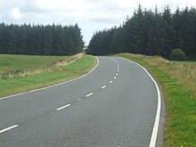
The A98 road is a major coastal road of northeast Scotland passing through Moray and Aberdeenshire. The A98 is no longer a primary route, with this status being removed shortly after the A92 was renumbered A90.
Route

It originates in the west at Fochabers at a junction with the A96, and proceeds northeast, passing close to Buckie, Findochty and Portknockie before passing through Cullen and Portsoy.
After a junction with the A95 it passes through Banff and Macduff. It then bears southeast and inland for some distance, passing near to the prehistoric monument of Longman Hill; thence it runs close to New Pitsligo before heading northeast to Fraserburgh where it terminates.
References
- ^ "Driving directions to A98". Google Maps. Retrieved 21 September 2013.
External links
 Media related to A98 road (Scotland) at Wikimedia Commons
57°40′00″N 2°28′30″W / 57.66666°N 2.47497°W


