
Fruita, Utah: Difference between revisions
m Correct cap in header and/or general fixes. |
No edit summary |
||
| Line 25: | Line 25: | ||
[[Category:Wayne County, Utah]] |
[[Category:Wayne County, Utah]] |
||
[[Category:Capitol Reef National Park]] |
[[Category:Capitol Reef National Park]] |
||
[[Category:One room schoolhouses]] |
|||
[[Category:Schoolhouses in the United States]] |
|||
[[de:Fruita (Utah)]] |
[[de:Fruita (Utah)]] |
||
Revision as of 18:43, 30 July 2010

Fruita is the best-known settlement in Capitol Reef National Park in Wayne County, Utah, United States. It is located at the confluence of Fremont River and Sulphur Creek.
It was established in 1880 by Mormons under the name "Junction," and first in 1902 or 1904 became known as Fruita. In 1900 Fruita was named The Eden of Wayne County for its large orchards.
Today few buildings remain, except for the restored schoolhouse and the Gifford house and barn. The orchards remain, now under the ownership of the National Park Service, and have about 2,500 trees. The orchards are preserved by the NPS as a "historic landscape" and a small crew takes care of them, pruning, irrigating, replanting, and spraying.
The one-room schoolhouse was built and opened in 1896. The few students were instructed mainly in reading, writing, and arithmetic, but when the teachers were capable, they also studied other subjects such as history or geography. The room was also used for balls and religious services. It was renovated in 1966 by the National Park Service.[1]
See also
Popular culture
- Used as the setting for Western Five Bloody Graves at IMDb 1970, according to DVD audio commentary.
References
- ^ Template:PDFlink — National Register of Historic Places - Original Nominiation Form
Municipalities and communities of Wayne County, Utah, United States | ||
|---|---|---|
| Towns | 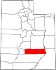 | |
| CDPs | ||
| Unincorporated communities | ||
| Ghost towns | ||