Miliana: Difference between revisions
No edit summary |
No edit summary |
||
| Line 1: | Line 1: | ||
{{for|the coaster in service with the French Government from 1946-48|SS Miliana}} |
{{for|the coaster in service with the French Government from 1946-48|SS Miliana}} |
||
'''Miliana''' ({{lang-ar|مليانا}}) is a town in [[Ain Defla Province]], northwestern [[Algeria]]. It is approximately 160 km southwest of the Algerian capital, [[Algiers]].<ref name="eb">[http://www.britannica.com/EBchecked/topic/382254/Miliana Miliana(Algeria)]. Encyclopaedia Britannica Online. Retrieved October 3, 2010.</ref> The population was estimated at 40,000 in 2005.<ref name="LookLex">[http://i-cias.com/e.o/miliana.htm Miliana]. LookLex Encyclopaedia. Retrieved on October 3, 2010.</ref> The town is located south of the Dahra Massif, on the wooded southern flank of Mount Zaccar Rherbi, five kilometers north of the |
'''Miliana''' ({{lang-ar|مليانا}}) is a town in [[Ain Defla Province]], northwestern [[Algeria]]. It is approximately 160 km southwest of the Algerian capital, [[Algiers]].<ref name="eb">[http://www.britannica.com/EBchecked/topic/382254/Miliana Miliana(Algeria)]. Encyclopaedia Britannica Online. Retrieved October 3, 2010.</ref> The population was estimated at 40,000 in 2005.<ref name="LookLex">[http://i-cias.com/e.o/miliana.htm Miliana]. LookLex Encyclopaedia. Retrieved on October 3, 2010.</ref> The town is located south of the Dahra Massif, on the wooded southern flank of Mount Zaccar Rherbi, five kilometers north of the [[Chelif River]], and overlooking the Zaccar plateau to the west.<ref name="eb"/><ref name="LookLex"/> |
||
The center of Miliana has an Arab quarter and a French quarter, both of which are surrounded by city walls built on [[Turkish]] and [[Berber]] foundations. The main site in the Arab quarter is the [[Mosque]] of Sidi Ahmed ben Yousef. Built in the [[Moors|Moorish]] style, the mosque is the location of a biannual [[pilgrimage]]. The Arab quarter also contains a covered [[marketplace]]. The modern section of the town center, known as the Place Cornot (or Place de l’Horloge), is shaded by trees and contains a [[clock tower]], formerly a [[minaret]].<ref name="eb"/><ref name="LookLex"/> |
The center of Miliana has an Arab quarter and a French quarter, both of which are surrounded by city walls built on [[Turkish]] and [[Berber]] foundations. The main site in the Arab quarter is the [[Mosque]] of Sidi Ahmed ben Yousef. Built in the [[Moors|Moorish]] style, the mosque is the location of a biannual [[pilgrimage]]. The Arab quarter also contains a covered [[marketplace]]. The modern section of the town center, known as the Place Cornot (or Place de l’Horloge), is shaded by trees and contains a [[clock tower]], formerly a [[minaret]].<ref name="eb"/><ref name="LookLex"/> |
||
Revision as of 02:24, 4 October 2010
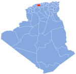
Miliana (Arabic: مليانا) is a town in Ain Defla Province, northwestern Algeria. It is approximately 160 km southwest of the Algerian capital, Algiers.[1] The population was estimated at 40,000 in 2005.[2] The town is located south of the Dahra Massif, on the wooded southern flank of Mount Zaccar Rherbi, five kilometers north of the Chelif River, and overlooking the Zaccar plateau to the west.[1][2]
The center of Miliana has an Arab quarter and a French quarter, both of which are surrounded by city walls built on Turkish and Berber foundations. The main site in the Arab quarter is the Mosque of Sidi Ahmed ben Yousef. Built in the Moorish style, the mosque is the location of a biannual pilgrimage. The Arab quarter also contains a covered marketplace. The modern section of the town center, known as the Place Cornot (or Place de l’Horloge), is shaded by trees and contains a clock tower, formerly a minaret.[1][2]
Miliana is primarily an agricultural town. Its vineyards, orchards and gardens, which lie below the town center, are fed by water from nearby mountains that usually have snow in winters. Hydroelectric power is used for tile factories, flour mills and other light industries.[1][2]
History
Miliana was founded in the 10th century by Buluggin ibn Ziri on the site of an ancient Roman city, Zucchabar (Succhabar). In the 1830s, the town came under the control of Abd al-Qadir in opposition to the increasing French occupation of Algeria. In 1840, al-Qadir ordered Miliana to be burned down instead of surrendering it to the French. The town eventually fell under French control in 1842,[2] and was rebuilt in the French Colonial architectural style.[1]
Zucchabar
Zucchabar (located at 36°15′57″N 2°17′50″E / 36.26583°N 2.29722°E, near present day Miliana) was an ancient town in the Roman province of Mauretania Caesariensis. It was constituted as a Roman colony (Colonia Iulia Augusta Zucchabar) under Augustus. In late antiquity it was an episcopal see and has been a titular see of the Catholic Church since 1967.[citation needed]
Zucchabar is featured in the film Gladiator, where it is falsely introduced as the name of a Roman province.[3]
References
36°18′36″N 2°9′44″E / 36.31000°N 2.16222°E

