
Cortegada Island: Difference between revisions
No edit summary |
No edit summary |
||
| Line 10: | Line 10: | ||
Is valued by many researchers and scientists, as well as by the richness of its sea, by having the largest [[forest]] of [[Laurus nobilis|Laurel bay]] that exists in [[Europe]]. |
Is valued by many researchers and scientists, as well as by the richness of its sea, by having the largest [[forest]] of [[Laurus nobilis|Laurel bay]] that exists in [[Europe]]. |
||
It's renowned for having the last wild laurel forest of Galicia as well as a mix population of [[Pinus pinea|pinyon pinetrees]] and [[pinus pinaster]]. |
It's renowned for having the last wild laurel forest of Galicia as well as a mix population of [[Pinus pinea|pinyon pinetrees]] and [[pinus pinaster]]. |
||
It also retains a large [[oak]] forest and a large mass of ''[[Pinus pinaster]]'', which shows the island in sight completely covered of dense woodland. |
It also retains a large [[oak]] forest with ''[[Quercus robur]]'' and a large mass of ''[[Pinus pinaster]]'', which shows the island in sight completely covered of dense woodland. |
||
These forest formerly covered much of the coast and coastal mountains of the mainland surrounding and other Atlantic islands on the area, with locally favourable wet climate microenvironments, but the forests have been much reduced in extent by [[logging]], clearance for [[agriculture]] and [[grazing]], and the invasion of [[exotic species]]. |
These forest formerly covered much of the coast and coastal mountains of the mainland surrounding and other Atlantic islands on the area, with locally favourable wet climate microenvironments, but the forests have been much reduced in extent by [[logging]], clearance for [[agriculture]] and [[grazing]], and the invasion of [[exotic species]]. |
||
Revision as of 07:59, 2 May 2012

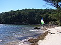
Cortegada is an island in the coast of Pontevedra in Galicia, Spain. It is part of the Atlantic Islands of Galicia National Park. Originally a village of the municipally of O Carril (today Vilagarcía de Arousa), it was offered as a present to King Alfonso XIII at the start of XX century, then sold to a private company. It was recently bought back by the government and added to the mentioned Natural Park.
Cortegada has an Oceanic climate with warm summers, and cool winters. The dense moisture from the ocean is precipitating constantly. Warm moist air masses blowing off the ocean are forced upwards by the terrain, which cools the air mass to the dew point, causing the moisture in the air to condense as rain or fog, creating an habitat characterized by cool, moist conditions in the air and soil. The resulting climate is wetter and mild, with the annual oscillation of the temperature moderated by the ocean. It has two main fresh water sources: a seasonal lagoon and subterranean fresh water. This last source is peculiar since the island is surrounded by salt water, anybody can dig a well without effort even near the beach, without the need of digging further than several tens of centimeters, around ten inches at the most. The island is almost flat, its highest elevation is 22 feet high. It has an area of 54 hectares of land with a rectangle shape. Due to the large amount of water in the terrain, it flows in streams everywhere or stay quiet in ponds and puddles. The water drips, cover and soak the plants, rocks, soil, logs, moss etc. and still the water is being impassable the island during heavy rain. However the beauty of the set make it a tourist attraction.
Cortegada island is an archipelago that apart from Cortegada, the largest island, has other island groups, such as Malveiras Islands or Briñas Islands. Cortegada, along with the two tiny island groups mentioned are part of the National Park Atlantic Islands of Galicia. Conveyed in the low sea lane, along a road.
Is valued by many researchers and scientists, as well as by the richness of its sea, by having the largest forest of Laurel bay that exists in Europe. It's renowned for having the last wild laurel forest of Galicia as well as a mix population of pinyon pinetrees and pinus pinaster. It also retains a large oak forest with Quercus robur and a large mass of Pinus pinaster, which shows the island in sight completely covered of dense woodland.
These forest formerly covered much of the coast and coastal mountains of the mainland surrounding and other Atlantic islands on the area, with locally favourable wet climate microenvironments, but the forests have been much reduced in extent by logging, clearance for agriculture and grazing, and the invasion of exotic species.
The type forests are made up of laurel-leaved evergreen hardwood trees, reaching up to 40 m in height when older. Many of the species are endemic to islands, and harbour and rich biota of understorey plants, invertebrates, and birds as Iberian fly, the coal tit, the great tit, collared dove, wood pigeon and blackbird. Besides many seabirds species such as cormorants take refuge on the island and several species of gulls nest in the breeding season.
The forests support a diverse understorey of ferns and bryophytes, which require moisture for reproduction, this vegetation besides cover the ruins of the old stone houses with mosses, lichens and creepers. There are numerous herbaceous plant species. Some evergreen climbing plants like asparagus species and Araliaceaes as Hedera helix, or Hedera iberica. Various feral fruit trees species as apple, plum and pear trees, garden trees Platanus × hispanica and Ulmus and dispersed by birds as Ligustrum, Prunus lusitanica, Crataegus, Sorbus, Cornus, Taxus baccata, and Ilex aquifolium species are widespread. There are two constituent species in Laurus genus Laurus nobilis and Laurus azorica known as Azores Laurel, Loureiro, a native to the laurisilva forests of the Azores, was also locally introduced in Cortegada Island. These recent forest are young yet with trees 18-20 m tall following the eviction of the last inhabitants. Ferns, liverworts, mosses and lichens grow up the trunks and branches. Creepers and vines complete the tangle.
A recent study found that native stands classified as L. nobilis in northern Spain shared greater genetic and morphological similarity to L. azorica than to populations of L. nobilis native to rest of Spain, France and Italy [Arroyo-Garcia et al. 2001]. This populations like the Cortegada Island population, famous for its large grove of laurels, come from seeds dispersed by birds but is not indigenous to the island, as this islander forest originated spontaneously from laurel specimens that were planted after the original vegetation was destroyed. The location of the Islands in the North Atlantic Ocean moderated these climatic fluctuations, and maintained the relatively humid and mild climate which has allowed these forests to persist to the present day, althought autochthonous vegetation was almost entirely cleared for orchards, wheat fields, subsistence crops and exotic timber plantations in the past. The forest regenerated easily, its decline was due to the tremendous pressure it supported.
They are relicts of a vegetation type named Laurissilva which originally covered much of the Mediterranean Basin when the climate of the region was more humid. With the drying of the Mediterranean Basin during the Pliocene, the laurel forests gradually retreated, replaced by more drought-tolerant sclerophyll plant communities. Most of the last remaining laurisilva forests around the Mediterranean are believed to have disappeared approximately 10,000 years ago at the end of the Pleistocene, when the Mediterranean basin became drier and with a harsher climate, although some remnants of the laurel forest flora still persist in the mountains of southern Spain, north-center of Portugal and northern Morocco.
The laurel forests, a type of cloud forest, must adapt to high rainfall and humidity. The trees are adapted developing leaves that repel water named Laurophyll or lauroid leaves, which permit the leaves to shed water despite the humidity, allowing perspiration and respiration from plant. Cloud forests are found on mountain slopes where the dense moisture from the sea or ocean is precipitated by the action of the relief. Warm moist air masses blowing off the ocean are forced upwards by the terrain, which cools the air mass to the dew point, causing the moisture in the air to condense as rain or fog, creating an habitat characterized by cool, moist conditions in the air and soil. The resulting climate is wetter and mild, with the annual oscillation of the temperature moderated by the proximity of the ocean.
Gallery
-

-
-
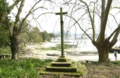 Cruceiro (Cross).


References
This article about a location in the autonomous community of Galicia, Spain is a stub. You can help Wikipedia by expanding it. |