Summersville, West Virginia: Difference between revisions
m Bot: Migrating 1 langlinks to WP:Wikidata - d:q615764 |
No edit summary |
||
| Line 102: | Line 102: | ||
==Speed limit enforcement== |
==Speed limit enforcement== |
||
Summersville, especially along [[U.S. Route 19]], is well known as |
Summersville, especially along [[U.S. Route 19]], is well known as the world's largest [[speed trap]]. In 2001 the police department of Summersville issued 18,133 tickets. Because of this, the city has been seen on several network TV programs including [[CNN]], [[CBS]], [[Canadian Broadcasting Corporation|CBC]], and the [[BBC]]. As late as 2007, the National Motorists Association ranked Summersville as the worst speed trap in the state of West Virginia.<ref>http://www.usatoday.com/travel/news/2007-11-20-worst-speed-traps_N.htm</ref> The city has been further seen in ''[[Money Magazine]]'', ''[[USA Today]]'', and dozens of local newspapers in the [[Midwest]]. [[Carnifex Ferry Battlefield State Park]] is near the town. |
||
== See also == |
== See also == |
||
Revision as of 14:59, 6 April 2013
Summersville, West Virginia | |
|---|---|
 | |
 Location of Summersville, West Virginia | |
| Country | United States |
| State | West Virginia |
| County | Nicholas |
| Area | |
| • Total | 4.26 sq mi (11.03 km2) |
| • Land | 4.22 sq mi (10.93 km2) |
| • Water | 0.04 sq mi (0.10 km2) |
| Elevation | 1,880 ft (573 m) |
| Population | |
| • Total | 3,572 |
| • Estimate (2011[3]) | 3,576 |
| • Density | 846.4/sq mi (326.8/km2) |
| Time zone | UTC-5 (Eastern (EST)) |
| • Summer (DST) | UTC-4 (EDT) |
| ZIP code | 26651 |
| Area code(s) | 304, 681 |
| FIPS code | 54-77980Template:GR |
| GNIS feature ID | 1547739Template:GR |

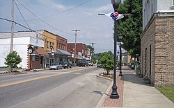
Summersville is a town in Nicholas County, West Virginia, United States. The population was 3,572 at the 2010 census. It is the county seat of Nicholas CountyTemplate:GR.
Geography
Summersville is located at 38°17′0″N 80°50′39″W / 38.28333°N 80.84417°W (38.283342, -80.844207)Template:GR. It is located just north of the Gauley River which is famous for its challenging whitewater. The river is impounded by a large dam which creates Summersville Lake, creating flatwater recreation as well.
According to the United States Census Bureau, the town has a total area of 4.26 square miles (11.03 km2), of which, 4.22 square miles (10.93 km2) is land and 0.04 square miles (0.10 km2) is water.[1]
Summersville is home to the annual Potato Festival.
Demographics
The median income for a household in the town was $29,783, and the median income for a family was $43,314. Males had a median income of $33,633 versus $22,348 for females. The per capita income for the town was $23,217. About 6.9% of families and 12.7% of the population were below the poverty line, including 8.1% of those under age 18 and 11.2% of those age 65 or over.
2010 census
As of the census[2] of 2010, there were 3,572 people, 1,640 households, and 974 families residing in the town. The population density was 846.4 inhabitants per square mile (326.8/km2). There were 1,761 housing units at an average density of 417.3 per square mile (161.1/km2). The racial makeup of the town was 97.4% White, 0.4% African American, 0.3% Native American, 0.9% Asian, 0.3% from other races, and 0.7% from two or more races. Hispanic or Latino of any race were 1.4% of the population.
There were 1,640 households out of which 26.3% had children under the age of 18 living with them, 42.1% were married couples living together, 13.6% had a female householder with no husband present, 3.7% had a male householder with no wife present, and 40.6% were non-families. 36.8% of all households were made up of individuals and 14.9% had someone living alone who was 65 years of age or older. The average household size was 2.14 and the average family size was 2.77.
The median age in the town was 43 years. 20.4% of residents were under the age of 18; 7.9% were between the ages of 18 and 24; 24.2% were from 25 to 44; 30.4% were from 45 to 64; and 17.1% were 65 years of age or older. The gender makeup of the town was 46.8% male and 53.2% female.
Speed limit enforcement
Summersville, especially along U.S. Route 19, is well known as the world's largest speed trap. In 2001 the police department of Summersville issued 18,133 tickets. Because of this, the city has been seen on several network TV programs including CNN, CBS, CBC, and the BBC. As late as 2007, the National Motorists Association ranked Summersville as the worst speed trap in the state of West Virginia.[4] The city has been further seen in Money Magazine, USA Today, and dozens of local newspapers in the Midwest. Carnifex Ferry Battlefield State Park is near the town.
See also
References
- ^ a b "US Gazetteer files 2010". United States Census Bureau. Retrieved 2013-01-24.
{{cite web}}: External link in|publisher= - ^ a b "American FactFinder". United States Census Bureau. Retrieved 2013-01-24.
{{cite web}}: External link in|publisher= - ^ "Population Estimates". United States Census Bureau. Retrieved 2013-01-24.
{{cite web}}: External link in|publisher= - ^ http://www.usatoday.com/travel/news/2007-11-20-worst-speed-traps_N.htm

