
Verona, North Dakota: Difference between revisions
Modified historical population template (via CenPop script) |
Rescuing 3 sources and tagging 0 as dead. #IABot (v1.1) |
||
| Line 84: | Line 84: | ||
}} |
}} |
||
'''Verona''' is a city in [[LaMoure County, North Dakota|LaMoure County]], [[North Dakota]], [[United States]]. The population was 85 at the [[2010 United States Census|2010 census]].<ref name="2010 Census (City)">{{cite web|title=2010 Census Redistricting Data (Public Law 94-171) Summary File|url=http://factfinder2.census.gov/faces/tableservices/jsf/pages/productview.xhtml?pid=DEC_10_PL_GCTPL2.ST13&prodType=table|work=American FactFinder|publisher=[[United States Census Bureau]]|accessdate=2 May 2011}}</ref> Verona was founded in 1886. |
'''Verona''' is a city in [[LaMoure County, North Dakota|LaMoure County]], [[North Dakota]], [[United States]]. The population was 85 at the [[2010 United States Census|2010 census]].<ref name="2010 Census (City)">{{cite web|title=2010 Census Redistricting Data (Public Law 94-171) Summary File |url=http://factfinder2.census.gov/faces/tableservices/jsf/pages/productview.xhtml?pid=DEC_10_PL_GCTPL2.ST13&prodType=table |work=American FactFinder |publisher=[[United States Census Bureau]] |accessdate=2 May 2011 |deadurl=yes |archiveurl=http://web.archive.org/web/20110721034521/http://factfinder2.census.gov/faces/tableservices/jsf/pages/productview.xhtml?pid=DEC_10_PL_GCTPL2.ST13&prodType=table |archivedate=July 21, 2011 }}</ref> Verona was founded in 1886. |
||
==Geography== |
==Geography== |
||
Verona is located at {{coord|46|21|55|N|98|4|17|W|type:city}} (46.365230, -98.071423).<ref name="GR1">{{cite web|url=http://www.census.gov/geo/www/gazetteer/gazette.html|publisher=[[United States Census Bureau]]|accessdate=2011-04-23|date=2011-02-12|title=US Gazetteer files: 2010, 2000, and 1990}}</ref> |
Verona is located at {{coord|46|21|55|N|98|4|17|W|type:city}} (46.365230, -98.071423).<ref name="GR1">{{cite web|url=http://www.census.gov/geo/www/gazetteer/gazette.html|publisher=[[United States Census Bureau]]|accessdate=2011-04-23|date=2011-02-12|title=US Gazetteer files: 2010, 2000, and 1990}}</ref> |
||
According to the [[United States Census Bureau]], the city has a total area of {{convert|0.25|sqmi|sqkm|2}}, all land.<ref name |
According to the [[United States Census Bureau]], the city has a total area of {{convert|0.25|sqmi|sqkm|2}}, all land.<ref name="Gazetteer files">{{cite web|title=US Gazetteer files 2010 |url=http://www.census.gov/geo/www/gazetteer/files/Gaz_places_national.txt |publisher=[[United States Census Bureau]] |accessdate=2012-06-14 |deadurl=yes |archiveurl=http://www.webcitation.org/64vfLAeJ2 |archivedate=January 24, 2012 }}</ref> |
||
==Demographics== |
==Demographics== |
||
| Line 108: | Line 108: | ||
|estref=<ref name="USCensusEst2015">{{cite web|url=http://www.census.gov/popest/data/cities/totals/2015/SUB-EST2015.html|title=Annual Estimates of the Resident Population for Incorporated Places: April 1, 2010 to July 1, 2015|accessdate=July 2, 2016}}</ref> |
|estref=<ref name="USCensusEst2015">{{cite web|url=http://www.census.gov/popest/data/cities/totals/2015/SUB-EST2015.html|title=Annual Estimates of the Resident Population for Incorporated Places: April 1, 2010 to July 1, 2015|accessdate=July 2, 2016}}</ref> |
||
|align-fn=center |
|align-fn=center |
||
|footnote=U.S. Decennial Census<ref>{{cite web|url=http://www.census.gov/prod/www/decennial.html|title=Census of Population and Housing|author=[[United States Census Bureau]]|accessdate=January 23, 2014}}</ref><br>2014 Estimate<ref name="2014 Pop Estimate"/> |
|footnote=U.S. Decennial Census<ref>{{cite web|url=http://www.census.gov/prod/www/decennial.html |title=Census of Population and Housing |author=[[United States Census Bureau]] |accessdate=January 23, 2014 |deadurl=yes |archiveurl=http://www.webcitation.org/6YSasqtfX |archivedate=May 11, 2015 }}</ref><br>2014 Estimate<ref name="2014 Pop Estimate"/> |
||
}} |
}} |
||
Revision as of 20:31, 20 July 2016
Verona, North Dakota | |
|---|---|
 Fire department in Verona | |
 Location of Verona, North Dakota | |
| Country | United States |
| State | North Dakota |
| County | LaMoure |
| Area | |
| • Total | 0.25 sq mi (0.65 km2) |
| • Land | 0.25 sq mi (0.65 km2) |
| • Water | 0 sq mi (0 km2) |
| Elevation | 1,388 ft (423 m) |
| Population | |
| • Total | 85 |
| • Estimate (2014)[3] | 86 |
| • Density | 340.0/sq mi (131.3/km2) |
| Time zone | UTC-6 (Central (CST)) |
| • Summer (DST) | UTC-5 (CDT) |
| ZIP code | 58490 |
| Area code | 701 |
| FIPS code | 38-81900 |
| GNIS feature ID | 1033683[4] |
Verona is a city in LaMoure County, North Dakota, United States. The population was 85 at the 2010 census.[5] Verona was founded in 1886.
Geography
Verona is located at 46°21′55″N 98°4′17″W / 46.36528°N 98.07139°W (46.365230, -98.071423).[6]
According to the United States Census Bureau, the city has a total area of 0.25 square miles (0.65 km2), all land.[1]
Demographics
| Census | Pop. | Note | %± |
|---|---|---|---|
| 1910 | 235 | — | |
| 1920 | 258 | 9.8% | |
| 1930 | 222 | −14.0% | |
| 1940 | 201 | −9.5% | |
| 1950 | 189 | −6.0% | |
| 1960 | 162 | −14.3% | |
| 1970 | 140 | −13.6% | |
| 1980 | 126 | −10.0% | |
| 1990 | 103 | −18.3% | |
| 2000 | 108 | 4.9% | |
| 2010 | 85 | −21.3% | |
| 2015 (est.) | 86 | [7] | 1.2% |
| U.S. Decennial Census[8] 2014 Estimate[3] | |||
2010 census
As of the census[2] of 2010, there were 85 people, 38 households, and 23 families residing in the city. The population density was 340.0 inhabitants per square mile (131.3/km2). There were 47 housing units at an average density of 188.0 per square mile (72.6/km2). The racial makeup of the city was 97.6% White, 1.2% Native American, and 1.2% from two or more races.
There were 38 households of which 23.7% had children under the age of 18 living with them, 50.0% were married couples living together, 5.3% had a female householder with no husband present, 5.3% had a male householder with no wife present, and 39.5% were non-families. 31.6% of all households were made up of individuals and 13.1% had someone living alone who was 65 years of age or older. The average household size was 2.24 and the average family size was 2.91.
The median age in the city was 45.5 years. 20% of residents were under the age of 18; 7.1% were between the ages of 18 and 24; 22.4% were from 25 to 44; 28.2% were from 45 to 64; and 22.4% were 65 years of age or older. The gender makeup of the city was 52.9% male and 47.1% female.
2000 census
As of the census of 2000, there were 108 people, 44 households, and 30 families residing in the city. The population density was 417.6 people per square mile (160.4/km²). There were 53 housing units at an average density of 205.0 per square mile (78.7/km²). The racial makeup of the city was 99.07% White and 0.93% Native American.
There were 44 households out of which 34.1% had children under the age of 18 living with them, 54.5% were married couples living together, 6.8% had a female householder with no husband present, and 31.8% were non-families. 25.0% of all households were made up of individuals and 13.6% had someone living alone who was 65 years of age or older. The average household size was 2.45 and the average family size was 2.97.
In the city the population was spread out with 25.9% under the age of 18, 2.8% from 18 to 24, 38.0% from 25 to 44, 20.4% from 45 to 64, and 13.0% who were 65 years of age or older. The median age was 37 years. For every 100 females there were 86.2 males. For every 100 females age 18 and over, there were 95.1 males.
The median income for a household in the city was $36,875, and the median income for a family was $39,375. Males had a median income of $31,250 versus $22,250 for females. The per capita income for the city was $14,327. There were 10.8% of families and 11.2% of the population living below the poverty line, including 14.6% of under eighteens and none of those over 64.
Notable person
- Frank J. Magill, United States Federal Court judge
Climate
This climatic region is typified by large seasonal temperature differences, with warm to hot (and often humid) summers and cold (sometimes severely cold) winters. According to the Köppen Climate Classification system, Verona has a humid continental climate, abbreviated "Dfb" on climate maps.[9]
References
- ^ a b "US Gazetteer files 2010". United States Census Bureau. Archived from the original on January 24, 2012. Retrieved 2012-06-14.
{{cite web}}: Unknown parameter|deadurl=ignored (|url-status=suggested) (help) - ^ a b "American FactFinder". United States Census Bureau. Retrieved 2012-06-14.
- ^ a b "Population Estimates". United States Census Bureau. Retrieved July 10, 2015.
- ^ "US Board on Geographic Names". United States Geological Survey. 2007-10-25. Retrieved 2008-01-31.
- ^ "2010 Census Redistricting Data (Public Law 94-171) Summary File". American FactFinder. United States Census Bureau. Archived from the original on July 21, 2011. Retrieved 2 May 2011.
{{cite web}}: Unknown parameter|deadurl=ignored (|url-status=suggested) (help) - ^ "US Gazetteer files: 2010, 2000, and 1990". United States Census Bureau. 2011-02-12. Retrieved 2011-04-23.
- ^ "Annual Estimates of the Resident Population for Incorporated Places: April 1, 2010 to July 1, 2015". Retrieved July 2, 2016.
- ^ United States Census Bureau. "Census of Population and Housing". Archived from the original on May 11, 2015. Retrieved January 23, 2014.
{{cite web}}: Unknown parameter|deadurl=ignored (|url-status=suggested) (help) - ^ Climate Summary for Verona, North Dakota
Municipalities and communities of LaMoure County, North Dakota, United States | ||
|---|---|---|
| Cities | 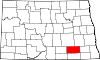 | |
| Townships | ||
| Unincorporated communities | ||