
Donaldson, Arkansas: Difference between revisions
Modified historical population template (via CenPop script) |
Rescuing 2 sources and tagging 0 as dead. #IABot (v1.2.7.1) |
||
| Line 69: | Line 69: | ||
|estimate=300 |
|estimate=300 |
||
|estref=<ref name="USCensusEst2015">{{cite web|url=http://www.census.gov/popest/data/cities/totals/2015/SUB-EST2015.html|title=Annual Estimates of the Resident Population for Incorporated Places: April 1, 2010 to July 1, 2015|accessdate=July 2, 2016}}</ref> |
|estref=<ref name="USCensusEst2015">{{cite web|url=http://www.census.gov/popest/data/cities/totals/2015/SUB-EST2015.html|title=Annual Estimates of the Resident Population for Incorporated Places: April 1, 2010 to July 1, 2015|accessdate=July 2, 2016}}</ref> |
||
|footnote=<center>U.S. Decennial Census<ref>{{cite web|url=http://www.census.gov/prod/www/decennial.html|title=Census of Population and Housing|publisher=Census.gov|accessdate=June 4, 2015}}</ref><br>2014 Estimate<ref>{{cite web|url=http://www.census.gov/popest/data/cities/totals/2014/SUB-EST2014-3.html|title=Annual Estimates of the Resident Population for Incorporated Places: April 1, 2010 to July 1, 2014|accessdate=June 4, 2015}}</ref></center> |
|footnote=<center>U.S. Decennial Census<ref>{{cite web|url=http://www.census.gov/prod/www/decennial.html |title=Census of Population and Housing |publisher=Census.gov |accessdate=June 4, 2015 |deadurl=yes |archiveurl=http://www.webcitation.org/6YSasqtfX?url=http%3A%2F%2Fwww.census.gov%2Fprod%2Fwww%2Fdecennial.html |archivedate=May 11, 2015 |df= }}</ref><br>2014 Estimate<ref>{{cite web|url=http://www.census.gov/popest/data/cities/totals/2014/SUB-EST2014-3.html|title=Annual Estimates of the Resident Population for Incorporated Places: April 1, 2010 to July 1, 2014|accessdate=June 4, 2015}}</ref></center> |
||
}} |
}} |
||
As of the [[census]]<ref name="GR2">{{cite web|url=http://factfinder2.census.gov|publisher=[[United States Census Bureau]]|accessdate=2008-01-31|title=American FactFinder}}</ref> of 2000, there were 326 people, 130 households, and 93 families residing in the town. The [[population density]] was 499.1 inhabitants per square mile (193.6/km²). There were 143 housing units at an average density of 218.9 per square mile (84.9/km²). The racial makeup of the town was 97.85% [[Race (United States Census)|White]], 0.61% [[Race (United States Census)|Native American]], and 1.53% from two or more races. 0.61% of the population were [[Race (United States Census)|Hispanic]] or [[Race (United States Census)|Latino]] of any race. |
As of the [[census]]<ref name="GR2">{{cite web|url=http://factfinder2.census.gov |publisher=[[United States Census Bureau]] |accessdate=2008-01-31 |title=American FactFinder |deadurl=yes |archiveurl=https://web.archive.org/web/20130911234518/http://factfinder2.census.gov |archivedate=2013-09-11 |df= }}</ref> of 2000, there were 326 people, 130 households, and 93 families residing in the town. The [[population density]] was 499.1 inhabitants per square mile (193.6/km²). There were 143 housing units at an average density of 218.9 per square mile (84.9/km²). The racial makeup of the town was 97.85% [[Race (United States Census)|White]], 0.61% [[Race (United States Census)|Native American]], and 1.53% from two or more races. 0.61% of the population were [[Race (United States Census)|Hispanic]] or [[Race (United States Census)|Latino]] of any race. |
||
There were 130 households out of which 31.5% had children under the age of 18 living with them, 56.9% were [[Marriage|married couples]] living together, 11.5% had a female householder with no husband present, and 27.7% were non-families. 25.4% of all households were made up of individuals and 16.9% had someone living alone who was 65 years of age or older. The average household size was 2.51 and the average family size was 3.01. |
There were 130 households out of which 31.5% had children under the age of 18 living with them, 56.9% were [[Marriage|married couples]] living together, 11.5% had a female householder with no husband present, and 27.7% were non-families. 25.4% of all households were made up of individuals and 16.9% had someone living alone who was 65 years of age or older. The average household size was 2.51 and the average family size was 3.01. |
||
Revision as of 13:56, 15 December 2016
Donaldson, Arkansas | |
|---|---|
 Location in Hot Spring County and the state of Arkansas | |
| Country | United States |
| State | Arkansas |
| County | Hot Spring |
| Area | |
| • Total | 0.7 sq mi (1.7 km2) |
| • Land | 0.7 sq mi (1.7 km2) |
| • Water | 0 sq mi (0 km2) |
| Elevation | 230 ft (70 m) |
| Population (2010) | |
| • Total | 409 |
| • Density | 584.3/sq mi (240.6/km2) |
| Time zone | UTC-6 (Central (CST)) |
| • Summer (DST) | UTC-5 (CDT) |
| ZIP code | 71941 |
| Area code | 501 |
| FIPS code | 05-19450 |
| GNIS feature ID | 0057673 |
Donaldson is a town in Hot Spring County, Arkansas, United States. The population was 326 at the 2000 census.
Geography
Donaldson is located at 34°14′14″N 92°55′16″W / 34.23722°N 92.92111°W (34.237169, -92.921177).[1]
According to the United States Census Bureau, the town has a total area of 0.6 square miles (1.6 km2), all land.
Demographics
| Census | Pop. | Note | %± |
|---|---|---|---|
| 2000 | 326 | — | |
| 2010 | 301 | −7.7% | |
| 2015 (est.) | 300 | [2] | −0.3% |
2014 Estimate[4] | |||
As of the census[5] of 2000, there were 326 people, 130 households, and 93 families residing in the town. The population density was 499.1 inhabitants per square mile (193.6/km²). There were 143 housing units at an average density of 218.9 per square mile (84.9/km²). The racial makeup of the town was 97.85% White, 0.61% Native American, and 1.53% from two or more races. 0.61% of the population were Hispanic or Latino of any race.
There were 130 households out of which 31.5% had children under the age of 18 living with them, 56.9% were married couples living together, 11.5% had a female householder with no husband present, and 27.7% were non-families. 25.4% of all households were made up of individuals and 16.9% had someone living alone who was 65 years of age or older. The average household size was 2.51 and the average family size was 3.01.
In the town the population was spread out with 26.7% under the age of 18, 8.6% from 18 to 24, 25.2% from 25 to 44, 24.5% from 45 to 64, and 15.0% who were 65 years of age or older. The median age was 36 years. For every 100 females there were 97.6 males. For every 100 females age 18 and over, there were 100.8 males.
The median income for a household in the town was $22,813, and the median income for a family was $28,500. Males had a median income of $29,250 versus $20,500 for females. The per capita income for the town was $13,307. About 15.0% of families and 17.1% of the population were below the poverty line, including 25.3% of those under age 18 and 10.7% of those age 65 or over.
Education
Public education for early childhood, elementary and secondary school students is available by the Ouachita School District, which leads to graduation from Ouachita High School.
References
- ^ "US Gazetteer files: 2010, 2000, and 1990". United States Census Bureau. 2011-02-12. Retrieved 2011-04-23.
- ^ "Annual Estimates of the Resident Population for Incorporated Places: April 1, 2010 to July 1, 2015". Retrieved July 2, 2016.
- ^ "Census of Population and Housing". Census.gov. Archived from the original on May 11, 2015. Retrieved June 4, 2015.
{{cite web}}: Unknown parameter|deadurl=ignored (|url-status=suggested) (help) - ^ "Annual Estimates of the Resident Population for Incorporated Places: April 1, 2010 to July 1, 2014". Retrieved June 4, 2015.
- ^ "American FactFinder". United States Census Bureau. Archived from the original on 2013-09-11. Retrieved 2008-01-31.
{{cite web}}: Unknown parameter|deadurl=ignored (|url-status=suggested) (help)
Municipalities and communities of Hot Spring County, Arkansas, United States | ||
|---|---|---|
| Cities | 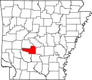 | |
| Towns | ||
| Townships | ||
| CDPs | ||
| Other unincorporated communities | ||