
Grant, Alabama: Difference between revisions
Content deleted Content added
JJMC89 bot (talk | contribs) Migrate {{Infobox settlement}} coordinates parameters to {{Coord}}, see Wikipedia:Coordinates in infoboxes |
Rescuing 2 sources and tagging 2 as dead. #IABot (v1.3beta3) |
||
| Line 54: | Line 54: | ||
|website = http://www.grantal.org/ |
|website = http://www.grantal.org/ |
||
}} |
}} |
||
'''Grant''' is a town in [[Marshall County, Alabama|Marshall County]], in the northeast of [[Alabama]]. As of the [[2010 United States Census|2010 census]], the population of Grant was 896;<ref name="Census 2010">{{Cite web| |
'''Grant''' is a town in [[Marshall County, Alabama|Marshall County]], in the northeast of [[Alabama]]. As of the [[2010 United States Census|2010 census]], the population of Grant was 896;<ref name="Census 2010">{{Cite web|url=http://factfinder2.census.gov |title=Profile of General Population and Housing Characteristics: 2010 Demographic Profile Data (DP-1): Grant town, Alabama |publisher=U.S. Census Bureau, American Factfinder |accessdate=June 5, 2012 |deadurl=yes |archiveurl=https://web.archive.org/web/20130911234518/http://factfinder2.census.gov/ |archivedate=September 11, 2013 |df= }}</ref> it is included in the [[Huntsville-Decatur Combined Statistical Area]]. The town incorporated in November 1945.<ref>http://www.encyclopediaofalabama.org/article/h-3502</ref> |
||
==Geography== |
==Geography== |
||
| Line 70: | Line 70: | ||
|estyear=2015 |
|estyear=2015 |
||
|estimate=903 |
|estimate=903 |
||
|estref=<ref name="USCensusEst2015">{{cite web|url=http://www.census.gov/popest/data/cities/totals/2015/SUB-EST2015.html|title=Annual Estimates of the Resident Population for Incorporated Places: April 1, 2010 to July 1, 2015|accessdate=July 2, 2016}}</ref> |
|estref=<ref name="USCensusEst2015">{{cite web|url=http://www.census.gov/popest/data/cities/totals/2015/SUB-EST2015.html |title=Annual Estimates of the Resident Population for Incorporated Places: April 1, 2010 to July 1, 2015 |accessdate=July 2, 2016 }}{{dead link|date=March 2017 |bot=InternetArchiveBot |fix-attempted=yes }}</ref> |
||
|align-fn=center |
|align-fn=center |
||
|footnote=U.S. Decennial Census<ref>{{cite web|url=http://www.census.gov/prod/www/decennial.html|title=U.S. Decennial Census|publisher=Census.gov|accessdate=June 6, 2013}}</ref><br>2013 Estimate<ref>{{cite web|url=http://www.census.gov/popest/data/cities/totals/2013/SUB-EST2013-3.html|title=Annual Estimates of the Resident Population: April 1, 2010 to July 1, 2013|accessdate=June 3, 2014}}</ref> |
|footnote=U.S. Decennial Census<ref>{{cite web|url=http://www.census.gov/prod/www/decennial.html |title=U.S. Decennial Census |publisher=Census.gov |accessdate=June 6, 2013 |deadurl=yes |archiveurl=http://www.webcitation.org/6YSasqtfX?url=http%3A%2F%2Fwww.census.gov%2Fprod%2Fwww%2Fdecennial.html |archivedate=May 11, 2015 |df= }}</ref><br>2013 Estimate<ref>{{cite web|url=http://www.census.gov/popest/data/cities/totals/2013/SUB-EST2013-3.html |title=Annual Estimates of the Resident Population: April 1, 2010 to July 1, 2013 |accessdate=June 3, 2014 }}{{dead link|date=March 2017 |bot=InternetArchiveBot |fix-attempted=yes }}</ref> |
||
}} |
}} |
||
Revision as of 07:40, 24 March 2017
Grant, Alabama | |
|---|---|
| Nickname: "Home of the DAR Patriots" | |
| Motto: "...a scenic mountain town" | |
 Location in Marshall County and the state of Alabama | |
| Coordinates: 34°30′10″N 86°15′19″W / 34.50278°N 86.25528°W | |
| Country | United States |
| State | Alabama |
| County | Marshall |
| Area | |
| • Total | 1.8 sq mi (4.6 km2) |
| • Land | 1.8 sq mi (4.6 km2) |
| • Water | 0 sq mi (0 km2) |
| Elevation | 1,227 ft (374 m) |
| Population (2013) | |
| • Total | 914 |
| • Density | 510/sq mi (200/km2) |
| Time zone | UTC-6 (Central (CST)) |
| • Summer (DST) | UTC-5 (CDT) |
| ZIP code | 35747 |
| Area code | 256 |
| FIPS code | 01-31096 |
| GNIS feature ID | 0119235 |
| Website | http://www.grantal.org/ |
Grant is a town in Marshall County, in the northeast of Alabama. As of the 2010 census, the population of Grant was 896;[1] it is included in the Huntsville-Decatur Combined Statistical Area. The town incorporated in November 1945.[2]
Geography
According to the U.S. Census Bureau, the town has a total area of 1.8 square miles (4.7 km2), all land.[1] Grant is located on the plateau of Gunters Mountain. A historical cave, Cathedral Caverns, is just outside Grant in nearby Woodville.
Demographics
| Census | Pop. | Note | %± |
|---|---|---|---|
| 1950 | 191 | — | |
| 1960 | 274 | 43.5% | |
| 1970 | 382 | 39.4% | |
| 1980 | 632 | 65.4% | |
| 1990 | 638 | 0.9% | |
| 2000 | 665 | 4.2% | |
| 2010 | 896 | 34.7% | |
| 2015 (est.) | 903 | [3] | 0.8% |
| U.S. Decennial Census[4] 2013 Estimate[5] | |||
Notable person
- Vernon Derrick, fiddle and mandolin player for Hank Williams Jr's Bama Band in the 1980s
References
- ^ a b "Profile of General Population and Housing Characteristics: 2010 Demographic Profile Data (DP-1): Grant town, Alabama". U.S. Census Bureau, American Factfinder. Archived from the original on September 11, 2013. Retrieved June 5, 2012.
{{cite web}}: Unknown parameter|deadurl=ignored (|url-status=suggested) (help) - ^ http://www.encyclopediaofalabama.org/article/h-3502
- ^ "Annual Estimates of the Resident Population for Incorporated Places: April 1, 2010 to July 1, 2015". Retrieved July 2, 2016.[permanent dead link]
- ^ "U.S. Decennial Census". Census.gov. Archived from the original on May 11, 2015. Retrieved June 6, 2013.
{{cite web}}: Unknown parameter|deadurl=ignored (|url-status=suggested) (help) - ^ "Annual Estimates of the Resident Population: April 1, 2010 to July 1, 2013". Retrieved June 3, 2014.[permanent dead link]
External links
34°30′10″N 86°15′19″W / 34.502899°N 86.255378°W
Municipalities and communities of Marshall County, Alabama, United States | ||
|---|---|---|
| Cities | 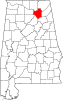 | |
| Towns | ||
| CDPs | ||
| Unincorporated communities | ||
| Ghost town | ||
| Footnotes | ‡This populated place also has portions in an adjacent county or counties | |