
Lignite, North Dakota: Difference between revisions
m fixed redirect |
Rescuing 5 sources and tagging 0 as dead. #IABot (v1.3.1.1) |
||
| Line 53: | Line 53: | ||
|population_est = 253 |
|population_est = 253 |
||
|pop_est_as_of = 2015 |
|pop_est_as_of = 2015 |
||
|pop_est_footnotes = <ref name="2015 Pop Estimate">{{cite web|title=Population Estimates|url=http://www.census.gov/popest/data/cities/totals/2015/SUB-EST2015-3.html|publisher=[[United States Census Bureau]]|accessdate=June 24, 2016}}</ref> |
|pop_est_footnotes = <ref name="2015 Pop Estimate">{{cite web|title=Population Estimates |url=http://www.census.gov/popest/data/cities/totals/2015/SUB-EST2015-3.html |publisher=[[United States Census Bureau]] |accessdate=June 24, 2016 |deadurl=yes |archiveurl=https://web.archive.org/web/20161019182931/https://www.census.gov/popest/data/cities/totals/2015/SUB-EST2015-3.html |archivedate=October 19, 2016 |df= }}</ref> |
||
|population_footnotes = <ref name ="FactFinder"/> |
|population_footnotes = <ref name ="FactFinder"/> |
||
|population_total = 155 |
|population_total = 155 |
||
| Line 79: | Line 79: | ||
}} |
}} |
||
'''Lignite''' is a city in [[Burke County, North Dakota|Burke County]], [[North Dakota]], [[United States]]. The population was 155 at the [[2010 United States Census|2010 census]].<ref name="2010 Census (City)">{{cite web|title=2010 Census Redistricting Data (Public Law 94-171) Summary File|url=http://factfinder2.census.gov/faces/tableservices/jsf/pages/productview.xhtml?pid=DEC_10_PL_GCTPL2.ST13&prodType=table|work=American FactFinder|publisher=[[United States Census Bureau]]|accessdate=2 May 2011}}</ref> Lignite was founded in 1907 and was named for the quantities of [[lignite]], a low-grade coal, present in the area.<ref name=Wick>{{cite web|last=Wick|first=Douglas A.|title=Lignite (Burke County)|url=http://www.webfamilytree.com/North_Dakota_Place_Names/L/lignite_%28burke_county%29.htm|work=North Dakota Place Names|accessdate=9 May 2011}}</ref> |
'''Lignite''' is a city in [[Burke County, North Dakota|Burke County]], [[North Dakota]], [[United States]]. The population was 155 at the [[2010 United States Census|2010 census]].<ref name="2010 Census (City)">{{cite web|title=2010 Census Redistricting Data (Public Law 94-171) Summary File |url=http://factfinder2.census.gov/faces/tableservices/jsf/pages/productview.xhtml?pid=DEC_10_PL_GCTPL2.ST13&prodType=table |work=American FactFinder |publisher=[[United States Census Bureau]] |accessdate=2 May 2011 |deadurl=yes |archiveurl=https://web.archive.org/web/20110721034521/http://factfinder2.census.gov/faces/tableservices/jsf/pages/productview.xhtml?pid=DEC_10_PL_GCTPL2.ST13&prodType=table |archivedate=21 July 2011 |df= }}</ref> Lignite was founded in 1907 and was named for the quantities of [[lignite]], a low-grade coal, present in the area.<ref name=Wick>{{cite web|last=Wick|first=Douglas A.|title=Lignite (Burke County)|url=http://www.webfamilytree.com/North_Dakota_Place_Names/L/lignite_%28burke_county%29.htm|work=North Dakota Place Names|accessdate=9 May 2011}}</ref> |
||
==Geography== |
==Geography== |
||
Lignite is located at {{coord|48|52|37|N|102|33|45|W|type:city}} (48.876908, -102.562603).<ref name="GR1">{{cite web|url=http://www.census.gov/geo/www/gazetteer/gazette.html|publisher=[[United States Census Bureau]]|accessdate=2011-04-23|date=2011-02-12|title=US Gazetteer files: 2010, 2000, and 1990}}</ref> |
Lignite is located at {{coord|48|52|37|N|102|33|45|W|type:city}} (48.876908, -102.562603).<ref name="GR1">{{cite web|url=http://www.census.gov/geo/www/gazetteer/gazette.html|publisher=[[United States Census Bureau]]|accessdate=2011-04-23|date=2011-02-12|title=US Gazetteer files: 2010, 2000, and 1990}}</ref> |
||
According to the [[United States Census Bureau]], the city has a total area of {{convert|0.14|sqmi|sqkm|2}}, all land.<ref name |
According to the [[United States Census Bureau]], the city has a total area of {{convert|0.14|sqmi|sqkm|2}}, all land.<ref name="Gazetteer files">{{cite web|title=US Gazetteer files 2010 |url=http://www.census.gov/geo/www/gazetteer/files/Gaz_places_national.txt |publisher=[[United States Census Bureau]] |accessdate=2012-06-14 |deadurl=yes |archiveurl=http://www.webcitation.org/699nOulzi?url=http://www.census.gov/geo/www/gazetteer/files/Gaz_places_national.txt |archivedate=2012-07-14 |df= }}</ref> |
||
==Demographics== |
==Demographics== |
||
| Line 100: | Line 100: | ||
|estyear=2015 |
|estyear=2015 |
||
|estimate=253 |
|estimate=253 |
||
|estref=<ref name="USCensusEst2015">{{cite web|url=http://www.census.gov/popest/data/cities/totals/2015/SUB-EST2015.html|title=Annual Estimates of the Resident Population for Incorporated Places: April 1, 2010 to July 1, 2015|accessdate=July 2, 2016}}</ref> |
|estref=<ref name="USCensusEst2015">{{cite web|url=http://www.census.gov/popest/data/cities/totals/2015/SUB-EST2015.html |title=Annual Estimates of the Resident Population for Incorporated Places: April 1, 2010 to July 1, 2015 |accessdate=July 2, 2016 |deadurl=yes |archiveurl=https://archive.is/20160602200744/http://www.census.gov/popest/data/cities/totals/2015/SUB-EST2015.html |archivedate=June 2, 2016 |df= }}</ref> |
||
|align-fn=center |
|align-fn=center |
||
|footnote=U.S. Decennial Census<ref>{{cite web|url=http://www.census.gov/prod/www/decennial.html|title=Census of Population and Housing|author=[[United States Census Bureau]]|accessdate=September 7, 2013}}</ref><br>2015 Estimate<ref name="2015 Pop Estimate"/> |
|footnote=U.S. Decennial Census<ref>{{cite web|url=http://www.census.gov/prod/www/decennial.html|title=Census of Population and Housing|author=[[United States Census Bureau]]|accessdate=September 7, 2013}}</ref><br>2015 Estimate<ref name="2015 Pop Estimate"/> |
||
| Line 122: | Line 122: | ||
==Economy== |
==Economy== |
||
Lignite is in the center of farming country. Historically there has been some oil activity in the area, but it is a bit north of the current "Bakken" boom.{{citation needed|date=March 2011}} In 2010, a London-based resources company announced it had gotten the first potash drilling permit in three decades from the state of North Dakota. [[Sirius Minerals plc|Sirius Minerals]] drilled an exploratory potash well near Lignite in November, 2010.<ref>{{Cite press release |
Lignite is in the center of farming country. Historically there has been some oil activity in the area, but it is a bit north of the current "Bakken" boom.{{citation needed|date=March 2011}} In 2010, a London-based resources company announced it had gotten the first potash drilling permit in three decades from the state of North Dakota. [[Sirius Minerals plc|Sirius Minerals]] drilled an exploratory potash well near Lignite in November, 2010.<ref>{{Cite press release|title=North Dakota: Commencement of drilling |publisher=Sirius Minerals Plc |date=9 November 2010 |url=http://www.siriusminerals.com/north-dakota-commencement-of-drilling/ |accessdate=3 March 2011 |deadurl=yes |archiveurl=https://web.archive.org/web/20101120144033/http://www.siriusminerals.com/north-dakota-commencement-of-drilling/ |archivedate=20 November 2010 |df= }}</ref> |
||
==References== |
==References== |
||
Revision as of 18:33, 15 May 2017
Lignite, North Dakota | |
|---|---|
 Location of Lignite, North Dakota | |
| Coordinates: 48°52′37″N 102°33′45″W / 48.87694°N 102.56250°W | |
| Country | United States |
| State | North Dakota |
| County | Burke |
| Area | |
| • Total | 0.14 sq mi (0.36 km2) |
| • Land | 0.14 sq mi (0.36 km2) |
| • Water | 0 sq mi (0 km2) |
| Elevation | 1,982 ft (604 m) |
| Population | |
| • Total | 155 |
| • Estimate (2015)[3] | 253 |
| • Density | 1,107.1/sq mi (427.5/km2) |
| Time zone | UTC-6 (Central (CST)) |
| • Summer (DST) | UTC-5 (CDT) |
| ZIP code | 58752 |
| Area code | 701 |
| FIPS code | 38-46540 |
| GNIS feature ID | 1029886[4] |
Lignite is a city in Burke County, North Dakota, United States. The population was 155 at the 2010 census.[5] Lignite was founded in 1907 and was named for the quantities of lignite, a low-grade coal, present in the area.[6]
Geography
Lignite is located at 48°52′37″N 102°33′45″W / 48.87694°N 102.56250°W (48.876908, -102.562603).[7]
According to the United States Census Bureau, the city has a total area of 0.14 square miles (0.36 km2), all land.[1]
Demographics
| Census | Pop. | Note | %± |
|---|---|---|---|
| 1920 | 214 | — | |
| 1930 | 217 | 1.4% | |
| 1940 | 235 | 8.3% | |
| 1950 | 230 | −2.1% | |
| 1960 | 355 | 54.3% | |
| 1970 | 354 | −0.3% | |
| 1980 | 332 | −6.2% | |
| 1990 | 242 | −27.1% | |
| 2000 | 174 | −28.1% | |
| 2010 | 155 | −10.9% | |
| 2015 (est.) | 253 | [8] | 63.2% |
| U.S. Decennial Census[9] 2015 Estimate[3] | |||
2010 census
As of the census[2] of 2010, there were 155 people, 76 households, and 44 families residing in the city. The population density was 1,107.1 inhabitants per square mile (427.5/km2). There were 96 housing units at an average density of 685.7 per square mile (264.8/km2). The racial makeup of the city was 96.1% White, 2.6% Native American, 0.6% Asian, and 0.6% from two or more races. Hispanic or Latino of any race were 4.5% of the population.
There were 76 households of which 23.7% had children under the age of 18 living with them, 52.6% were married couples living together, 3.9% had a female householder with no husband present, 1.3% had a male householder with no wife present, and 42.1% were non-families. 36.8% of all households were made up of individuals and 19.7% had someone living alone who was 65 years of age or older. The average household size was 2.04 and the average family size was 2.66.
The median age in the city was 49.4 years. 18.1% of residents were under the age of 18; 9% were between the ages of 18 and 24; 16.8% were from 25 to 44; 38% were from 45 to 64; and 18.1% were 65 years of age or older. The gender makeup of the city was 52.3% male and 47.7% female.
2000 census
As of the census of 2000, there were 174 people, 85 households, and 57 families residing in the city. The population density was 1,244.4 people per square mile (479.9/km²). There were 111 housing units at an average density of 793.8 per square mile (306.1/km²). The racial makeup of the city was 100.00% White.
There were 85 households out of which 22.4% had children under the age of 18 living with them, 54.1% were married couples living together, 8.2% had a female householder with no husband present, and 31.8% were non-families. 30.6% of all households were made up of individuals and 16.5% had someone living alone who was 65 years of age or older. The average household size was 2.05 and the average family size was 2.48.
In the city, the population was spread out with 17.2% under the age of 18, 4.6% from 18 to 24, 19.5% from 25 to 44, 37.9% from 45 to 64, and 20.7% who were 65 years of age or older. The median age was 48 years. For every 100 females there were 100.0 males. For every 100 females age 18 and over, there were 94.6 males.
The median income for a household in the city was $20,833, and the median income for a family was $33,750. Males had a median income of $37,917 versus $11,607 for females. The per capita income for the city was $15,346. About 5.6% of families and 11.4% of the population were below the poverty line, including 28.0% of those under the age of eighteen and 19.0% of those sixty five or over.
Economy
Lignite is in the center of farming country. Historically there has been some oil activity in the area, but it is a bit north of the current "Bakken" boom.[citation needed] In 2010, a London-based resources company announced it had gotten the first potash drilling permit in three decades from the state of North Dakota. Sirius Minerals drilled an exploratory potash well near Lignite in November, 2010.[10]
References
- ^ a b "US Gazetteer files 2010". United States Census Bureau. Archived from the original on 2012-07-14. Retrieved 2012-06-14.
{{cite web}}: Unknown parameter|deadurl=ignored (|url-status=suggested) (help) - ^ a b "American FactFinder". United States Census Bureau. Retrieved 2012-06-14.
- ^ a b "Population Estimates". United States Census Bureau. Archived from the original on October 19, 2016. Retrieved June 24, 2016.
{{cite web}}: Unknown parameter|deadurl=ignored (|url-status=suggested) (help) - ^ "US Board on Geographic Names". United States Geological Survey. 2007-10-25. Retrieved 2008-01-31.
- ^ "2010 Census Redistricting Data (Public Law 94-171) Summary File". American FactFinder. United States Census Bureau. Archived from the original on 21 July 2011. Retrieved 2 May 2011.
{{cite web}}: Unknown parameter|deadurl=ignored (|url-status=suggested) (help) - ^ Wick, Douglas A. "Lignite (Burke County)". North Dakota Place Names. Retrieved 9 May 2011.
- ^ "US Gazetteer files: 2010, 2000, and 1990". United States Census Bureau. 2011-02-12. Retrieved 2011-04-23.
- ^ "Annual Estimates of the Resident Population for Incorporated Places: April 1, 2010 to July 1, 2015". Archived from the original on June 2, 2016. Retrieved July 2, 2016.
{{cite web}}: Unknown parameter|deadurl=ignored (|url-status=suggested) (help) - ^ United States Census Bureau. "Census of Population and Housing". Retrieved September 7, 2013.
- ^ "North Dakota: Commencement of drilling" (Press release). Sirius Minerals Plc. 9 November 2010. Archived from the original on 20 November 2010. Retrieved 3 March 2011.
{{cite press release}}: Unknown parameter|deadurl=ignored (|url-status=suggested) (help)
Municipalities and communities of Burke County, North Dakota, United States | ||
|---|---|---|
| Cities | 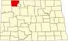 | |
| Townships | ||
| Unorganized territory | ||
| CDP | ||
| Other communities | ||
| Indian reservation | ||
| Footnotes | ‡This populated place also has portions in an adjacent county or counties | |