
Finke Gorge National Park: Difference between revisions
Rescuing 1 sources and tagging 0 as dead. #IABot (v1.3.1.1) |
Rescuing 1 sources and tagging 0 as dead. #IABot (v1.5.4) |
||
| Line 41: | Line 41: | ||
==External links== |
==External links== |
||
*[http://www.nt.gov.au/nreta/parks/find/finkegorge.html Finke Gorge National Parks web page] |
*[https://web.archive.org/web/20091030033422/http://www.nt.gov.au/nreta/parks/find/finkegorge.html Finke Gorge National Parks web page] |
||
*[https://web.archive.org/web/20130512194857/http://www.parksandwildlife.nt.gov.au/__data/assets/pdf_file/0020/10586/Finke-Gorge.pdf Official fact sheet and map] |
*[https://web.archive.org/web/20130512194857/http://www.parksandwildlife.nt.gov.au/__data/assets/pdf_file/0020/10586/Finke-Gorge.pdf Official fact sheet and map] |
||
Revision as of 01:33, 1 October 2017
| Finke Gorge National Park Northern Territory | |
|---|---|
 Finke Gorge National Park map | |
| Nearest town or city | Alice Springs |
| Established | 1967 |
| Area | 452.93 km2 (174.9 sq mi)[1] |
| Managing authorities |
|
| Website | Finke Gorge National Park |
| See also | Protected areas of the Northern Territory |
Finke Gorge is a national park in the Northern Territory of Australia, 1318 km south of Darwin.[2] The Park covers an area of 458 km2 (177 sq mi), and includes the impressive desert oasis Palm Valley, home to a diverse range of plant species, many of which are rare and unique to the area. There are good opportunities for bushwalking and bushcamping in the park.[3]
Heritage
The park is noted for its ancient palms and Aboriginal cultural sites. The Central Australian Cabbage Palm is found only in Palm Valley and prolifically here.[3] The Finke River is claimed to be one of the oldest catchments in the world,[3] with areas dating back 350 million years.
The park and nearby areas hold cultural significance to the Western Arrernte Aboriginal people and there is also evidence of early European settlement.
Access
A popular four-wheel-drive route down the Finke River to Illamurta Springs and Watarrka National Park begins at Finke Gorge. Bush walking is another popular activity. Kalaranga lookout is an easy 20 minute climb, with spectacular views of the rock amphitheatre encircled by rugged cliffs. The Mpaara Walk introduces the mythology of the Western Arrernte Aboriginal culture. In Palm Valley, the Arankaia Walk and the longer Mpulungkinya Walk meander among lush, slender palms, returning across a scenic plateau.
Gallery
-
 Palm Valley, located in the park
 -
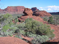 Amphitheatre


See also
External links
References
- ^ "CAPAD 2012 Northern Territory Summary (see 'DETAIL' tab)". CAPAD 2012. Australian Government - Department of the Environment. 7 February 2014. Retrieved 7 February 2014.
- ^ Hema, Maps (2007). Australia Road and 4WD Atlas (Map). Eight Mile Plains Queensland: Hema Maps. p. 100. ISBN 978-1-86500-456-3.
{{cite map}}: Cite has empty unknown parameter:|1=(help) - ^ a b c Hema Maps (1997). Discover Australia's National Parks. Milsons Point, New South Wales: Random House Australia. p. 221. ISBN 1-875992-47-2.
{{cite book}}: Cite has empty unknown parameter:|coauthors=(help)