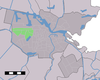
Geuzenveld-Slotermeer
Appearance
You can help expand this article with text translated from the corresponding article in Dutch. (June 2010) Click [show] for important translation instructions.
|
Geuzenveld-Slotermeer | |
|---|---|
neighborhood | |
 Geuzenveld-Slotermeer as part of Amsterdam | |
| Coordinates: 52°22′42″N 4°48′24″E / 52.37833°N 4.80667°E | |
| Country | Netherlands |
| Province | North Holland |
| Municipality (Gemeente) | Amsterdam |
| Borough (Stadsdeel) | Nieuw-West |
| Time zone | UTC+1 (CET) |
| Area code | 020 |
Geuzenveld-Slotermeer is a neighborhood and former borough (stadsdeel) comprising some of the most western parts of the city of Amsterdam, Netherlands. As a borough it existed from 1990 till 2010, when it merged with the boroughs Osdorp and Slotervaart to form the new borough Amsterdam Nieuw-West.
Geuzenveld-Slotermeer comprised the following neighborhoods and areas:
- Eendracht
- Geuzenveld
- Spieringhorn
- Slotermeer

