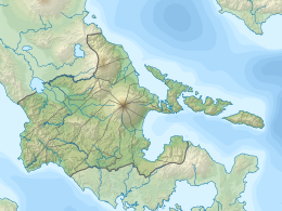
Sula Island
Appearance
| Geography | |
|---|---|
| Coordinates | 13°16′15.8″N 123°49′48.9″E / 13.271056°N 123.830250°E |
| Adjacent to | |
| Administration | |
| Region | Bicol Region |
| Province | Albay |
| Municipality | |
| Additional information | |
 | |
Sula Island is an island located in the Albay province of the Philippines.[1]
See also
References
- ^ Official Gazette - Republic of the Philippines. 1921. p. 765.
Further reading
- "Sula Island, Philippines". National Geospatial-Intelligence Agency. January 10, 2003. Retrieved April 20, 2017.


