
Boneville, Georgia
Boneville, Georgia | |
|---|---|
 Boneville  Boneville | |
| Coordinates: 33°26′00″N 82°26′19″W / 33.43333°N 82.43861°W | |
| Country | United States |
| State | Georgia |
| County | McDuffie |
| Elevation | 472 ft (144 m) |
| Time zone | UTC-5 (Eastern (EST)) |
| • Summer (DST) | UTC-4 (EDT) |
| ZIP code | 30806 |
| Area codes | 706 & 762 |
| GNIS feature ID | 354810[1] |
Boneville is an unincorporated community in McDuffie County, Georgia, United States. The community is located along Georgia State Route 10, 4.6 miles (7.4 km) east-southeast of Thomson. Boneville has a post office with ZIP code 30806, which opened on September 15, 1884.[2][3]
References[edit]
- ^ "Boneville". Geographic Names Information System. United States Geological Survey, United States Department of the Interior.
- ^ United States Postal Service. "USPS - Look Up a ZIP Code". Retrieved November 20, 2015.
- ^ "Postmaster Finder - Post Offices by ZIP Code". United States Postal Service. Archived from the original on October 17, 2020. Retrieved November 20, 2015.
Municipalities and communities of McDuffie County, Georgia, United States | ||
|---|---|---|
| City | 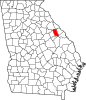 | |
| Town | ||
| Unincorporated communities | ||
This McDuffie County, Georgia state location article is a stub. You can help Wikipedia by expanding it. |