Törökszentmiklós
Appearance
Törökszentmiklós | |
|---|---|
 | |
| Country | |
| County | Jász-Nagykun-Szolnok |
| Area | |
| • Total | 185.16 km2 (71.49 sq mi) |
| Population (2002) | |
| • Total | 23,145 |
| • Density | 125/km2 (320/sq mi) |
| Time zone | UTC+1 (CET) |
| • Summer (DST) | UTC+2 (CEST) |
| Postal code | 5200 |
| Area code | 56 |

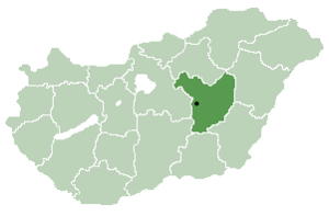
Törökszentmiklós is a town in Jász-Nagykun-Szolnok county, in the Northern Great Plain region of central Hungary. It is the third largest settlement in the county.
Geography
It covers an area of 185.16 km2 (71 sq mi) and has a population of 23,145 people (2002).
Timeline of the history of Törökszentmiklós
| B.C. | Chalcolithic-, bronze and iron age cultures, Celtic ruins. |
| 1399 | The charters of King Zsigmond mention the name Zenthmyclos. |
| 1552 | The castle of Balaszentmiklós fell under the Turkish siege. |
| 1685 | Destruction of the castle. |
| 1738 | The settlement, Török Szent Miklós became a market town. |
It is home to the Törökszentmiklós palace (shown in photo).

International relations
Törökszentmiklós is Twinned with :
47°11′N 20°25′E / 47.183°N 20.417°E


