
Search results
Did you mean: plateau of the chorus
The page "Plateau+of+the+Chotts" does not exist. You can create a draft and submit it for review or request that a redirect be created, but consider checking the search results below to see whether the topic is already covered.
- Nefzaoua (category Regions of Tunisia)region of southwest Tunisia bounded by the salt lake Chott el Djerid to the west, the Grand Erg Oriental to the south, and the Dahar plateau to the east...1 KB (102 words) - 23:16, 24 October 2023
 The following is a list of endorheic basins, watersheds which do not drain to the sea. Chott Melrhir (Algeria) Chott Ech Chergui (Algeria) Chott el Hodna...12 KB (1,280 words) - 15:07, 10 April 2024
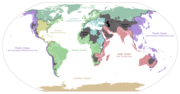
- basin – Geologic basin under the sea Oceanic plateau – Relatively flat submarine region that rises well above the level of the ambient seabed Oceanic ridge –...28 KB (8,330 words) - 00:26, 7 May 2024
 Tacfarinas (category Wars involving the Roman Empire)for the animals. In winter, they lived around the chotts (pronounced "shots"), a string of large salt lakes on the desert southern fringes of the Roman...36 KB (5,008 words) - 22:55, 1 August 2024
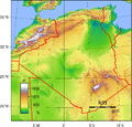 valleys, and plateaus between the Mediterranean and the Sahara Desert, forms an integral part of the section of North Africa known as the Maghreb. This...30 KB (2,582 words) - 18:20, 6 July 2024
 Hautes Plaines (category Cultural regions of Algeria)plains. The Hodna region, with the Chott el Hodna lies at the eastern end of the Hautes Plaines. The main towns of the plateau are Bordj Bou Arreridj, Sétif...7 KB (390 words) - 19:22, 5 September 2023
 Endorheic basin (category Bodies of water)turlough, the largest turlough in the Republic of Ireland. Laacher See, in Germany. The Lasithi Plateau in Crete, Greece, is a high endorheic plateau. A few...33 KB (3,767 words) - 06:24, 6 May 2024
 Hodna (category Geography of Algeria)the plateau stretches further westwards. The northern part of the Hodna is composed of silt and the southern part is mainly sandy. The lowest area of...7 KB (481 words) - 21:32, 13 June 2024
 Mareth Line (section Battle of the Mareth Line)the rocky Dahar Plateau, which later became part of an SD across the Matmata Hills to Kebili on the edge of the Chott el Djerid. The chott and Chott El...22 KB (2,666 words) - 20:52, 29 November 2023
 tabletop plateau shared with Venezuela and Brazil. The highest point of the plateau is inside Venezuelan territory at 2,810 metres (9,220 ft). The Guyanese...49 KB (2,072 words) - 00:58, 1 August 2024
 Maghreb (redirect from History of the Maghreb)salt lakes of central Tunisia, Chott Melghir in Algeria, and other areas of Egypt, Algeria, Mauritania, and Western Sahara. The countries of the Maghreb...84 KB (8,422 words) - 07:03, 2 August 2024
 Selja Gorges (category Geography of Tunisia)Gafsa Governorate. The gorges link the Gafsa Valley with the Redeyef plateau. The area contains abundant phosphate deposits. The Gorges are several kilometers...6 KB (574 words) - 17:57, 3 July 2024
 collected on the margins of the chotts. In 2019, the country was the 17th largest world producer of gypsum, and the 19th largest world producer of phosphate...50 KB (4,821 words) - 05:59, 25 July 2024
 Sahara (redirect from History of the Sahara)seas, stone plateaus, gravel plains (reg), dry valleys (wadi), dry lakes (oued), and salt flats (shatt or chott). Unusual landforms include the Richat Structure...103 KB (11,736 words) - 17:21, 24 June 2024
- Climate change in Algeria (category CS1 maint: DOI inactive as of January 2024)called "chotts”. This region has unique wetlands that provide habitat and breeding grounds for migratory birds. The Saharan Atlas Mountains lie to the south...28 KB (3,167 words) - 13:00, 20 July 2024
 deposits and vadose diagenetic features with dinosaur tracks. The Tunisian coastal "chotts" and their cyclic muddy deposits represent a good recent equivalent...32 KB (3,833 words) - 12:03, 28 November 2023
- protected under by the Ramsar Convention an international treaty for the conservation and sustainable use of wetlands, recognizing the fundamental ecological...242 KB (220 words) - 17:35, 29 July 2024
 Djelfa (redirect from History of Djelfa)Hautes Plaines (high plateaus) of the north, characterized by chotts (intermittent salt lakes), and the Sahara to the south. The town was founded in 1852...11 KB (741 words) - 05:52, 4 August 2024
 Laghouat (category Populated places established in the 11th century)one of a large number of seasonal streams that empty into Chott Melrhir. It is bordered to the north by the municipality of Sidi Makhlouf, to the west...19 KB (1,986 words) - 17:37, 7 June 2024
- and incision of a plateau such that only a small part of the plateau surface is at or near the original elevation of the summit; much of the area instead...261 KB (26,722 words) - 23:39, 21 July 2024


- geological map of the Central Sahara), in Bull. de la Soc. Géol. de France (1881); Roudaire, Rapport sur la dernière expéd. des Chotts (1881) (and other