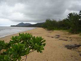
Bramston Beach, Queensland
| Bramston Beach Queensland | |
|---|---|
 Bramston Beach | |
| Population | 176[1] |
| Postcode(s) | 4871 |
| Location |
|
| LGA(s) | Cairns |
| State electorate(s) | Mulgrave |
| Federal division(s) | Kennedy |
Bramston Beach is a town located in Queensland, Australia. It is located 60 kilometres (37 mi) south of the regional centre of Cairns. It is located 17 kilometres east of the Bruce Highway. At the 2006 census, Bramston Beach had a population of 176.[1]
The Eubenangee Swamp National Park and Queensland's highest mountain, Mount Bartle Frere are nearby.
It is a popular spot with caravaners and is a good fishing location and has a slightly older than average population.
References
- ^ a b Australian Bureau of Statistics (25 October 2007). "Bramston Beach (L) (Urban Centre/Locality)". 2006 Census QuickStats. Retrieved 2008-01-27.
