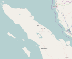
Muara Dua
Muara Dua | |
|---|---|
 | |
| Coordinates: 5°11′17″N 97°8′25″E / 5.18806°N 97.14028°E | |
| Country | Indonesia |
| Province | Aceh |
| City | lhokseumawe |
| District | Muara Dua |
| City Established | June 21, 2001 |
| Government | |
| • Camat | Umar, S.Sos |
| Area | |
| • Total | 57.80 km2 (22.32 sq mi) |
| Population (2012[1]) | |
| • Total | 22,850 |
| • Density | 400/km2 (1,000/sq mi) |
| Time zone | UTC+7 (WIB) |
| Area code | +62645 |
| Website | http://www.bappedalhokseumawe.web.id |
Muara Dua is a district in Lhokseumawe, Aceh, Indonesia.
Administrative divisions[edit]
list the name of the village (Gampong) is in Districts of Muara Dua
- Gampong Alue Awe (postcode : 24352)
- Gampong Blang Crum (postcode : 24352)
- Gampong Blang Pohroh (postcode : 24352)
- Gampong Cot Girek Kandang (postcode : 24352)
- Gampong Cut Mamplam(postcode : 24352)
- Gampong Keude Cunda (postcode : 24352)
- Gampong Lhok Mon Puteh (postcode : 24352)
- Gampong Meunasah Alue (postcode : 24352)
- Gampong Meunasah Blang (postcode : 24352)
- Gampong Meunasah Manyang (postcode : 24352)
- Gampong Meunasah Mee (postcode : 24352)
- Gampong Meunasah Mesjid (postcode : 24352)
- Gampong Paloh Batee (postcode : 24352)
- Gampong Panggoi (postcode : 24352)
- Gampong Paya Bili (postcode : 24352)
- Gampong Paya Punteut (Punteuet) (postcode : 24352)
- Gampong Uteun Kot (postcode : 24352)
References[edit]
- ^ Lhokseumawe Dalam Angka 2013 Archived 2014-03-17 at the Wayback Machine


