Råholt
Råholt | |
|---|---|
Village | |
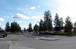
 View of the village from Eidsvoll Verk Station | |
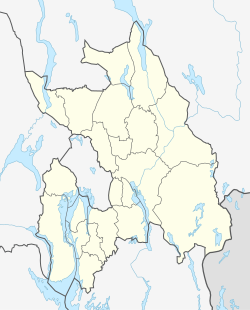
Location in Akershus | |
| Coordinates: 60°16′N 11°11′E / 60.267°N 11.183°E | |
| Country | Norway |
| Region | Østlandet |
| County | Akershus |
| Municipality | Eidsvoll |
| Time zone | UTC+01:00 (CET) |
| • Summer (DST) | UTC+02:00 (CEST) |
Råholt is a village in the municipality of Eidsvoll, Norway. It is located at an average elevation of 189 meters above the sea level.[1] Its population (2022) is 14,830.[2]
Råholt has experienced growth following the airport at Gardermoen, and expansion still takes place.
Råholt's Main station for many residents is Eidsvoll Verk Stasjon
References[edit]
- ^ "Råholt topographic map, elevation, terrain". Topographic maps. Retrieved 7 September 2023.
- ^ "Norway: Major Urban Settlements - Population Statistics, Maps, Charts, Weather and Web Information". www.citypopulation.de. Retrieved 7 September 2023.


