
Search results
The page "Mareham+on+the+Hill" does not exist. You can create a draft and submit it for review or request that a redirect be created, but consider checking the search results below to see whether the topic is already covered.
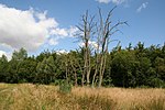
 Mareham on the Hill is a village and civil parish about 2.5 miles (4.0 km) south-east from the town of Horncastle, Lincolnshire, England. Mareham on the...4 KB (242 words) - 23:09, 10 April 2023
 Salmonby (category Coordinates on Wikidata)gate leading to the Churchyard, and a few photographs, remaining: In 1971 the civil parish had a population of 58. On 1 April 1987 the parish was abolished...5 KB (402 words) - 21:21, 22 November 2023
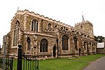 Horncastle (category Coordinates on Wikidata)and Mareham on the Hill on the eastern outskirts. The Viking Way meets the River Waring, then north of the A158 the village of High Toynton. The A153...35 KB (3,250 words) - 04:24, 6 March 2024
 Scrivelsby (category Coordinates on Wikidata)road 1 mile (1.6 km) east from the A153 road. It is administered by the civil parish of Mareham on the Hill. Historically the manor was held by grand serjeanty...13 KB (1,300 words) - 06:45, 22 January 2024
 New York, Lincolnshire (category Coordinates on Wikidata)York is a hamlet in the East Lindsey district of Lincolnshire, England, in the parish of Wildmore in the Lincolnshire Fens on the B1192 road near Coningsby...3 KB (162 words) - 21:44, 12 December 2022
- Manby, Manthorpe, Bourne, Manthorpe, Grantham, Manton, Mareham le Fen, Mareham on the Hill, Markby, Market Deeping, Market Rasen, Market Stainton, Marshchapel...24 KB (1,557 words) - 22:44, 26 January 2024
 Gibraltar Point, Lincolnshire (redirect from The Wash Study Centre)nature reserve is an area of about 4.3 km2 (1.7 sq mi) on the coast of Lincolnshire, England. The reserve is owned by Lincolnshire County Council and East...6 KB (605 words) - 17:21, 17 October 2022
- LN postcode area (category Postcode areas covering the East Midlands)Template:Attached KML/LN postcode area KML is from Wikidata The LN postcode area, also known as the Lincoln postcode area, is a group of thirteen postcode...4 KB (145 words) - 06:58, 18 March 2024
 Westville, Lincolnshire (category Coordinates on Wikidata)the East Lindsey district of Lincolnshire, England. It is situated 7 miles (11 km) north from Boston. Westville lies in the fen country close to the village...3 KB (182 words) - 21:04, 17 May 2022
 Saltfleetby (category Coordinates on Wikidata)24 November 2018 Foot, William (2006). Beaches, fields, streets, and hills: the anti-invasion landscapes of England, 1940. Council for British Archaeology...5 KB (401 words) - 15:39, 27 August 2023
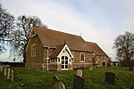 Thornton, Lincolnshire (category Coordinates on Wikidata)the civil parish of Roughton, in the East Lindsey district of Lincolnshire, England. It is situated on the B1191 road, 1 mile (1.6 km) west from the A153...3 KB (184 words) - 22:17, 22 November 2023
 Tetford (category Coordinates on Wikidata)cut off from the south.[citation needed] An electoral ward in the same name exists. This ward stretches south west to Mareham on the Hill with a total...9 KB (889 words) - 17:12, 29 November 2023
 New Bolingbroke (category Coordinates on Wikidata)is a village in the civil parish of Carrington and New Bolingbroke, in the East Lindsey district of Lincolnshire, England. It is in the Lincolnshire Fens...5 KB (398 words) - 17:44, 5 July 2023
 a complete list of acts of the Parliament of the United Kingdom for the year 1805. Note that the first parliament of the United Kingdom was held in 1801;...85 KB (538 words) - 15:15, 11 April 2024
 Sutton-on-Sea (originally Sutton in the Marsh or Sutton le Marsh) is a seaside town in the East Lindsey district of Lincolnshire, England, beside a long...11 KB (1,152 words) - 21:33, 29 January 2024
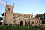 Winthorpe, Lincolnshire (category Coordinates on Wikidata)Winthorpe is a small coastal village in the civil parish of Skegness, in the East Lindsey district of Lincolnshire, England. It is situated approximately...3 KB (211 words) - 19:44, 3 May 2024
- Sandilands, Lincolnshire (category Coordinates on Wikidata)of Sutton-on-Sea, in the East Lindsey district of Lincolnshire, England. It forms part of the civil parish of Mablethorpe and Sutton. The former golf...3 KB (176 words) - 07:21, 18 August 2022
 Minting (category Coordinates on Wikidata)civil parish in the East Lindsey district of Lincolnshire, England. The village is situated 1 mile (1.6 km) south from the A158 road. The population (including...3 KB (176 words) - 20:40, 30 August 2022
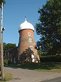 Saltfleet (category Coordinates on Wikidata)Inn). The beaches at Saltfleet attract visitors for days out and holidays, some of whom gather samphire on the coast close to the village. The parish...7 KB (577 words) - 19:14, 2 March 2024
 Louth and Horncastle (UK Parliament constituency) (category Constituencies of the Parliament of the United Kingdom established in 1997)Donington on Bain, Fotherby, Grimoldby, Halton Holegate, Hogsthorpe, Holton le Clay, Horncastle, Hundleby, Legbourne, Mablethorpe, Mareham le Fen, Marshchapel...21 KB (826 words) - 11:21, 20 May 2024


- Cock and Breeches Inn, 162. Cock-fighting. 164. Coins found at Mareham-on-the-Hill, 184. Coningsby, 203-207. „ Church, 204-7. „ land owners of,