Tipu, Belize: Difference between revisions
Content deleted Content added
Citation bot (talk | contribs) Removed parameters. | Use this bot. Report bugs. | Suggested by Spinixster | Category:Belize geography stubs | #UCB_Category 98/157 |
m mayan --> maya |
||
| Line 1: | Line 1: | ||
{{short description| |
{{short description|Maya archaeological site in Belize}} |
||
{{about|a |
{{about|a Maya archaeological site|the sultan|Tipu Sultan}} |
||
{{UBE|date=December 2022}} |
{{UBE|date=December 2022}} |
||
{{DMY|date=December 2022}} |
{{DMY|date=December 2022}} |
||
| Line 25: | Line 25: | ||
| map_dot_label = |
| map_dot_label = |
||
| location = [[Cayo District|Cayo, Belize]] |
| location = [[Cayo District|Cayo, Belize]] |
||
| region = [[ |
| region = [[Maya Lowlands]]<!-- or larger units, eg Maya Region, or smaller unit, eg Tikal uses Peten Basin rather than Lowlands --> |
||
| type = [[Human settlement|Settlement]] |
| type = [[Human settlement|Settlement]] |
||
| part_of = |
| part_of = |
||
| Line 40: | Line 40: | ||
| abandoned = 1707 {{small|(by ''[[Reductions|reduccion]]'')}}{{sfn|Shwartz|1990|p=36}} |
| abandoned = 1707 {{small|(by ''[[Reductions|reduccion]]'')}}{{sfn|Shwartz|1990|p=36}} |
||
| epochs = [[Mesoamerican chronology|Postclassic]] to [[Spanish colonization of the Americas|Spanish colonial]]<!-- actually displays as "Periods" --> |
| epochs = [[Mesoamerican chronology|Postclassic]] to [[Spanish colonization of the Americas|Spanish colonial]]<!-- actually displays as "Periods" --> |
||
| cultures = [[Maya civilization| |
| cultures = [[Maya civilization|Maya]] |
||
| dependency_of = |
| dependency_of = |
||
| occupants = |
| occupants = |
||
| Line 57: | Line 57: | ||
| notes = |
| notes = |
||
}} |
}} |
||
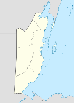
'''Tipu''' is a [[Maya civilization|Maya]]n archaeological site{{sfn|AC|nd}} in the [[Maya Mountains]] near the [[Belize]]–[[Guatemala]] border. This site is situated near the [[Macal River]]. Further downstream is located the |
'''Tipu''' is a [[Maya civilization|Maya]]n archaeological site{{sfn|AC|nd}} in the [[Maya Mountains]] near the [[Belize]]–[[Guatemala]] border. This site is situated near the [[Macal River]]. Further downstream is located the Maya site of [[Chaa Creek]].{{sfn|ML|nd}} Slightly further downstream is the site of [[Cahal Pech]].{{sfn|UCL|nd}} In Spanish colonial times, Tipu is thought to have played a major role in delaying the [[Spanish conquest of Petén|conquest of Peten]].{{sfn|Shwartz|1990|p=36}} |
||
== Notes and references == |
== Notes and references == |
||
<!-- === Explanatory footnotes === --> |
<!-- === Explanatory footnotes === --> |
||
Latest revision as of 15:04, 8 April 2024
| Alternative name |
|
|---|---|
| Location | Cayo, Belize |
| Region | Maya Lowlands |
| Coordinates | 17°04′46″N 89°04′49″W / 17.079512443938867°N 89.08030277594041°W |
| Type | Settlement |
| History | |
| Abandoned | 1707 (by reduccion)[1] |
| Periods | Postclassic to Spanish colonial |
| Cultures | Maya |
| Events | |
Tipu is a Mayan archaeological site[2] in the Maya Mountains near the Belize–Guatemala border. This site is situated near the Macal River. Further downstream is located the Maya site of Chaa Creek.[3] Slightly further downstream is the site of Cahal Pech.[4] In Spanish colonial times, Tipu is thought to have played a major role in delaying the conquest of Peten.[1]
Notes and references[edit]
Short citations[edit]
Full citations[edit]
- "Early History of Belize".
- "C.Michael Hogan, Chaa Creek, Megalithic Portal, ed. A. Burnham, 2007".
- "Distribution of Early Middle Formative Period Sites". Archived from the original on 20 February 2003.
- Shwartz, Norman B. (1990). Forest society : a social history of Petén, Guatemala. Ethnohistory series. Philadelphia, PA: University of Pennsylvania Press. ISBN 0812282485. OCLC 21974298.


