Água Clara
Appearance
You can help expand this article with text translated from the corresponding article in Portuguese. (February 2018) Click [show] for important translation instructions.
|
Água Clara | |
|---|---|
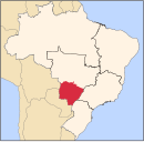
 Location in Mato Grosso do Sul state | |
| Coordinates: 20°26′52″S 52°52′40″W / 20.44778°S 52.87778°W | |
| Country | Brazil |
| Region | Central-West |
| State | Mato Grosso do Sul |
| Government | |
| • Mayor | Edvaldo Queiroz - Tupete (PDT, 2017 - 2020) |
| Area | |
| • Total | 11,031 km2 (4,259 sq mi) |
| Population (2020 [1]) | |
| • Total | 15,776 |
| • Density | 1.4/km2 (3.7/sq mi) |
| Time zone | UTC−4 (AMT) |
Água Clara is a municipality located in the Brazilian state of Mato Grosso do Sul. Its population was 15,776 (2020) and its area is 11,031 km2 (4,259 sq mi).
Geography
[edit]The municipality of Água Clara is located in the south of the Midwest region of Brazil. It is located at latitude 20º26'53 ” south and longitude 52º52'40” west. It has just over 14,000 inhabitants. It is 204 km from the state capital (Campo Grande) and 868 km from the federal capital (Brasília).


