2022–23 South-West Indian Ocean cyclone season
| 2022–23 South-West Indian Ocean cyclone season | |
|---|---|
 Season summary map | |
| Seasonal boundaries | |
| First system formed | 23 September 2022 |
| Last system dissipated | Season ongoing |
| Strongest storm | |
| Name | Balita[nb 1] |
| • Maximum winds | 65 km/h (40 mph) (10-minute sustained) |
| • Lowest pressure | 996 hPa (mbar) |
| Seasonal statistics | |
| Total disturbances | 3 |
| Total depressions | 3 |
| Total storms | 2 |
| Total fatalities | None |
| Total damage | None |
| Related articles | |
The 2022–23 South-West Indian Ocean cyclone season is an ongoing event of the annual cycle of tropical cyclone and subtropical cyclone formation. It will begin on 15 November 2022, and will end on 30 April 2023, with the exception for Mauritius and the Seychelles, for which it will end on 15 May 2023. These dates conventionally delimit the period of each year when most tropical and subtropical cyclones form in the basin, which is west of 90°E and south of the Equator. However, tropical cyclones can form year-round, and all tropical cyclones that will form between 1 July 2022 and 30 June 2023 will be part of the season. Tropical and subtropical cyclones in this basin are monitored by the Regional Specialised Meteorological Centre in Réunion and unofficially by the Joint Typhoon Warning Center.
Seasonal forecasts
| Forecast Center |
Systems | |||
|---|---|---|---|---|
| Mauritius Meteorological Services | 11–9 tropical cyclones | |||
| Météo-France | 6–10 tropical cyclones | |||
| Forecast Center |
Chance of above average | |||
| Météo-France | 30% | 60% | 10% | |
| Source: Seasonal Outlook for Tropical Cyclones.[1][2] | ||||
In October 2022, the Météo-France issued its seasonal forecast of cyclone activity for the basin.[2] The MFR predicted a season that was slightly below average to average, citing the effects of a La Niña event.[2] The MFR also predicted that the storm would form with a 60% chance.[2] The formation of the cyclone's activity was given a 30% chance, and an above-average level of activity was given a 10% chance.[2] The season in the South-West Indian Ocean was expected to be above average, with 6-10 tropical cyclones or moderate tropical storm.[2]
The Mauritius Meteorological Services (MMS) released their summer 2022–23 outlooks.[1] An average season, with around eleven to nine cyclones forming, was expected.[1] The MMS also indicates that the eastern part of the basin is more conducive to cyclone formation in the second half of summer, and the western part of the basin will also become favorable for storm formation during the second half.[1]
Seasonal summary

The season began early, with a weak tropical low being produced on 22 September. Improving conditions over the next 3 days allowed development of the system, which strengthened into Moderate Tropical Storm Ashley on 27 September. The storm slowly moved westward and dissipated on the 30th. Pre-season activity continued, with a disturbance being produced as a result of a westerly wind burst. Another storm formed on 6 October, and was named Balita on the 8th. The storm dissipated the next day, with no impacts.
Systems
Moderate Tropical Storm Ashley
| Moderate tropical storm (MFR) | |
| Tropical storm (SSHWS) | |
| Duration | 23 September – 28 September |
|---|---|
| Peak intensity | 75 km/h (45 mph) (10-min); 1000 hPa (mbar) |
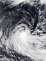
On 22 September, a near-equatorial trough produced a weak tropical low in the Indian Ocean, initially expected by MFR to not form due to upper wind shear.[3] Environmental conditions improved over the next 3 days,[4] and the low organized enough to become the first tropical depression of the season by 26 September.[5] Early the next day, the JTWC subsequently designated the storm as Tropical Cyclone 02S, citing a scatterometer pass indicating tropical storm-force winds in its western and eastern semicircles.[6] The MFR also upgraded the system into a moderate tropical storm, and the Mauritius Meteorological Services (MMS) named it Ashley.[7][8] The system then reached peak intensity, with 10-minute sustained winds of 75 km/h (45 mph),[8] before succumbing to strong northeasterly shear and significant dry air intrusions late on the same day, prompting the JTWC to issue their final advisory on Ashley.[9] The MFR terminated advisories by 06:00 UTC on 28 September as Ashley weakened into a remnant low,[10] but continued to track the storm until it was last noted on 30 September as a dissipating low.[11]
Moderate Tropical Storm Balita
| Moderate tropical storm (MFR) | |
| Tropical storm (SSHWS) | |
| Duration | 3 October – 9 October |
|---|---|
| Peak intensity | 65 km/h (40 mph) (10-min); 996 hPa (mbar) |
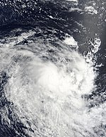
On 2 October, the MFR began to monitor a disturbance associated with the convergence of the westerly wind burst.[12] However, convective activity was located in the low-level convergences.[13] Later the next day, the JTWC began monitoring an area of convection.[14] Satellite images indicated that the low-level cloud lines wrapping into the low-level center.[15] Early on 5 October, the JTWC issued a Tropical Cyclone Formation Alert on the system.[16] The JTWC subsequently initiated advisories on the system and classified it as Tropical Cyclone 03S at 03:00 UTC on 6 October.[17] By 06:00 UTC, the MFR upgraded it to a tropical depression.[18] An ASCAT pass featured below gale-force winds on its southern quadrant.[19] Despite moderate northeasterly wind shear, convection increased around the system.[20]
The MFR further upgraded it to a moderate tropical storm at 00:00 UTC on 8 October with the name Balita from the MMS.[21][22] Microwave imagery revealed that Balita had improved its convective structure.[23] At 06:00 UTC on 9 October, Balita's structure became elongated and asymmetrical, prompting MFR to reclassify the storm as a post-tropical depression.[24][25] Later that same day, the MFR ceased advisories, and the JTWC followed suit.[26] The remnants fully dissipated on 13 October.[27]
Tropical Depression 03
| Tropical depression (MFR) | |
| Duration | 5 November (Entered basin) – 6 November |
|---|---|
| Peak intensity | 55 km/h (35 mph) (10-min); 1008 hPa (mbar) |
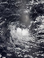
On 5 November, Tropical Low 02U that was being monitored by the MFR crossed into the South-West Indian Ocean basin from the Australian region.[28] At the time, there was no more convection associated, only a low-level vortex.[28] Thunderstorm activity has resumed in the southern part of the system in the last few hours.[28] Upon entering the basin, the JTWC ceased advisories by 09:00 UTC that day.[29] The MFR's reclassified the system as Tropical Depression 03.[30] Environmental conditions were assessed as being marginally conducive for tropical cyclogenesis, with low vertical wind shear and moderate equatorial outflow.[31] At 06:00 UTC on 6 November, the MFR's issued their last warning as the system degenerated into a remnant low.[32]
Storm names
Within the South-West Indian Ocean, tropical depressions and subtropical depressions that are judged to have 10-minute sustained windspeeds of 65 km/h (40 mph) by the Regional Specialized Meteorological Center on Réunion island, France (RSMC La Réunion) are usually assigned a name. However, it is the Sub-Regional Tropical Cyclone Advisory Centers in Mauritius and Madagascar who name the systems. The Sub-Regional Tropical Cyclone Advisory Center (Mauritius Meteorological Services) in Mauritius names a storm should it intensify into a moderate tropical storm between 55°E and 90°E. If instead a cyclone intensifies into a moderate tropical storm between 30°E and 55°E then the Sub-Regional Tropical Cyclone Advisory Center (Meteo Madagascar) in Madagascar assigns the appropriate name to the storm. Storm names are taken from three pre-determined lists of names, which rotate on a triennial basis, with any names that have been used automatically removed. Therefore, all storm names used this year will be removed from the rotation and replaced with a new name for the 2025–26 season, while the unused names will remain on the list.[33] New names this season are: Ashley, Balita, Cheneso, Dingani, Enali, Fabien, Gezani, Horacio, Indusa and Juluka. They replaced Ambali, Belna, Calvinia, Diane, Esami, Francisco, Gabekile, Herold, Irondro and Jeruto during the 2019–20 season.[33]
|
|
|
Season effects
This table lists all of the tropical cyclones and subtropical cyclones that were monitored during the 2022–2023 South-West Indian Ocean cyclone season. Information on their intensity, duration, name, areas affected, primarily comes from RSMC La Réunion. Death and damage reports come from either press reports or the relevant national disaster management agency while the damage totals are given in 2022 or 2023 USD.
| Name | Dates | Peak intensity | Areas affected | Damage (USD) |
Deaths | Refs | ||
|---|---|---|---|---|---|---|---|---|
| Category | Wind speed | Pressure | ||||||
| Ashley | 23 – 28 September | Moderate tropical storm | 75 km/h (45 mph) | 1000 hPa (29.53 inHg) | None | None | None | |
| Balita | 3 – 9 October | Moderate tropical storm | 65 km/h (40 mph) | 996 hPa (29.41 inHg) | None | None | None | |
| 03 | 5 – 6 November | Tropical depression | 55 km/h (35 mph) | 1008 hPa (29.77 inHg) | None | None | None | |
| Season aggregates | ||||||||
| 3 systems | 23 September – Season ongoing | 65 km/h (40 mph) | 996 hPa (29.41 inHg) | 0 | ||||
See also
- Tropical cyclones in 2022
- List of Southern Hemisphere cyclone seasons
- Atlantic hurricane seasons: 2022, 2023
- Pacific hurricane seasons: 2022, 2023
- Pacific typhoon seasons: 2022, 2023
- North Indian Ocean cyclone seasons: 2022, 2023
- 2022–23 Australian region cyclone season
- 2022–23 South Pacific cyclone season
Notes
- ^ The "strength" of a tropical cyclone is measured by the minimum barometric pressure, not wind speed. Most meteorological organizations rate the intensity of a storm by this figure, so the lower the minimum pressure of the storm, the more intense or "stronger" it is considered to be. The strongest winds were actually from Ashley, at 75 km/h (45 mph).
References
- ^ a b c d "Summer 2022–2023 Outlook for Mauritius and Rodrigues". Mauritius Meteorological Services. 29 October 2022. Archived from the original on 29 October 2022. Retrieved 29 October 2022.
{{cite web}}:|archive-date=/|archive-url=timestamp mismatch; 7 November 2022 suggested (help) - ^ a b c d e f "Prévision saisonnière d'activité cyclonique dans le Sud-Ouest de l'océan Indien Saison 2022-2023" [Seasonal forecast of hurricane activity in the South West Indian Ocean Season 2022-2023]. Météo-France. 22 October 2022. Archived from the original on 7 November 2022. Retrieved 7 November 2022.
- ^ Bulletin for Cyclonic Activity and Significant Tropical Weather in the Southwest Indian Ocean (PDF) (Report). Météo-France. 22 September 2022. Archived (PDF) from the original on 26 September 2022. Retrieved 26 September 2022.
- ^ Bulletin for Cyclonic Activity and Significant Tropical Weather in the Southwest Indian Ocean (PDF) (Report). Météo-France. 25 September 2022. Archived (PDF) from the original on 26 September 2022. Retrieved 26 September 2022.
- ^ Tropical Depression 01 Warning Number (1/1/20222023) (PDF) (Report). Météo-France. 26 September 2022. Archived (PDF) from the original on 26 September 2022. Retrieved 26 September 2022.
- ^ Prognostic Reasoning for Tropical Cyclone 02S (Ashley) Warning No. 1 (Report). United States Joint Typhoon Warning Center. 27 September 2022. Archived from the original on 27 September 2022. Retrieved 27 September 2022.
- ^ "Current Storm/Cyclone (Moderate Tropical Storm Ashley)". Mauritius Meteorological Services. 27 September 2022. Archived from the original on 27 September 2022. Retrieved 27 September 2022.
- ^ a b Moderate Tropical Storm 01 (Ashley) Warning Number (2/1/20222023) (PDF) (Report). Météo-France. 27 September 2022. Archived (PDF) from the original on 27 September 2022. Retrieved 27 September 2022.
- ^ Tropical Cyclone 02S (Ashley) Warning No. 3 (Report). United States Joint Typhoon Warning Center. 27 September 2022. Archived from the original on 27 September 2022. Retrieved 27 September 2022.
- ^ Remnant Low 01 (Ashley) Warning Number (6/1/20222023) (PDF) (Report). Météo-France. 28 September 2022. Archived (PDF) from the original on 28 September 2022. Retrieved 2 October 2022.
- ^ Bulletin for Cyclonic Activity and Significant Tropical Weather in the Southwest Indian Ocean (PDF) (Report). Météo-France. 30 September 2022. Archived (PDF) from the original on 6 October 2022. Retrieved 2 October 2022.
- ^ Bulletin for Cyclonic Activity and Significant Tropical Weather in the Southwest Indian Ocean (PDF) (Report). Météo-France. 2 October 2022. Archived (PDF) from the original on 6 October 2022. Retrieved 2 October 2022.
- ^ Bulletin for Cyclonic Activity and Significant Tropical Weather in the Southwest Indian Ocean (PDF) (Report). Météo-France. 3 October 2022. Archived (PDF) from the original on 6 October 2022. Retrieved 3 October 2022.
- ^ Significant Tropical Weather Advisory for the Indian Ocean, 14Z 3 October 2022 (Report). United States Joint Typhoon Warning Center. 3 October 2022. Retrieved 3 October 2022.
{{cite report}}:|archive-url=requires|archive-date=(help) - ^ Significant Tropical Weather Advisory for the Indian Ocean, 11Z 4 October 2022 (Report). United States Joint Typhoon Warning Center. 4 October 2022. Retrieved 4 October 2022.
{{cite report}}:|archive-url=requires|archive-date=(help) - ^ Tropical Cyclone Formation Alert (Invest 92S) (Report). United States Joint Typhoon Warning Center. 5 October 2022. Retrieved 5 October 2022.
{{cite report}}:|archive-url=requires|archive-date=(help) - ^ Tropical Cyclone 03S (Three) Warning No. 1 (Report). United States Joint Typhoon Warning Center. 6 October 2022. Archived from the original on 6 October 2022. Retrieved 6 October 2022.
- ^ Tropical Depression 02 Warning Number (1/2/20222023) (PDF) (Report). Météo-France. 6 October 2022. Archived (PDF) from the original on 6 October 2022. Retrieved 6 October 2022.
- ^ Tropical Depression 02 Warning Number (3/2/20222023) (PDF) (Report). Météo-France. 6 October 2022. Archived (PDF) from the original on 6 October 2022. Retrieved 6 October 2022.
- ^ Tropical Depression 02 Warning Number (4/2/20222023) (PDF) (Report). Météo-France. 7 October 2022. Archived (PDF) from the original on 7 October 2022. Retrieved 7 October 2022.
- ^ "Current Storm/Cyclone (Moderate Tropical Storm Balita)". Mauritius Meteorological Services. 7 October 2022. Archived from the original on 8 October 2022. Retrieved 8 October 2022.
- ^ Moderate Tropical Storm 02 (Balita) Warning Number (8/2/20222023) (PDF) (Report). Météo-France. 8 October 2022. Archived (PDF) from the original on 8 October 2022. Retrieved 8 October 2022.
- ^ Prognostic Reasoning for Tropical Cyclone 03S (Balita) Warning No. 5 (Report). United States Joint Typhoon Warning Center. 8 October 2022. Archived from the original on 8 October 2022. Retrieved 8 October 2022.
- ^ Post-Tropical Depression 02 (Balita) Warning Number (13/2/20222023) (PDF) (Report). Météo-France. 9 October 2022. Archived (PDF) from the original on 9 October 2022. Retrieved 9 October 2022.
- ^ Tropical Cyclone 03S (Balita) Warning No. 8 (Report). United States Joint Typhoon Warning Center. 9 October 2022. Archived from the original on 9 October 2022. Retrieved 9 October 2022.
- ^ Post-Tropical Depression 02 (Ex-Balita) Warning Number (14/2/20222023) (PDF) (Report). Météo-France. 9 October 2022. Archived from the original (PDF) on 9 October 2022. Retrieved 9 October 2022.
- ^ Bulletin for Cyclonic Activity and Significant Tropical Weather in the Southwest Indian Ocean (PDF) (Report). Météo-France. 13 October 2022. Archived (PDF) from the original on 18 October 2022. Retrieved 14 October 2022.
- ^ a b c Bulletin for Cyclonic Activity and Significant Tropical Weather in the Southwest Indian Ocean (PDF) (Report). Météo-France. 5 November 2022. Archived (PDF) from the original on 5 November 2022. Retrieved 5 November 2022.
- ^ Tropical Cyclone 04S (Four) Warning No. 4 (Report). United States Joint Typhoon Warning Center. 5 November 2022. Archived from the original on 5 November 2022. Retrieved 5 November 2022.
- ^ Tropical Depression 03 Warning Number (1/3/20222023) (PDF) (Report). Météo-France. 5 November 2022. Archived (PDF) from the original on 5 November 2022. Retrieved 6 November 2022.
{{cite report}}:|archive-date=/|archive-url=timestamp mismatch; 6 November 2022 suggested (help) - ^ Significant Tropical Weather Advisory for the Indian Ocean, 13Z 6 November 2022 (Report). United States Joint Typhoon Warning Center. 6 November 2022. Retrieved 6 November 2022.
{{cite report}}:|archive-url=requires|archive-date=(help) - ^ Remnant Low 03 Warning Number (3/3/20222023) (PDF) (Report). Météo-France. 6 November 2022. Archived (PDF) from the original on 6 November 2022. Retrieved 6 November 2022.
- ^ a b Regional Association I Tropical Cyclone Committee (2021). "Tropical Cyclone Operational Plan for the South-West Indian Ocean" (PDF). Retrieved 14 February 2022.
{{cite web}}: CS1 maint: url-status (link)


