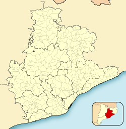
Espinelves
Appearance
Espinelves | |
|---|---|
 | |
| Coordinates: 41°52′16″N 2°25′5″E / 41.87111°N 2.41806°E | |
| Country | |
| Community | |
| Province | Girona |
| Comarca | Osona |
| Government | |
| • Mayor | Joan Manel Claveria Regales (2015)[1] |
| Area | |
• Total | 17.4 km2 (6.7 sq mi) |
| Elevation | 752 m (2,467 ft) |
| Population (2018)[3] | |
• Total | 206 |
| • Density | 12/km2 (31/sq mi) |
| Demonym(s) | Espinelvenc, espinelvenca |
| Website | www |
Espinelves is a municipality in the comarca of Osona in Catalonia, Spain. It is situated in the Guilleries in the east of the comarca. Forestry is the main economic activity of the municipality, particularly the cultivation of the local species Abies masjoanensis for Christmas trees. The Romanesque church of Sant Vincenç d'Espinelves dates from the 11th and 12th centuries. The village is linked to Arbúcies and to Vic by the GI-543 road.
Demography
| 1900 | 1930 | 1950 | 1970 | 1986 | 2007 |
|---|---|---|---|---|---|
| 421 | 481 | 445 | 296 | 240 | 183 |
References
- ^ "Ajuntament d'Espinelves". Generalitat of Catalonia. Retrieved 2015-11-13.
- ^ "El municipi en xifres: Espinelves". Statistical Institute of Catalonia. Retrieved 2015-11-23.
- ^ Municipal Register of Spain 2018. National Statistics Institute.
- Panareda Clopés, Josep Maria; Rios Calvet, Jaume; Rabella Vives, Josep Maria (1989). Guia de Catalunya, Barcelona: Caixa de Catalunya. ISBN 84-87135-01-3 (Spanish). ISBN 84-87135-02-1 (Catalan).
External links
Wikimedia Commons has media related to Espinelves.
- Official website (in Catalan)]
- Government data pages (in Catalan)


