Sant Ferriol
Appearance
Sant Ferriol | |
|---|---|
 El Torn, with St. Andrew's church tower | |
| Coordinates: 42°11′N 2°40′E / 42.183°N 2.667°E | |
| Country | |
| Community | |
| Province | |
| Comarca | Garrotxa |
| Government | |
| • Mayor | Albert Fàbrega Sánchez (2015)[1] |
| Area | |
| • Total | 42.2 km2 (16.3 sq mi) |
| Population (2018)[3] | |
| • Total | 245 |
| • Density | 5.8/km2 (15/sq mi) |
| Website | www |
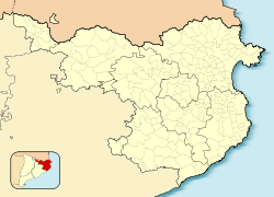
Sant Ferriol is a village in the province of Girona and autonomous community of Catalonia, Spain. The municipality covers an area of 42.26 square kilometres (16.32 sq mi) and the population in 2014 was 240.[2]
References
- ^ "Ajuntament de Sant Ferriol". Generalitat of Catalonia. Retrieved 2015-11-13.
- ^ a b "El municipi en xifres: Sant Ferriol". Statistical Institute of Catalonia. Retrieved 2015-11-23.
- ^ Municipal Register of Spain 2018. National Statistics Institute.
External links
- Government data pages (in Catalan)


