
Ballyduff, County Waterford
Ballyduff, County Waterford | |
|---|---|
Village | |
 Location in Ireland | |
| Coordinates: 52°08′52″N 8°03′11″W / 52.14791°N 8.05309°W | |
| Country | |
| Province | Munster |
| County | County Waterford |
| Time zone | UTC+0 (WET) |
| • Summer (DST) | UTC-1 (IST (WEST)) |
Ballyduff (Irish: Baile Dubh, meaning 'black village') is a village in County Waterford, Ireland.[1] It is also a parish in the Roman Catholic Diocese of Waterford and Lismore.
Historical maps mark the location of Ballyduff Castle in ruins. It was built in 1627 by the carpenter Andrew Tucker for the Earl of Cork. The Drew family gained possession of it later in the 17th century.[2]
Location and access
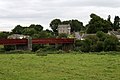
Ballyduff is a village on the Blackwater River in County Waterford, Ireland.[3] It has a bridge over the river. It is 6 miles (9.7 km) west of Lismore and 10 miles (16 km) east of Fermoy, Co. Cork.
Rail
Ballyduff railway station was located on the Waterford to Mallow line and closed in 1967. It was served by the Rosslare to Cork boat train.[4]
Bus
Local Link Waterford serve Ballyduff on certain days. A daily bus service to Dungarvan is available from Lismore. Until 2010 Ballyduff was served by Bus Éireann route 366.[5]
Facilities
Ballyduff has: a parish hall (old school hall) and a National School[6] with a new hall. It has a Roman Catholic church.
Sport
Gallery
-
 Bridge over Blackwater River
 -
 Former Garda Station


References
- ^ "Placenames Database of Ireland". Dublin City University. Retrieved 13 January 2015.
- ^ "Archaeological Survey Database SMR WA020-011". National Monuments Service. Retrieved 14 January 2015.
- ^ "Map Viewer". Ordnance Survey Ireland. Archived from the original on 29 August 2012. Retrieved 13 January 2015.
- ^ http://eiretrains.com/Photo_Gallery/Railway%20Stations%20B/Ballyduff/IrishRailwayStations.html
- ^ "Archived copy". Archived from the original on 29 February 2016. Retrieved 30 January 2016.
{{cite web}}: CS1 maint: archived copy as title (link) - ^ "St. Michael's Ballyduff National School" (PDF). Department of Education and Skills. Retrieved 13 January 2015.