Erk, Hungary
Erk | |
|---|---|
Village (község) | |
 | |
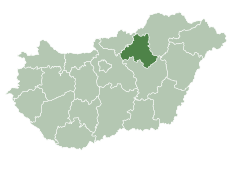
 Location of Heves County in Hungary | |
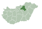
Location of Erk in Hungary | |
| Coordinates: 47°36′32″N 20°04′39″E / 47.60889°N 20.07750°E | |
| Country | |
| Region | Northern Hungary |
| County | Heves County |
| Subregion | Heves District |
| Government | |
| • Mayor | Béla Meleghegyi[1] |
| Area | |
| • Total | 21.68 km2 (8.37 sq mi) |
| Population (1 Jan. 2015) | |
| • Total | 935 |
| • Density | 42.9/km2 (111/sq mi) |
| Time zone | UTC+1 (CET) |
| • Summer (DST) | UTC+2 (CEST) |
| Postal code | 3295 |
| Area code | 36 |
Erk is a village in Heves County, Northern Hungary Region, Hungary.
Sights to visit
- The catholic church
- Wind Farm
See also
References
- ^ "Erk települési választás eredményei" (in Hungarian). Országos Választási Iroda. 2010-10-03. Retrieved 2011-12-22.
External links
 Media related to Erk, Hungary at Wikimedia Commons
47°36′32″N 20°04′39″W / 47.60889°N 20.07750°W


