Keller Brothers Airport
Appearance
This article has multiple issues. Please help improve it or discuss these issues on the talk page. (Learn how and when to remove these template messages)
|
Keller Brothers Airport | |||||||||||
|---|---|---|---|---|---|---|---|---|---|---|---|
| Summary | |||||||||||
| Airport type | Public-use, privately owned | ||||||||||
| Owner | Keller Brothers Airport Inc | ||||||||||
| Location | Lebanon, Pennsylvania | ||||||||||
| Elevation AMSL | 550 ft / 168 m | ||||||||||
| Coordinates | 40°17′29.5″N 076°19′43.5″W / 40.291528°N 76.328750°W | ||||||||||
| Map | |||||||||||
| Runways | |||||||||||
| |||||||||||
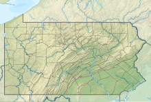
Keller Brothers Airport (FAA LID: 08N) is a privately owned, public-use airport 5 miles (8.0 km) south of Lebanon, in Lebanon County, Pennsylvania.
References

