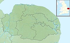
River Ainse (or Eyn)
Appearance
| River Ainse (Eyn) | |
|---|---|
 Eade's Mill on the River Ainse(Eyn) | |
| Location | |
| Country | England |
| State | Norfolk |
| Region | East of England |
| District | Broadland |
| Physical characteristics | |
| Source | |
| • location | near Heydon |
| • coordinates | 52°47′17″N 1°05′30″E / 52.7880°N 1.0917°E |
| • elevation | 47 m (154 ft) |
| Mouth | River Wensum |
• location | Lenwade |
• coordinates | 52°43′30″N 01°7′13.5″E / 52.72500°N 1.120417°E |
• elevation | 14 m (46 ft) |
| Length | 14.2 km (8.8 mi) |
The River Ainse (or Eyn) is a small river in the county of Norfolk. It is a tributary of the River Wensum which it merges with at Lenwade.[1] The River Ainse has several tributaries also.
Eade's watermill
[edit]The watermill located on the river at Great Witchingham is known as Eade's Mill.[2] The mill was built in 1666. Until 1948 the waterwheel was still in working order. By 1972 the watermill was still being used as a hammer mill to grind up pig meal and was powered by electricity. Today, the watermill and its surrounding buildings are listed.
References
[edit]- ^ ”OS Explorer Map” 238, Dereham & Aylsham, ISBN 0-319-23810-5
- ^ [1] Eade’s Watermill, Norfolk Mills
See also
[edit]

