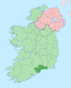
Ballysaggart, County Waterford
Appearance
Ballysaggart | |
|---|---|
Village | |
| Coordinates: 52°11′04″N 8°00′43″W / 52.18435°N 8.01182°W | |
| Country | Ireland |
| Province | Munster |
| County | Waterford |
| Elevation | 225 m (738 ft) |
| Time zone | UTC+0 (WET) |
| • Summer (DST) | UTC-1 (IST (WEST)) |
Ballysaggart is a village in County Waterford, Ireland.
Amenities
[edit]It has a Catholic church, public house, shop, garage and petrol filling station as well as a GAA playing field and civic amenity site.[1]
Access
[edit]The village is situated approximately 8 kilometres from Lismore and 25 kilometres from Fermoy. Some maps may refer to the area as Logleagh.
See also
[edit]References
[edit]- ^ "Services — Ballysaggart". Waterford County Development Plan 2005-2011. Waterford County Council. Archived from the original on 7 August 2011. Retrieved 31 August 2012.


