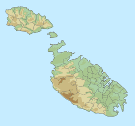
Ġebel San Pietru
Appearance
| Ġebel San Pietru | |
|---|---|
 View from Għargħur, showing Baħar iċ-Ċagħaq and Magħtab | |
| Highest point | |
| Elevation | 150 m (490 ft) |
| Coordinates | 35°55′40″N 14°27′08″E / 35.92778°N 14.45222°E |
| Geography | |
Ġebel San Pietru is a hill located on Għargħur Hill in Għargħur, Malta, with an altitude of 150 metres (492 ft).[1] Foreigners call it the Top of The World, whilst the locals call it L-Anċirietka. Locals and tourists often hike here.
Għaxqet L-Għajn is the road which passes through the hill.
The Victoria Lines are located nearby.
See also
[edit]References
[edit]- ^ Summit Page for: Gebel San Pietru, Summit Cheeseburger - July 12, 2010.

