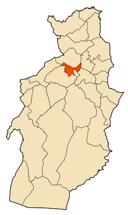
Hammamet, Tébessa
Appearance
Hammamet | |
|---|---|
Commune and town | |
 | |
| Coordinates: 35°26′54″N 7°57′11″E / 35.4483648°N 7.9530716°E | |
| Country | |
| Province | Tébessa Province |
| Area | |
| • Land | 34 sq mi (88 km2) |
| Population (2008) | |
| • Total | 20,148 |
| Time zone | UTC+1 (CET) |
Hammamet is a town and commune in Tébessa Province in north-eastern Algeria.[1]
References
[edit]- ^ "Communes of Algeria". Statoids. Retrieved December 12, 2010.
35°26′54″N 7°57′11″E / 35.44833°N 7.95306°E


