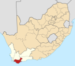
Infanta, South Africa
Appearance
Infanta | |
|---|---|
 The village of Infanta | |
| Coordinates: 34°25′S 20°51′E / 34.417°S 20.850°E | |
| Country | South Africa |
| Province | Western Cape |
| District | Overberg |
| Municipality | Swellendam |
| Area | |
| • Total | 20.45 km2 (7.90 sq mi) |
| Population (2011)[1] | |
| • Total | 90 |
| • Density | 4.4/km2 (11/sq mi) |
| Racial makeup (2011) | |
| • Black African | 8.9% |
| • Coloured | 21.1% |
| • White | 70.0% |
| First languages (2011) | |
| • Afrikaans | 50.0% |
| • English | 46.7% |
| • S. Ndebele | 1.1% |
| • Sotho | 1.1% |
| • Other | 1.1% |
| Time zone | UTC+2 (SAST) |
Infanta is a settlement in Overberg District Municipality in the Western Cape province of South Africa.
Seaside resort at the estuary of the Breede River, at St Sebastian Bay, some 80 km south-east of Swellendam. Takes its name from Cape Infanta several kilometres to the south, and from its situation on the Breede River.[2] The cape was in turn named after captain João Infante, who commanded one of Bartolomeu Dias's caravels.
References
[edit]- ^ a b c d "Main Place Infanta". Census 2011.
- ^ Raper, Peter Edmund (1987). Dictionary of Southern African Place Names. Johannesburg: Human Science Research Council. p. 223. (public domain)


