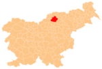
Spodnji Razbor
Appearance
Spodnji Razbor | |
|---|---|
| Coordinates: 46°26′45.23″N 15°2′44.97″E / 46.4458972°N 15.0458250°E | |
| Country | |
| Traditional region | Styria |
| Statistical region | Carinthia |
| Municipality | Slovenj Gradec |
| Area | |
| • Total | 10.43 km2 (4.03 sq mi) |
| Elevation | 819.3 m (2,688.0 ft) |
| Population (2002) | |
| • Total | 237 |
| [1] | |
Spodnji Razbor (pronounced [ˈspoːdnji ˈɾaːzbɔɾ], German: Unterrasswald[2]) is a dispersed settlement in the City Municipality of Slovenj Gradec in northern Slovenia. The area is part of the traditional region of Styria. The entire municipality is now included in the Carinthia Statistical Region.[3]
References
- ^ Statistical Office of the Republic of Slovenia
- ^ Leksikon občin kraljestev in dežel zastopanih v državnem zboru, vol. 4: Štajersko. Vienna: C. Kr. Dvorna in Državna Tiskarna. 1904. p. 266.
- ^ Slovenj Gradec municipal site


