Mirkovice
Appearance
Mirkovice | |
|---|---|
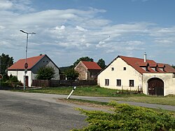
 Centre of Mirkovice | |
| Coordinates: 48°48′40″N 14°23′29″E / 48.81111°N 14.39139°E | |
| Country | |
| Region | South Bohemian |
| District | Český Krumlov |
| First mentioned | 1362 |
| Area | |
| • Total | 15.49 km2 (5.98 sq mi) |
| Elevation | 540 m (1,770 ft) |
| Population (2023-01-01)[1] | |
| • Total | 517 |
| • Density | 33/km2 (86/sq mi) |
| Time zone | UTC+1 (CET) |
| • Summer (DST) | UTC+2 (CEST) |
| Postal code | 382 32 |
| Website | www |
Mirkovice (German: Mirkowitz) is a municipality and village in Český Krumlov District in the South Bohemian Region of the Czech Republic. It has about 500 inhabitants. The village centre is well preserved and is protected by law as a village monument zone.
Mirkovice lies approximately 6 kilometres (4 mi) east of Český Krumlov, 19 km (12 mi) south of České Budějovice, and 142 km (88 mi) south of Prague.
Administrative parts
Villages and hamlets of Chabičovice, Malčice, Svachova Lhotka, Zahrádka and Žaltice are administrative parts of Mirkovice.
References
Wikimedia Commons has media related to Mirkovice.


