St. Koloman station
Appearance
| General information | |||||||||||
|---|---|---|---|---|---|---|---|---|---|---|---|
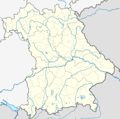
| Location | St2080/ED4 85457 Wörth Bavaria Germany | ||||||||||
| Coordinates | 48°14′37″N 11°52′58″E / 48.2436°N 11.8829°E | ||||||||||
| Owned by | DB Netz | ||||||||||
| Operated by | DB Station&Service | ||||||||||
| Line(s) | |||||||||||
| Platforms | 1 side platform | ||||||||||
| Tracks | 1 | ||||||||||
| Train operators | S-Bahn München | ||||||||||
| Connections | |||||||||||
| Other information | |||||||||||
| Station code | 5944 | ||||||||||
| DS100 code | MKL[1] | ||||||||||
| IBNR | 8005652 | ||||||||||
| Category | 6[2] | ||||||||||
| Fare zone | |||||||||||
| Website | www.bahnhof.de | ||||||||||
| History | |||||||||||
| Opened | 1 June 1890 | ||||||||||
| Services | |||||||||||
| |||||||||||
 | |||||||||||
St. Koloman station is a railway station in the St. Koloman district of the municipality of Wörth, located in the Erding district in Upper Bavaria, Germany.
References
- ^ Eisenbahnatlas Deutschland (German railway atlas) (2009/2010 ed.). Schweers + Wall. 2009. ISBN 978-3-89494-139-0.
- ^ "Stationspreisliste 2024" [Station price list 2024] (PDF) (in German). DB Station&Service. 24 April 2023. Retrieved 29 November 2023.
- ^ "S-Bahn, U-Bahn, Regionalzug, Tram und ExpressBus im MVV" (PDF). Münchner Verkehrs- und Tarifverbund. December 2019. Retrieved 28 February 2020.


