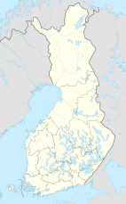
Kaldoaivi Wilderness Area
Appearance
You can help expand this article with text translated from the corresponding article in Finnish. (June 2023) Click [show] for important translation instructions.
|
| Kaldoaivi Wilderness Area | |
|---|---|
| Location | Lapland, Finland |
| Coordinates | 69°42′N 28°04′E / 69.700°N 28.067°E |
| Area | 2,924 km2 (1,129 sq mi) |
| Established | 1991 |
| Governing body | Metsähallitus |
The Kaldoaivi Wilderness Area (Template:Lang-fi) is the largest wilderness reserve in Finland, located in the municipalities of Utsjoki and Inari in Lapland. It was established in 1991 like all the other 11 wilderness areas in Lapland. Its area is 2,924 square kilometres (1,129 sq mi). The large area of roadless wilderness continues outside the borders of Finland and the official area to Norway. It is governed by the Metsähallitus.[1]
References
- ^ "Kaldoaivi Wilderness Area". Outdoors.fi. Metsähallitus. Retrieved 2015-05-10.

