Villa Centenario
Appearance
Villa Centenario | |
|---|---|
 View of Presidente Perón Freeway in Villa Centenario. | |
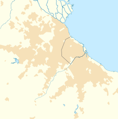
Location in Greater Buenos Aires | |
| Coordinates: 34°46′S 58°23′W / 34.767°S 58.383°W | |
| Country | |
| Province | |
| Partido | |
| Elevation | 20 m (70 ft) |
| Population | |
| • Total | 49,737 |
| • Density | 8,741.12/km2 (22,639.4/sq mi) |
| CPA Base | B 2700 |
| Area code | +54 11 |
Villa Centenario is a district of Lomas de Zamora Partido in Buenos Aires Province, Argentina. It forms part of the Greater Buenos Aires urban conurbation.
External links
[edit]- Municipal information: Municipal Affairs Federal Institute (IFAM), Municipal Affairs Secretariat, Ministry of Interior, Argentina. (in Spanish)

