Kumbungu District
Appearance
Kumbungu District | |
|---|---|
 Districts of Northern Region | |
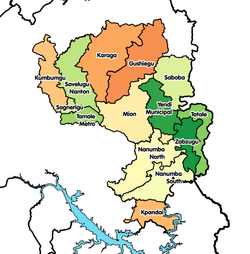
Location of Kumbungu District within Northern | |
| Coordinates: 9°40′37.92″N 1°1′13.08″W / 9.6772000°N 1.0203000°W | |
| Country | |
| Region | Northern |
| Capital | Kumbungu |
| Population (2021) | |
• Total | 110,586[1] |
| Time zone | UTC+0 (GMT) |
| ISO 3166 code | GH-NP-KM |
Kumbungu District is one of the sixteen districts in Northern Region, Ghana.[2][3][4][5] The district assembly is located in the northwest part of Northern Region and has Kumbungu as its capital town.
Originally it was formerly part of the then-larger Tolon-Kumbungu District in 1988, which was created from the former West Dagomba District Council, until the eastern part of the district was split off to create Kumbungu District on 28 June 2012; thus the remaining part has been renamed to become Tolon District.
Populated places
References
- ^ Ghana: Administrative Division
- ^ "People Of Kumbungu Laud Prez". Modernghana. Graphic Online. 23 November 2011. Retrieved April 10, 2015.
- ^ "Tolon District". Ghanadistricts.gov. Archived from the original on April 14, 2015. Retrieved April 10, 2015.
- ^ "Northern » Kumbungu (New)". Ghanadistricts. Archived from the original on April 4, 2015. Retrieved April 10, 2015.
- ^ "Prominent citizens asked to help develop new Districts". GNA. 24 December 2011. Retrieved April 10, 2015.

