Taulaga, American Samoa
Appearance
Taulaga | |
|---|---|
Village | |
 Location on Swains Island | |
| Country | |
| Territory | |
| Population (2020) | |
| • Total | 0 |
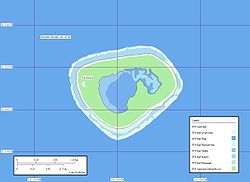
Taulaga is a deserted village on Swains Island, American Samoa (nearby Etena is also deserted).[1]
It had the majority of the island's population of 17, a church, a communications center, and a school. It was hit heavily by Cyclone Percy in 2005. Taulaga is in the northwest of the atoll.
The 2020 census recorded no people living on Swains Island, suggesting the village has no residents.[2]
References
- ^ Whistler, W. A. (1983). "The flora and vegetation of Swains Island". Atoll Research Bulletin. 262: 1–2. doi:10.5479/si.00775630.262.1. S2CID 8016446 – via Smithsonian Institution.
- ^ "Population of American Samoa: 2010 and 2020" (PDF). U.S. Census Bureau. Retrieved 27 March 2022.
11°03′18″S 171°05′17″W / 11.055°S 171.088°W
