Morphett Street
Morphett Street | |
|---|---|
 | |
| Coordinates | |
| General information | |
| Type | Street |
| Location | Adelaide city centre |
| Length | 1.6 km (1.0 mi)[1] |
| Opened | 1837 |
| Major junctions | |
| North end | Montefiore Road Adelaide |
| South end | Sir Lewis Cohen Drive Adelaide |
| Location(s) | |
| LGA(s) | City of Adelaide |
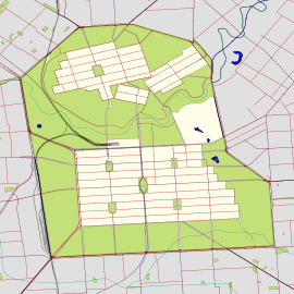
Morphett Street is a main street in the west of the city centre of Adelaide, South Australia, parallel to King William Street and numbered from north to south. At its northern end it is part of the West End of Adelaide, a thriving cultural and entertainment precinct, with the Lion Arts Centre on the south-western corner of its junction with North Terrace.
Location
The street runs from south to north between South Terrace and North Terrace, and passes around and through two of the five squares in the Adelaide city centre, Light Square and Whitmore Square. At Hindley Street it transforms into the start of the bridge which crosses North Terrace (at which point its name changes to Montefiore Road), the railway yards and the River Torrens.[2]
History
Morphett Street was named after Sir John Morphett, a prominent pioneer, whose votes at a meeting on 10 February 1837, (including numerous proxies), played an important role in confirming the site of Adelaide.[3][4]
A small brewery known as Morphett Street Brewery operated on a premises near the northern end from 1859 to about 1873.[5]
The southern half of Morphett Street, between Grote Street and South Terrace, was originally named Brown Street after John Brown, the first Immigration Officer of South Australia. Brown Street was subsumed into the expanded Morphett Street in August 1967. The Brown Street Memorial in Whitmore Square maintains the commemoration of John Brown.
From the late 1990s, a revitalisation of the "West End" of Adelaide was undertaken, which included the conversions of several old buildings (including the creation of the Lion Arts Centre in an old factory building) and the new University of South Australia's West End campus. The Mercury Cinema opened at no. 13 and the design studio JamFactory moved to a new purpose-built building at no. 19 in 1992.[6]
In March 2021, a laneway that runs off Morphett Street and parallel to Hindley Street, near the former Cargo Club building (since demolished), was renamed Sia Furler Lane, after Adelaide-born singer-songwriter Sia. A large mural titled She Imagined Buttons was painted on a wall nearby by local artist Jasmine Crisp, which is intended to reflect the response of a fan to Sia's 2011 performance in Adelaide.[7][8][9]
Notable buildings
Trinity Church Adelaide, established in 1836 as Holy Trinity Church in the earliest days of the colony of South Australia and listed on the now-defunct Register of the National Estate in 1980,[10] is on the north-eastern corner with North Terrace.[11]
The Lion Arts Centre is on the other side of the bridge, on the north-western corner, next door to the Mercury Cinema and JamFactory.
Southern and northern continuations
Morphett Street continues north of North Terrace as Montefiore Road, and south of South Terrace as Sir Lewis Cowen Avenue.[2] Montefiore Road and Hill were named after Jacob Barrow Montefiore, a Colonising Commissioner who was a cousin of the British philanthropist, Moses Montefiore.[12] Lewis Cohen served on the Adelaide City Council for 30 years, including several terms as Mayor and Lord Mayor.
Further reading
- "Morphett Street". Adelaidia.
See also
References
- ^ "Morphett Street" (Map). Google Maps. Retrieved 1 June 2022.
- ^ a b 2008 Adelaide Street Directory, 46th Edition. UBD (A Division of Universal Press Pty Ltd). 2008. ISBN 978-0-7319-2118-8.
- ^ Sir John Morphett Archived 27 August 2008 at the Wayback Machine, History of Adelaide Through Street Names, www.historysouthaustralia.net. Retrieved 2008-09-28.
- ^ Sir John Morphett (1809-1892), Australian Dictionary of Biography, on-line edition. Retrieved 2008-09-28.
- ^ "Miscellaneous". South Australian Register. Vol. XXX, no. 6052. South Australia. 27 March 1866. p. 4. Retrieved 7 March 2018 – via National Library of Australia.
- ^ "About". JamFactory. Retrieved 26 April 2019.
- ^ Gallagher, Alex (24 March 2021). "Laneway honouring Sia officially launched in Adelaide". NME. Retrieved 5 August 2022.
- ^ Brandle, Lars (23 March 2021). "Adelaide launches Sia Furler Lane, first of its music laneways". The Music Network. Retrieved 5 August 2022.
- ^ "Sia Furler La · Adelaide SA 5000, Australia". Google Maps. 2 August 2022. Retrieved 5 August 2022.
- ^ "Holy Trinity Anglican Church, 87 North Tce, Adelaide, SA, Australia (Place ID 6324)". Australian Heritage Database. Australian Government. 21 March 1978. Retrieved 18 May 2023.
- ^ "Site Redevelopment". Trinity Church Adelaide. 12 September 2022. Retrieved 18 May 2023.
- ^ Elton, Jude. "Montefiore Hill". Adelaidia. History SA. Retrieved 9 August 2017.

