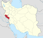
Dehloran
Dehloran
دیلران، دیلرو | |
|---|---|
City | |
| Coordinates: 32°41′21″N 47°16′08″E / 32.68917°N 47.26889°E[1] | |
| Country | Iran |
| Province | Ilam |
| County | Dehloran |
| District | Central |
| Government | |
| • Governor | Latif Sadeghi |
| Population (2016)[2] | |
• Total | 32,941 |
| Time zone | UTC+3:30 (IRST) |
Dehloran (Template:Lang-fa; also Romanized as Dehlorān[3]) is a city in the Central District of Dehloran County, Ilam province, Iran, and serves as both capital of the county and of the district. The city lies along Road 64, near the Iraqi border. A national natural monument lies in the north-eastern part of the city.
Demographics
At the 2006 National Census, its population was 27,602 in 5,787 households.[4] The following census in 2011 counted 30,989 people in 7,623 households.[5] The latest census in 2016 showed a population of 32,941 people in 9,204 households.[2]
The city is populated by Kurds and Lurs.[6]
Dehloran plain
This section needs additional citations for verification. (June 2023) |
Dehloran is located in the northern part of Dehloran Plain. The ancient site of Chogha Sefid is just to the west of the village. Culturally, the plain is known as a part of "Greater Susiana."
Dehloran Plain in the south of Ilam province, along with the Susiana Plain in Khuzestan to the southwest, has been the subject of the longest and most extensive archaeological research in Iran. These two areas had been culturally very similar during the Chalcolithic age. The important sites on Dehloran Plain are Ali Kosh, Chogha Sefid, and Tepe Sabz.
References
- ^ OpenStreetMap contributors (5 June 2023). "Dehloran, Dehloran County" (Map). OpenStreetMap. Retrieved 5 June 2023.
- ^ a b "Census of the Islamic Republic of Iran, 1395 (2016)". AMAR (in Persian). The Statistical Center of Iran. p. 16. Archived from the original (Excel) on 1 November 2020. Retrieved 19 December 2022.
- ^ Dehloran can be found at GEOnet Names Server, at this link, by opening the Advanced Search box, entering "-3060644" in the "Unique Feature Id" form, and clicking on "Search Database".
- ^ "Census of the Islamic Republic of Iran, 1385 (2006)". AMAR (in Persian). The Statistical Center of Iran. p. 16. Archived from the original (Excel) on 20 September 2011. Retrieved 25 September 2022.
- ^ "Census of the Islamic Republic of Iran, 1390 (2011)" (Excel). Iran Data Portal (in Persian). The Statistical Center of Iran. p. 16. Retrieved 19 December 2022.
- ^ "Language distribution: Ilam Province: Dēlıṛān, Dēlıṛo". Iran Atlas. Archived from the original on 14 January 2021.


