Diéma Cercle
Appearance
Diéma | |
|---|---|
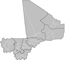
 Location of Diéma Cercle in Mali | |
| Country | |
| Region | Kayes Region |
| Admin HQ (Chef-lieu) | Diéma |
| Area | |
| • Total | 12,440 km2 (4,800 sq mi) |
| Population (2009)[2] | |
| • Total | 212,062 |
| • Density | 17/km2 (44/sq mi) |
| Time zone | UTC+0 (GMT) |
Diéma Cercle is an administrative subdivision of the Kayes Region of Mali. Its administrative center (chef-lieu) is the small town of Diéma. The Cercle is divided into one urban commune and fourteen rural communes. In the 2009 census the cercle had a population of 212,062.
The cercle is divided into 15 communes:[3]
- Béma
- Diangounté Camara
- Dianguirdé
- Diéma
- Diéoura
- Dioumara Koussata
- Fassoudébé
- Fatao an Urban Commune
- Gomitradougou
- Grouméra
- Guédébiné
- Lakamané
- Lambidou
- Madiga Sacko
- Sansankidé
References
- ^ Synthèsis des Plans de Sécurité Alimentaire des Communes du Cercle Diéma 2007-2011 (PDF) (in French), Commissariat à la Sécurité Alimentaire, République du Mali, USAID-Mali, 2007, archived from the original (PDF) on 2012-05-13.
- ^ Resultats Provisoires RGPH 2009 (Région de Kayes) (PDF) (in French), République de Mali: Institut National de la Statistique, archived from the original (PDF) on 2012-07-27.
- ^ Communes de la Région de Kayes (PDF) (in French), Ministère de l’administration territoriale et des collectivités locales, République du Mali, archived from the original (PDF) on 2012-03-09.


