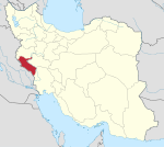
Central District (Chardavol County)
Central District (Chardavol County)
| |
|---|---|
| Coordinates: 33°43′57″N 46°36′14″E / 33.73250°N 46.60389°E[1] | |
| Country | |
| Province | Ilam |
| County | Chardavol |
| Capital | Sarableh |
| Population (2016)[2] | |
• Total | 24,568 |
| Time zone | UTC+3:30 (IRST) |
The Central District of Chardavol County (Template:Lang-fa) is in Ilam province, Iran. Its capital is the city of Sarableh.
At the National Census in 2006, its population was 41,034 in 8,461 households.[3] The following census in 2011 counted 41,469 people in 10,133 households.[4]
At the latest census in 2016, the district had 24,568 inhabitants in 6,737 households,[2] by which time Bijnavand Rural District had been separated from the district in the establishment of Zagros District, and Shabab Rural District to establish Shabab District.[5]
After the census, Asemanabad Rural District and the city of Asemanabad were separated from the district in the establishment of Asemanabad District. At the same time, Halehsam Rural District was established in the Central District.[6]
| Administrative Divisions | 2006[3] | 2011[4] | 2016[2] |
|---|---|---|---|
| Asemanabad RD1 | 6,411 | 6,275 | 5,895 |
| Bijnavand RD2 | 8,017 | 7,327 | |
| Halehsam RD3 | |||
| Shabab RD4 | 11,004 | 11,011 | |
| Asemanabad (city)1 | 5,899 | 5,889 | 6,280 |
| Sarableh (city) | 9,703 | 10,967 | 12,393 |
| Total | 41,034 | 41,469 | 24,568 |
| RD: Rural District 1Became a part of Asemanabad District after the 2016 census[6] 2Became a part of Zagros District[5] 3Established after the 2016 census[6] 4Became a part of Shabab District[5] | |||
References
- ^ OpenStreetMap contributors (3 June 2023). "Central District (Chardavol County)" (Map). OpenStreetMap. Retrieved 3 June 2023.
- ^ a b c "Census of the Islamic Republic of Iran, 1395 (2016)". AMAR (in Persian). The Statistical Center of Iran. p. 16. Archived from the original (Excel) on 1 November 2020. Retrieved 19 December 2022.
- ^ a b "Census of the Islamic Republic of Iran, 1385 (2006)". AMAR (in Persian). The Statistical Center of Iran. p. 16. Archived from the original (Excel) on 20 September 2011. Retrieved 25 September 2022.
- ^ a b "Census of the Islamic Republic of Iran, 1390 (2011)" (Excel). Iran Data Portal (in Persian). The Statistical Center of Iran. p. 16. Retrieved 19 December 2022.
- ^ a b c Rahimi, Mohammad Reza (7 July 2013). "With some changes in the geography map of Alborz and Ilam provinces: The counties of Fardis and Badreh and the city of Balavah were added to the map of the country's divisions". DOLAT (in Persian). Ministry of Interior, Board of Ministers. Archived from the original on 10 January 2017. Retrieved 11 November 2023.
- ^ a b c Mokhbar, Mohammad (19 May 1402). "Approval letter regarding country divisions of Chardavol County of Ilam province". Laws and Regulations Portal of Iran (in Persian). Ministry of Interior, Board of Ministers. Archived from the original on 9 May 2023. Retrieved 3 June 2023.


