Grange, County Waterford
Appearance
Grange
An Ghráinsigh | |
|---|---|
Village | |
 St. Marys Church, Grange | |
| Coordinates: 51°59′21″N 7°44′28″W / 51.989193°N 7.741178°W | |
| Country | Ireland |
| Province | Munster |
| County | Waterford |
| Time zone | UTC+0 (WET) |
| • Summer (DST) | UTC-1 (IST (WEST)) |
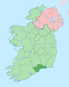
Grange (Irish: An Ghráinsigh) is a small village and townland in west County Waterford, Ireland.[1] It borders Ardmore and An Seanphobal. Ardmore and Grange are two villages that make up the Ardmore-Grange parish.
Amenities
[edit]The village lies on the N25 road, between the towns of Youghal to the west and Dungarvan to the north-east.
Amenities include the local Roman Catholic church (built in 1835),[2] a national school (St. Mary's), two shops and a pub.[citation needed]
Sport
[edit]Stage 2 of the 1998 Tour de France passed through Grange.
See also
[edit]References
[edit]- ^ "An Ghráinsigh/Grange". Dublin City University. Archived from the original on 24 September 2021. Retrieved 2 January 2022.
- ^ "Saint Mary's Catholic Church". Department of Arts, Heritage and the Gaeltacht. Archived from the original on 1 January 2015. Retrieved 31 December 2014.


