Qaleh-ye Khanjan
Appearance
Qaleh-ye Khanjan
| |
|---|---|
Village | |
| Coordinates: 33°18′33″N 48°42′54″E / 33.30917°N 48.71500°E[1] | |
| Country | |
| Province | Lorestan |
| County | Khorramabad |
| District | Papi |
| Rural District | Gerit |
| Population (2016)[2] | |
• Total | 119 |
| Time zone | UTC+3:30 (IRST) |
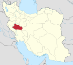
Qaleh-ye Khanjan (Template:Lang-fa, also Romanized as Qal‘eh-ye Khānjān; also known as Khānjān Khān, Qal‘eh-ye Khānjān Khān, and Sar Tang-e Eslāmābād)[3][4] is a village in, and the capital of, Gerit Rural District of Papi District, Khorramabad County, Lorestan province, Iran.[5]
At the 2006 National Census, its population was 119 in 23 households.[6] The following census in 2011 counted 110 people in 27 households.[7] The latest census in 2016 showed a population of 119 people in 36 households.[2]
References
- ^ OpenStreetMap contributors (3 January 2024). "Qaleh-ye Khanjan, Khorramabad County" (Map). OpenStreetMap. Retrieved 3 January 2024.
- ^ a b "Census of the Islamic Republic of Iran, 1395 (2016)". AMAR (in Persian). The Statistical Center of Iran. p. 15. Archived from the original (Excel) on 12 October 2020. Retrieved 19 December 2022.
- ^ Qaleh-ye Khanjan can be found at GEOnet Names Server, at this link, by opening the Advanced Search box, entering "-3070632" in the "Unique Feature Id" form, and clicking on "Search Database".
- ^ Hashemi, Akbar. "The law on the establishment of 77 rural districts without the population quorum mentioned in the Law on Definitions and Rules of Country Divisions and the addition of a note to Article 4 of the said law, the law on the establishment of 77 units". Research Center of the System of Laws of the Islamic Council of the Farabi Library of Mobile Users (in Persian). Shura Council. Archived from the original on 5 July 2013. Retrieved 3 January 2024.
- ^ Habibi, Hassan (12 December 1371). "Creation of 48 rural districts in several rural areas of the country". Qavanin (in Persian). Ministry of Interior, Political-Defense Commission of the Government Council. Archived from the original on 28 November 2018. Retrieved 2 January 2024.
- ^ "Census of the Islamic Republic of Iran, 1385 (2006)". AMAR (in Persian). The Statistical Center of Iran. p. 15. Archived from the original (Excel) on 20 September 2011. Retrieved 25 September 2022.
- ^ "Census of the Islamic Republic of Iran, 1390 (2011)" (Excel). Iran Data Portal (in Persian). The Statistical Center of Iran. p. 15. Retrieved 19 December 2022.


