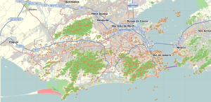
Caju, Rio de Janeiro

Coordinates: 22°52′48″S 43°13′14″W / 22.88000°S 43.22056°W / -22.88000; -43.22056
From Wikipedia, the free encyclopedia

This is an old revision of this page, as edited by Hugo999 (talk | contribs) at 02:36, 2 September 2017 (added Category:Social class in Brazil using HotCat). The present address (URL) is a permanent link to this revision, which may differ significantly from the current revision.

Caju
Neighborhood
Caju is located in Rio de Janeiro
Caju
Caju
Location in Rio de Janeiro
Caju is located in Brazil
Caju
Caju
Caju (Brazil)
Coordinates: 22°52′48″S 43°13′14″W / 22.88000°S 43.22056°W / -22.88000; -43.22056
Country Brazil
StateRio de Janeiro (RJ)
Municipality/CityRio de Janeiro
ZoneCentro

Caju is a working-class district of the North Zone of Rio de Janeiro, Brazil. Prior to the current region Caju belonged to the historic district of São Cristóvão.