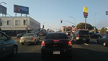
Macdonald Avenue


Macdonald Avenue is the main east-to-west artery in Richmond.[1]
History
Macdonald Avenue runs in a straight line from the Richmond Parkway through downtown to San Pablo Avenue, after which it continues as a minor street for a few blocks, ending at Ludwig Avenue in El Cerrito.
The portion from about 8th Street through 16th Street was historically the main commercial area of Richmond. It is currently the focus of the,[2] an accredited Main Street program designed to preserve and revitalize the Downtown Richmond area.[3]
Bus service is provided along the entire length of the corridor west of San Pablo Avenue on AC Transit route 72M. The avenue fronts the Richmond Civic Center and Macdonald 80 Shopping Centers. BART, Capitol Corridor, and Amtrak share the Richmond BART/Amtrak station along the avenue, the end of the line. The station serves as a transit hub for trains and AC and Golden Gate Transit buses.

References
- ^ Point Molate Casino EIR, Volume I, 2009, accessed May 25, 2010 Archived July 15, 2011, at the Wayback Machine
- ^ Richmond Main Street Initiative, access date 02-03-2009
- ^ TTCA Welcomes the City of Richmond Into the California Main Street Program., Business Wire, December 13, 2007, retrieved May 24, 2007
External links
- Richmond Main Street Initiative, Inc.
- California Office of Historic Preservation, Main Street Program
- National Trust for Historic Preservation, Main Street Center
"Contra Costa County, California" is an invalid category parameter for Template:Coord missing.
The problem is usually caused either by a spelling mistake or by an-over-precise category.
For a full list of categories, see Category:Unclassified articles missing geocoordinate data and its subcategories.
